

Some links on our site may earn us a commission at no extra cost to you. Learn more.
Charlies Bunion is an 8-mile round-trip hike on the Appalachian Trail from the Newfound Gap parking area. It ends at a bare rock ledge above steep cliffs. The route has many steep sections, roots and rocks, and the trailhead sits above 5,000 feet, so bring a parking tag, a warm layer and an early start.
I would start from Newfound Gap before the lot fills. The overlook is one of the busiest stops on the road, and the crowd thins out once you are walking. I would treat the ledge as a lunch stop rather than a finish line, and I would pack one more layer than the forecast suggests.
Charlies Bunion from Newfound Gap
The hike starts at Newfound Gap Overlook on US 441, where the Appalachian Trail trailhead sits at the end of the parking area. The park’s trail page lists the round trip at 8 miles. Charlies Bunion itself is about 4 miles from the gap.
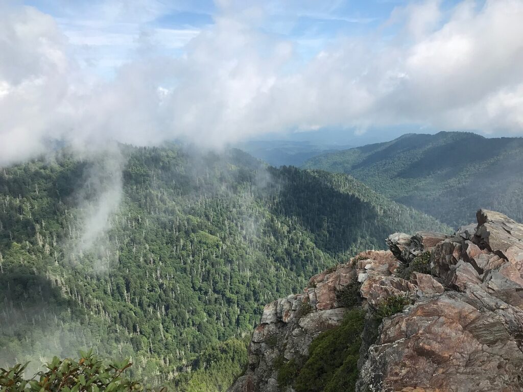
The trail runs through hardwood forest, then high-elevation spruce-fir, with big mountain views and a rocky outcrop ringed by steep cliffs at the far end. The wide, firmly packed path narrows as it climbs to Mount Ambler, then drops to Masa Knob and the Bunion. Whatever you descend on the way out, you climb on the way back.

You also pass the Icewater Spring Shelter, a backcountry shelter, and the junction with the Boulevard Trail, which is the route toward Mount LeConte. Stay on the Appalachian Trail for the Bunion. Take any water from a spring or pipe only after treating it.

The Jumpoff is a quieter lookout reached by a side trail off the Boulevard Trail, and it looks back toward the Bunion. It adds miles, so save it for a long day with plenty of daylight.
| Leg | Distance | Climb | Notes |
|---|---|---|---|
| Newfound Gap trailhead | Start | Parking area at 5,046 feet | Trailhead at the end of the lot; parking tag required |
| Up to Mount Ambler | Part of the 8-mile round trip | Climb | Wide trail that narrows as it rises |
| Down to Masa Knob | Part of the 8-mile round trip | Descent | Steep sections, roots and rocks |
| Icewater Spring Shelter | Before the ledge | Mid-route landmark | Boulevard Trail junction nearby; route to Mount LeConte |
| Charlies Bunion | About 4 miles from the gap | Rock ledge | Steep cliffs; stay back from the edge |
| Return to Newfound Gap | About 4 miles back | Descents become climbs | Save energy for the last stretch |
How to get to Charlies Bunion
You drive to the trailhead. Newfound Gap is reached on Newfound Gap Road, US 441, from either Gatlinburg, Tennessee, or Cherokee, North Carolina, and the overlook straddles the state line. The park calls it the lowest drivable gap through the Smokies, which still puts it above 5,000 feet.
Either approach is a long, winding climb, so build the drive into the morning rather than treating the hike as the only effort. Fill the gas tank and download an offline map in town, and I would not count on a phone signal once you are in the park. Our Smokies trip planner covers where to base yourself on either side.
If you are building a multi-day trip, Charlies Bunion slots in as the big hike day. Our Smokies itinerary shows how to pair it with the easier stops so you are not hiking back to back.
Charlies Bunion Parking
Newfound Gap Overlook has an auto parking area with seasonal restrooms, and the Appalachian Trail starts at the far end of it. In peak season the lot is full by mid-morning. An early start is the only reliable fix, and it also puts you on the ledge before the crowds arrive.
The Newfound Gap lot has no exception to the parking tag rule. The park’s fee page lists $5 for a day, $15 for a week and $40 for a year, required for any vehicle parked longer than 15 minutes. America the Beautiful passes do not replace a tag, and a tag does not guarantee a space.
Most trailheads have no tag machine, so buy before you drive up. Our parking tag guide covers where to buy one online and how to display it.
Newfound Gap Road Closure
Newfound Gap Road is US 441, the through road between Gatlinburg and Cherokee. It has no fixed winter season. The park closes it when winter weather makes the steep grades and sharp curves dangerous, as in its January 23, 2026 release announcing a 7 p.m. closure, and then reopens it.
Check the park website or its X account, @GreatSmokyNPS, before you leave Gatlinburg or Cherokee. A closed road means no hike. Our Newfound Gap Road guide covers the drive, the overlooks and what to expect on the way up.
Then check the trail. The park’s closures page lists trail closures and Newfound Gap Road overlook closures for the whole park, so read it the morning you go.
Charlies Bunion hike difficulty
Eight miles is a full day for most people, and the park describes many steep sections plus roots and rocks. The first half feels easier than it is because you are fresh and the views are new. The way back is where the hike is won or lost.
Pick a turnaround time before you leave the car and keep to it. If the ridge is socked in with cloud when you reach Masa Knob, the view you came for may be gone, and that is a fair reason to turn around. It is a good hike for someone fit and used to a long day at elevation, and a poor first big hike.

Walk it at a pace where you can talk. Eat before you are hungry, drink on a schedule and rest at a wide spot rather than on a steep section where the trail narrows. Walk out in the morning, eat at the ledge and start back with enough daylight that the climbs do not happen in the dark.
Is Charlies Bunion dangerous?
The ledge is the point of the hike and it is also the hazard. The rock outcrop is surrounded by steep cliffs, and the park’s guidance is to use caution near exposed cliffs. Stay back from the edge, hold on to anyone small, and never step out for a photo.
In cold weather, expect ice on the trail. The park recommends microspikes, the small traction spikes that slip over your shoes, in winter. Wet rock is slick in any season, and fog can hide where the ledge ends.
This is bear country. The park requires you to keep at least 50 yards (150 feet) from any bear, and it is illegal to approach closer. Keep food and trash sealed in your pack, never leave a snack on a rock, and lock food out of sight in the car.
Charlies Bunion Weather
Newfound Gap is much colder than the valleys on either side. Rain in Gatlinburg or Cherokee can arrive as snow at the gap, and the park advises packing layers even in summer. Cool, wet and windy conditions can lead to hypothermia at any time of year.
The ledge has no cover from wind, and a warm walk uphill turns into a cold stop in minutes. Put a layer on before you sit down to eat. Our Smokies packing guide has the full list.
- A warm mid-layer and a rain jacket, even on a clear morning
- Wool or synthetic layers, not cotton, which holds sweat and rain
- At least 1 liter of water for every 2 hours of hiking
- A headlamp, not just a phone, in case the day runs long
- Microspikes from late fall through early spring
Why is it called Charlies Bunion?
The park explains that the name refers to a rock formation exposed by an early 1900s wildfire and the erosion that followed. It honors Charlie Conner, a local Appalachian Trail supervisor in the 1920s who reportedly hiked in worn shoes that left his feet sore.
A bunion is a painful bump on the side of the foot. The bare knob of rock jutting from the ridge looks like one, and the name stuck. The ledge you stand on is the product of fire and weather, not a natural treeline.
Kuwohi Clingmans Dome
Charlies Bunion fills a day, so I would not stack another long hike on top of it. If you have a second day in the high country, Kuwohi is the easier one: a short walk to a tower and big views, and a reward for tired legs. Our Kuwohi guide covers the road and the walk.
Mount LeConte is the harder second day. The Boulevard Trail leaves the Appalachian Trail near the Icewater Spring Shelter, and our Mount LeConte guide compares the routes. For more big days in the park, see our best hiking trails in the Smokies.
Charlies Bunion FAQ
How long is the Charlies Bunion hike?
The park lists the hike as 8 miles round trip on the Appalachian Trail from Newfound Gap. Plan on most of a day with a long stop at the ledge, and add time for the climbs on the way back.
Is Charlies Bunion trail open?
In early October 2026 the park’s closures page did not list the Appalachian Trail between Newfound Gap and Charlies Bunion as closed. Conditions change with storms, so check the page again the morning you go.
Do you need a parking tag to park at Newfound Gap?
Yes. The park requires a parking tag for any vehicle parked longer than 15 minutes. Tags are $5 a day, $15 a week or $40 a year, and America the Beautiful passes do not replace them.
Are there bears on the Appalachian Trail in the Smokies?
Yes. Black bears live throughout Great Smoky Mountains National Park. Keep food sealed in your pack and stay at least 50 yards (150 feet) away from any bear.
Prices are approximate, current as of publication, and change frequently — confirm the latest price with the retailer before buying.
Published October 11, 2026.
Photo credits: (1) featured, Rocky ledge of Charlies Bunion with ridges… — National Park Service, U.S. Government work, public domain, via Wikimedia Commons; (2) View from Newfound Gap in Great Smoky… — Douglas P Perkins (Douglaspperkins (talk)), CC BY 3.0, via Wikimedia Commons; (3) Appalachian Trail shelter at Icewater… — Justin Meissen from St Paul, United States, CC BY-SA 2.0, via Wikimedia Commons; (4) Ridges near Charlies Bunion and the Jumpoff… — Brian Stansberry, CC BY 2.5, via Wikimedia Commons; (5) Charlies Bunion rock outcrop on the… — National Park Service, U.S. Government work, public domain, via Wikimedia Commons.