

Some links on our site may earn us a commission at no extra cost to you. Learn more.
Newfound Gap Road is the 34-mile drive that carries US 441 straight through Great Smoky Mountains National Park. It connects Gatlinburg, Tennessee to Cherokee, North Carolina. It climbs about 3,000 feet from the Sugarlands entrance to the 5,046-foot gap. Then it drops back down the North Carolina side, past Mingus Mill, to Oconaluftee. Plan on an hour or more behind the wheel with no stops, and closer to half a day if you pull off at the overlooks. This drive is also the backbone of our Smoky Mountains road trip itinerary if you’re stringing together a longer multi-day loop.
I’ve driven Newfound Gap Road more times than I can count, in every season the park throws at it. June can put the gap twenty degrees cooler than the parking lot you left in Gatlinburg. By October the ridgelines go orange and red while the valley floor is still green. Come January, the road can be bare and dry at Sugarlands and glazed with ice a thousand feet higher. None of that changes the route. It just changes what you wear and how long you linger at the top.
Newfound Gap Road
Newfound Gap Road is US 441 between Gatlinburg and Cherokee. It’s the only paved road that fully crosses Great Smoky Mountains National Park. Both Tennessee and North Carolina designated it a State Scenic Byway in 2009. The park’s own announcement of that status puts the road at 34 miles end to end. Most of it sits inside the park, so a parking tag is required at any pullout where you’ll be stopped more than 15 minutes.
The drive works in either direction, but I usually run it Tennessee to North Carolina: start at Sugarlands, climb to the gap, then coast down into Cherokee for lunch. Below is the order I stop in, with rough drive times from Sugarlands Visitor Center. One pullout worth knowing about even though it isn’t in the table: the Alum Cave Trailhead, about halfway to the gap, is where hikers set off for Mount LeConte.
| Stop | Side | What it is | Time from Sugarlands |
|---|---|---|---|
| Sugarlands Visitor Center | TN, mile 0 | Park orientation, maps, restrooms | Start |
| Campbell Overlook | TN | Early ridge view, first real pullout | ~10 min |
| Chimney Tops Overlook | TN | View of the twin peaks, trailhead | ~25 min |
| Morton Overlook | TN, near the gap | Sunset view down the valley | ~35 min |
| Newfound Gap | TN/NC line, 5,046 ft | Rockefeller Memorial, AT crossing, Kuwohi turnoff | ~40 min |
| Oconaluftee Valley Overlook | NC | First big view of the NC side | ~50 min |
| Mingus Mill | NC, near Oconaluftee | 1886 water-powered gristmill | ~70 min |
| Oconaluftee Visitor Center | NC, mile 34 | Mountain Farm Museum, elk field | ~70 min |
How Long Is Newfound Gap Road?
Newfound Gap Road runs 34 miles from Gatlinburg to Cherokee, all of it two-lane and most of it curving. Driven straight through with no stops, it takes an hour to an hour and a half. Add real time for the overlooks. From Sugarlands, the turnoff for Kuwohi sits about 45 minutes up the road. The detour to the summit and back adds another hour or two.
My rule for this road: budget the whole day if it’s your only stop in the park. Budget half a day if you’re pairing it with Cades Cove or the Roaring Fork loop. Don’t try to squeeze it into an hour between check-in and dinner. You’ll spend the whole drive looking for a pullout you never find.
Sugarlands Visitor Center
Sugarlands sits at the Tennessee end of the road, just inside the park boundary from Gatlinburg. The park describes it as one of the busiest spots in the Smokies. It’s the natural place to start. Exhibits, a short film, and maps are all here, along with the park’s backcountry office for anyone planning a longer hike.

I always stop here even on a repeat trip, mostly to check the road status board before climbing. Cell service disappears fast once you’re past the parking lot, and the rangers at the desk know about any closures higher up before your phone does.
Chimney Tops Overlook
A few miles up from Sugarlands, the road passes a pullout with a clean view of the Chimney Tops. These twin, rocky peaks give the trail its name. You don’t have to hike a step to get this view. It’s right off the shoulder.
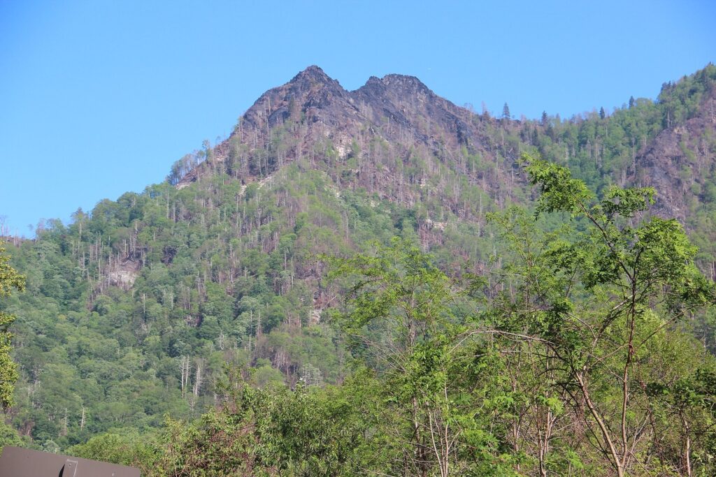
The trailhead is just past the overlook if you want to walk it. It’s short but steep. The exposed rock scramble at the old summit has been closed for years after fire damage. The trail now ends at a viewpoint rather than the peaks themselves. For most families, the roadside overlook is the better stop anyway. Five minutes, no boots required.
Morton Overlook
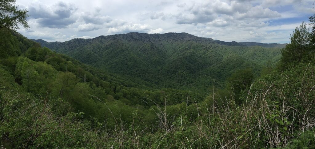
Morton Overlook sits close to the gap, on a sweeping curve looking down the Walker Camp Prong valley toward Mount Le Conte. It’s the sunset spot on this side of the mountain, and everyone who’s ever driven up here at golden hour already knows it.
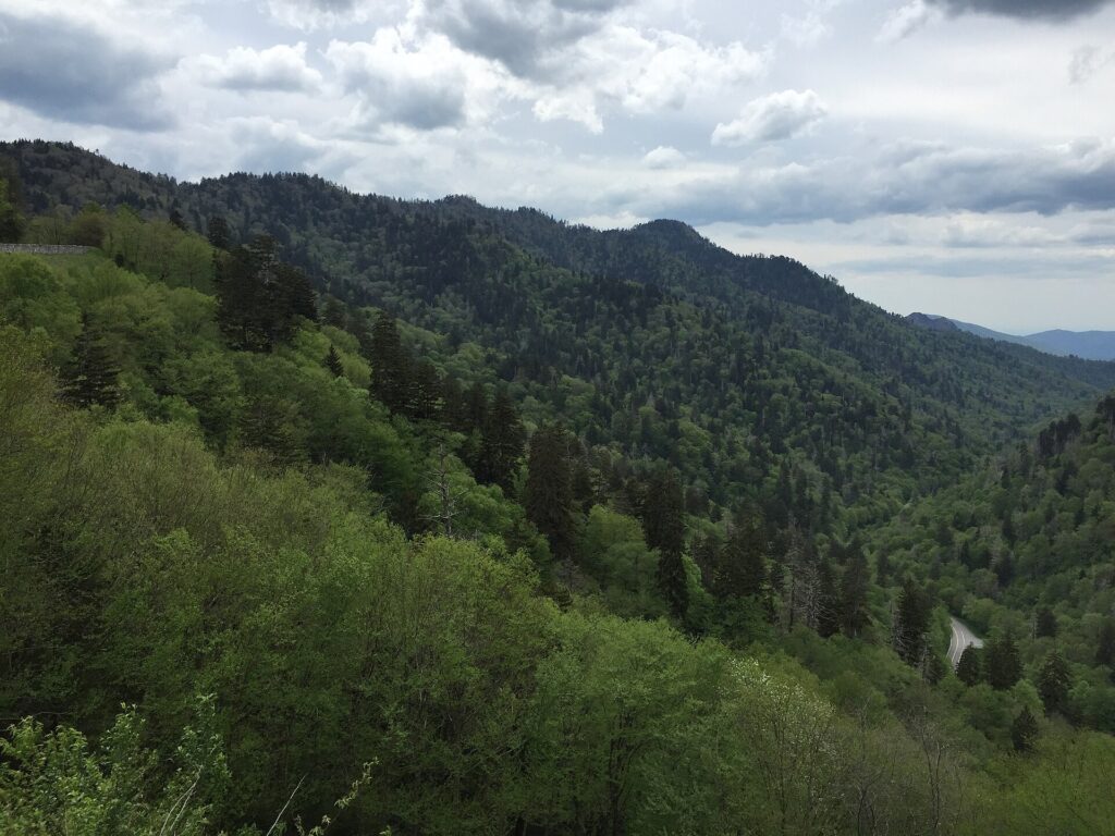
Parking is tight and it fills fast in the last hour before sunset. If that’s the plan, get there early and walk the shoulder rather than circling for a spot. Coming back down after dark, go slow. This stretch is popular with elk and deer at dusk.
Newfound Gap
Newfound Gap is the high point of the drive, at 5,046 feet. It’s the lowest drivable pass across the whole park. This is where Tennessee becomes North Carolina. It’s also where the Appalachian Trail crosses the road, on its way from Georgia to Maine. There’s a large parking area, a big stone semicircular platform, and views in both directions on a clear day.
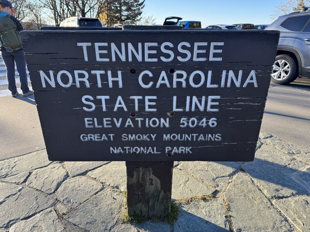
The stone platform is the Rockefeller Memorial, dedicated to the family whose donation helped complete the park’s land purchase. Most people walk up, read the plaque, take the state-line photo, and move on. That’s the right amount of time to spend here. This is also where the turnoff for Kuwohi branches off, if the summit drive is on your list.
Bring a layer. The gap sits well above the valley floor, and the temperature drop from Gatlinburg is real, not a travel-blog exaggeration. I’ve stood up here in a jacket while it was warm enough for shorts down at Sugarlands.
Newfound Gap Road Tunnel
South of the gap, the road does something most drivers don’t expect. It loops all the way around and crosses back over itself through a tunnel. That’s how it gains elevation on a hillside too steep for a straight climb. Locals call this stretch the Loop. It’s one of the more interesting pieces of road engineering in the park.
You won’t get much of a photo from the driver’s seat. A passenger can usually spot the road doubling back below, through the trees. It’s a fun thing to point out to kids in the back seat, and a good reminder to keep both hands on the wheel.
Oconaluftee Visitor Center
Oconaluftee marks the North Carolina end of the road, near Cherokee and the Qualla Boundary. The park calls this area the southern gateway to the Smokies. It’s home to one of the park’s two main elk herds. The visitor center sits next to the Mountain Farm Museum, a cluster of relocated log buildings you can walk through.
Elk graze the open field behind the visitor center most mornings and evenings, especially in fall. Watch them from the field edge or the porch, not from the middle of the grass. From here it’s a short drive into Cherokee, NC for dinner or a place to stay the night.
Mingus Mill
Mingus Mill sits just north of Oconaluftee, close enough that it’s an easy add to the same stop. Built in 1886, it’s a working gristmill powered by a turbine rather than a water wheel. That let it grind faster than older mills nearby. The park’s materials describe it as a mill that ground everything from corn to wheat and rye for the community.
It runs seasonally, so check ahead if seeing it in operation matters to you. Even closed, the building and the mill race along the millpond are worth the short walk from the parking area. It’s a quiet, easy stop after the climb over the gap.
Newfound Gap Road Conditions
Does Newfound Gap Road close in winter?
Not on a fixed schedule. The park closes it temporarily during winter storms for snow and ice, then reopens it once crews clear the road, rather than shutting it down for the season the way it does with some higher spur roads.
Is Newfound Gap Road open at night?
Yes. It’s a through route connecting Gatlinburg and Cherokee, and it stays open around the clock outside of storm closures. Just expect deer and elk on the shoulders after dark.
How much snow does Newfound Gap get?
The park’s snow page puts the gap’s average at around 69 inches a year, with flurries possible anytime from October through April at the higher elevations.
Where do I check if Newfound Gap Road is open?
Call the park’s road status line at (865) 436-1200, extension 631, before heading up in winter weather. It’s the fastest way to know before you’re already on the mountain.
Published September 27, 2026.
Photo credits: (1) featured, The Rockefeller Memorial plaque and… — Billy Hathorn, CC BY-SA 3.0, via Wikimedia Commons; (2) The CCC memorial outside Sugarlands Visitor… — National Park Service, U.S. Government work, public domain, via Wikimedia Commons; (3) Mountain valley view from Morton Overlook… — Famartin, CC BY-SA 4.0, via Wikimedia Commons; (4) The Tennessee-North Carolina state line… — Missvain, CC BY 4.0, via Wikimedia Commons; (5) Panoramic mountain valley view from the… — Famartin, CC BY-SA 4.0, via Wikimedia Commons.