

Some links on our site may earn us a commission at no extra cost to you. Learn more.
Kuwohi, known for generations as Clingmans Dome, is the highest point in the Great Smoky Mountains. It reaches 6,643 feet. Yes, Clingmans Dome is worth visiting. A short, steep paved trail leads to an observation tower with a 360-degree view. It’s one of the few spots in the park where you stand above the treeline. The catch is a small parking lot that fills fast, and a road that closes every winter.
I’ve made the walk up to the tower more times than I can count. I usually time it for early morning, before the lot fills and the haze rolls in. It’s a short trail on paper and a real leg-burner in practice, especially coming from sea level. The payoff is standing above the spruce-fir forest with the whole range spread out around you. That’s not something you get anywhere else in the Smokies.
This isn’t a stop you tack onto the end of a long day. Get there early, wear real shoes, and give it a full hour once you factor in parking. Everything below is what to expect and what the park itself says about it.
How Long Is the Clingmans Dome Hike?
The walk from the parking area to the tower is 0.5 miles one way, paved the whole way. That’s a mile round trip. It sounds short, and it is. But the trail climbs steadily from the moment you leave the lot.
Plan on 30 to 45 minutes round trip. That’s if you’re stopping to catch your breath and take photos. It’s faster if you’re moving quickly. Here’s the quick reference we use ourselves.
| Detail | Figure |
|---|---|
| Elevation | 6,643 feet (highest point in the park and in Tennessee) |
| Trail to tower | 0.5 miles one way, paved |
| Trail grade | Steep; too steep to be wheelchair accessible |
| Road to trailhead | 7 miles from Newfound Gap |
| Road closure season | Early December through late March, plus severe weather days |
| Appalachian Trail | Crosses Kuwohi at its highest point from Georgia to Maine |
All of those figures come from the National Park Service’s own Great Smoky Mountains pages, not estimates. The one number that changes year to year is exactly when the road reopens each spring, which depends on weather.
Kuwohi Observation Tower
The tower at the top is 45 feet tall. A 375-foot ramp winds up gradually to the deck instead of climbing in a straight run. It was built in 1959 as part of Mission 66, the National Park Service’s park-wide construction program from that era.
Only nine towers went up under that program. This one served as the model for two later ones: Look Rock Tower elsewhere in the Smokies, and Shark Valley Observation Tower in the Everglades. It’s now listed on the National Register of Historic Places. That’s part of why the structure hasn’t been swapped for something more modern.
How Hard Is the Clingmans Dome Hike?
Harder than the distance suggests. The pavement is smooth, but the grade is constant. There’s no flat stretch to recover on. At 6,600 feet the air is thinner than most visitors are used to. That catches people who assume a half-mile paved path will be easy.
Bring a jacket even in summer. Temperatures at the summit run 10 to 20 degrees cooler than down in Gatlinburg or Cherokee. Wind on the tower deck makes it feel colder still.

Where to Park for Kuwohi
There’s one parking area, at the end of Kuwohi Road, and it’s the trailhead for the walk to the tower. The National Park Service says plainly that demand at Kuwohi often exceeds the parking supply. That’s especially true midday and on fall weekends.
We get there before 9 a.m. or after 5 p.m. to actually find a spot. If the lot is full, the park’s advice is to have a backup destination in mind rather than circle and hope. Never park with wheels in the roadway. A Smokies parking tag is required on the dashboard the same as anywhere else in the park, so sort that out before you drive up.
Kuwohi Road, the road up to the tower, branches off Newfound Gap Road at Newfound Gap itself. That’s the pass on the Tennessee-North Carolina state line. It’s an easy add-on whether you’re coming up from Gatlinburg on the Tennessee side or Cherokee on the North Carolina side. Both routes funnel through the same gap.
There’s a small visitor center right at the parking area, with restrooms and rangers who can answer questions about current conditions. Kuwohi draws more than 650,000 visitors a year, NPS figures show. That’s most of the reason the lot fills as fast as it does.
When Is Clingmans Dome Road Closed?
The road up to Kuwohi closes seasonally. That’s typically early December through late March, plus any time dangerous weather demands it, the park’s closure schedule shows. Newfound Gap Road itself can also close separately in bad weather, even when the Kuwohi spur is open.
If a fall or spring trip lands close to those dates, check the park’s current road status before you drive up. It is not a short backtrack if the gate is closed when you arrive from Gatlinburg or Cherokee.
Best Time to Visit Clingmans Dome
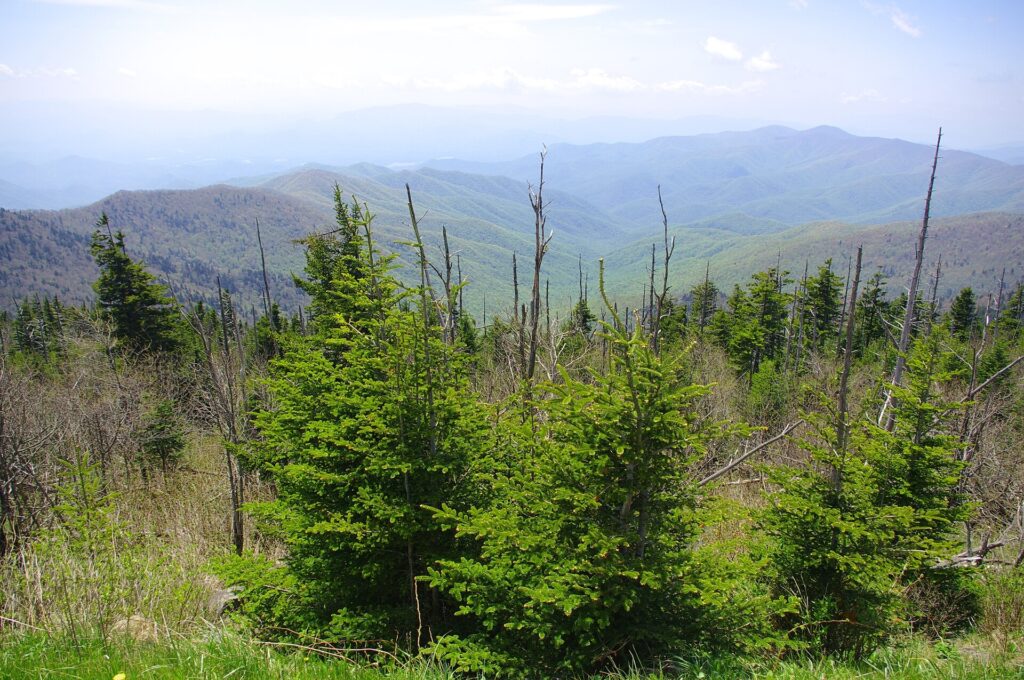
Early morning is the best time to visit Clingmans Dome, both for parking and for the view. Haze builds through the day, especially in summer. The National Park Service notes that visibility on a clear day can top 100 miles. It often drops under 20 miles once air pollution settles in.
Fall brings the clearest air and the biggest crowds at once. That early arrival matters more, not less. Winter has the best visibility of all on a clear day. But the road is usually closed then, which rules it out for most visitors.
Summer afternoons are the worst combination: haze at its thickest, thunderstorms that build fast at elevation, and a lot that’s already full by 10 a.m. If a summer trip is all you’ve got, treat sunrise as the only realistic window for a clear view.

Is Clingmans Dome Worth It?
We think so, and we’d put it near the top of a first Smokies trip. It’s the one place in the park with a full 360-degree view instead of a single overlook. The tower itself, a concrete spiral ramp rising above the trees, is worth seeing on its own.
What it isn’t is a quiet spot. The lot fills, the trail gets crowded on the way up, and the view depends entirely on haze that day. Pair it with a Smokies itinerary that puts you there early. Spend the afternoon somewhere less trafficked.
Skip it only if you’re set on solitude, or you’re visiting during a stretch of hazy days. The whole point of the trip is the view from the deck. On a clear morning, there isn’t a better single stop in the park for the effort involved.
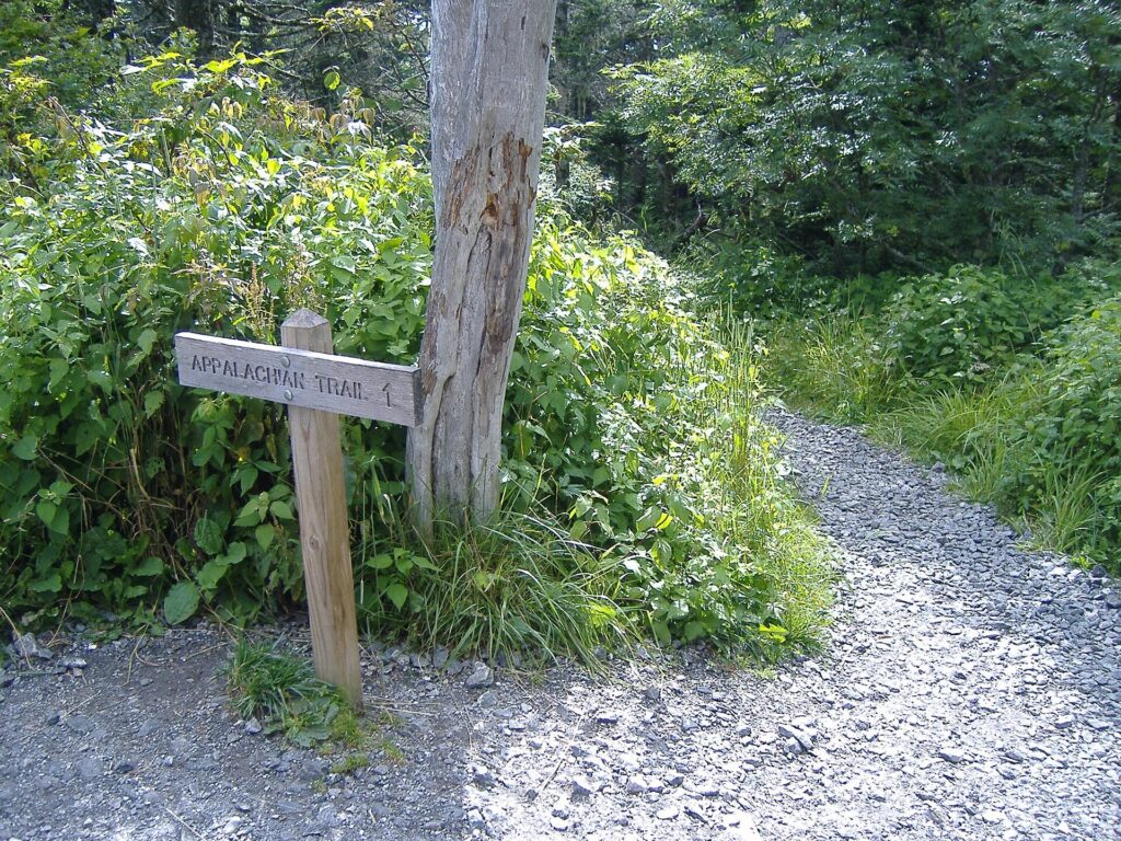
The Appalachian Trail crosses right at the tower. It marks the highest point on the entire trail from Georgia to Maine. Thru-hikers pass through here on their way north. It’s worth a minute to find the AT crossing sign near the parking area before you start up the paved trail.
If you’re building a longer stay around it, our guide to planning a Smokies trip covers where to base yourself for easy access to Newfound Gap Road.
Clingmans Dome Facts
What Does Kuwohi Mean?
Kuwohi translates to “mulberry place” in English, the park notes. It’s the Cherokee name for the mountain and predates the name Clingmans Dome by centuries.
Why Was Clingmans Dome Renamed?
The U.S. Board on Geographic Names voted to restore the name Kuwohi on September 18, 2024, per the National Park Service. The Eastern Band of Cherokee Indians had submitted the request. The mountain had carried the name Clingmans Dome since an 1859 survey, long after the Cherokee name was already in use.
Does Clingmans Dome Cost Money?
There’s no separate fee to visit Kuwohi. A park-wide parking tag is required to leave a vehicle anywhere in Great Smoky Mountains National Park, including the Kuwohi lot; see our parking tag guide for current details.
Does the Appalachian Trail Go Through Clingmans Dome?
Yes. The Appalachian Trail crosses Kuwohi at its highest point on the entire trail between Georgia and Maine. A short spur connects the AT to the paved trail up to the tower.
Can You Drive Up to Clingmans Dome?
Yes, when the road is open. Kuwohi Road runs 7 miles from Newfound Gap to the parking area, and closes seasonally from early December through late March.
Published September 25, 2026.
Photo credits: (1) Spiral concrete ramp leading up to the… — Kevin Payravi, CC BY-SA 4.0, via Wikimedia Commons; (2) View southwest from the Forney Ridge… — Brian Stansberry, CC BY 3.0, via Wikimedia Commons; (3) Appalachian Trail crossing through… — Peter K., CC BY-SA 3.0, via Wikimedia Commons; (4) Spruce-fir forest atop Kuwohi (Clingmans… — Brian Stansberry, CC BY 3.0, via Wikimedia Commons.