

Some links on our site may earn us a commission at no extra cost to you. Learn more.
Zion vs Bryce Canyon comes down to one question. Do you want to walk into the canyon, or stand on the rim and look down? Zion is the better first park for most trips, because it works in every season and fills a whole day. Bryce Canyon is the higher, colder, smaller stop, and half a day sees it well.
I would choose between them by the kind of day you want, not by the name on the map. We have done long national park days with nieces and nephews along. The park with the big hike wears everybody out, and the park with the viewpoint gives you an easy afternoon. Zion is the big hike. Bryce is the viewpoint, and a down jacket in October there is not over-packing.
Difference between Bryce Canyon and Zion
The difference between Bryce Canyon and Zion is the shape of the day. Zion is a river canyon with a free shuttle, a paved road along the floor and one famously wet hike. Bryce is a rim with an amphitheater of orange hoodoos below it. Most of the good views are a short walk from a parking lot or a shuttle stop.
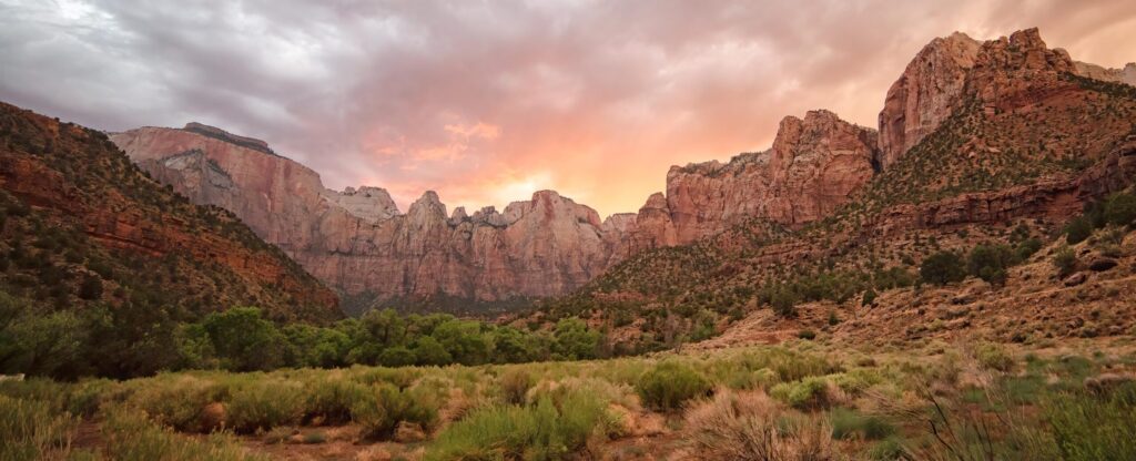
The table puts the two side by side. Every number in it comes from the park pages read on October 2, 2026. The sections below explain each row.
| Factor | Zion | Bryce Canyon | Who it fits |
|---|---|---|---|
| Vehicle entry | $35 | $35 | Same price, so decide on the trip |
| Shuttle | Free, no reservation, required on the Scenic Drive in season | Free with admission, optional | Zion for drivers who hate parking, Bryce for viewpoint hoppers |
| Signature hike | Angels Landing (5.4 miles, permit) and the Narrows | Queen’s Garden and Navajo Loop (2.9 miles) | Zion for stamina, Bryce for a steady half day |
| Elevation | Canyon floor | Rim around 8,000 feet, over 9,000 in places | Bryce asks more of your lungs |
| Winter days | Highs of 50 to 60°F | Average highs of 36 to 38°F | Zion for a mild-ish winter trip |
| Lodge in the park | 76 rooms, 6 suites, 40 cabins | 114 rooms | Book either one early |
Zion and Bryce Canyon entrance fee
On the date checked, October 2, 2026, both parks listed the same prices on their fee pages. A private vehicle pays $35, a motorcycle pays $30, and anyone on foot or on a bicycle pays $20 per person. A Bryce entry is valid for seven days, and Zion lists one to seven days. Each park also sells its own $70 annual pass, good only at that park.
The America the Beautiful pass costs $80 for the resident version and $250 for the non-resident version. It covers entrance and standard amenity fees at six federal agencies. That means one private vehicle fee or four per-person fees. If Zion and Bryce are your only two fee parks, two $35 vehicle entries cost less than the $80 pass.
A third entry at the same $35 pushes you past it. That is why a longer loop like the Utah Mighty 5 road trip tips toward the pass. Our national park road trip cost guide runs the wider budget.
Zion shuttle
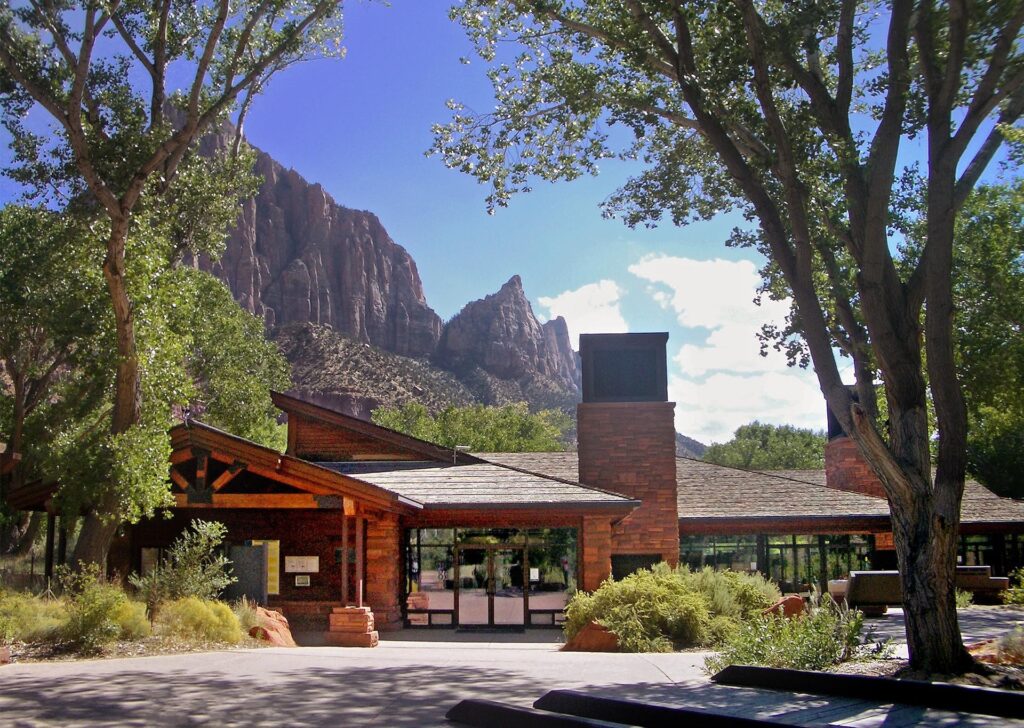
For most of the year you ride a shuttle on the Zion Canyon Scenic Drive instead of driving it. The park’s 2026 shuttle page lists service from September 13 through January 2. It pauses from November 29 to December 25. Nobody needs a permit or reservation to ride, and private vehicles cannot use the Scenic Drive during shuttle season.
From September 13 to October 24, the first shuttle leaves the Visitor Center at 7:00 am. The last leaves at 6:00 pm, and the last bus back from Temple of Sinawava leaves at 7:15 pm. The separate Springdale line has nine stops in town. One is the pedestrian and bicycle entrance at Zion Canyon Village. Hours change after October 24, so check the shuttle page.
Bryce Canyon shuttle
Bryce’s shuttle is optional, and it is free with your park entrance receipt or pass. It serves the amphitheater area with 15 stops. Four are Bryce Point, Inspiration Point, Sunset Point and Sunrise Point. Buses typically reach each stop every 15 minutes.
The 2026 schedule lists three windows. April 3 to May 8 runs 8:00 am to 6:00 pm, and so does September 21 to October 18. May 9 to September 20 runs 8:00 am to 8:00 pm. The last window ends October 18, so check the shuttle page before you plan a later trip around it. I would ride it in summer rather than circle a viewpoint lot.
Angels Landing permit lottery
Angels Landing is 5.4 miles round trip with 1,488 feet of climbing, and most hikers take around four hours. The permit covers the half mile of chains that starts at Scout Lookout. Rangers can check it anywhere on the trail. The park’s permit page sends you to Recreation.gov for both lotteries.
Apply for tomorrow’s hike in the day-before lottery, which closes at 3 pm Mountain Time. The seasonal lottery covers hikes from December 1 to February 28, and the permit page listed October 20, 2026 as the close of that winter’s lottery. Check Recreation.gov for the next window.
Zion’s conditions page, last updated September 16, 2026, reported the East Rim Trail partially closed by a large rockfall. Hidden Canyon was closed as a result. Observation Point could not be reached from Zion Canyon, only from the east. Read the page again the week you go.
Zion Narrows hike
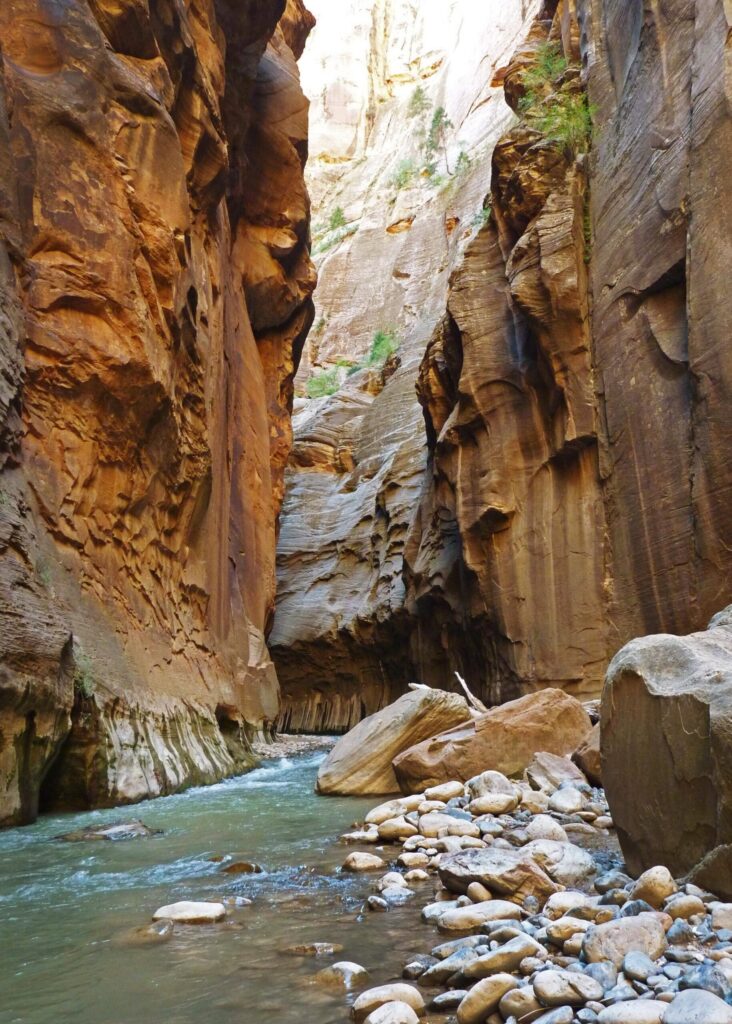
The bottom-up Narrows needs no permit. The park says an hour in the river makes a great experience, and the all-day version is a ten-mile round trip to Big Spring. Under 70 CFS the park describes knee-deep crossings and pools up to waist-deep. From 70 to 150 CFS, crossings are thigh-deep and pools can be chest-deep.
Over 150 CFS the Narrows closes to all travel. It also closes when the National Weather Service issues a Flash Flood Warning. It stays closed for at least two hours after the warning lifts. Monsoon season runs July to September, and fall water is colder.
Navajo Loop Trail
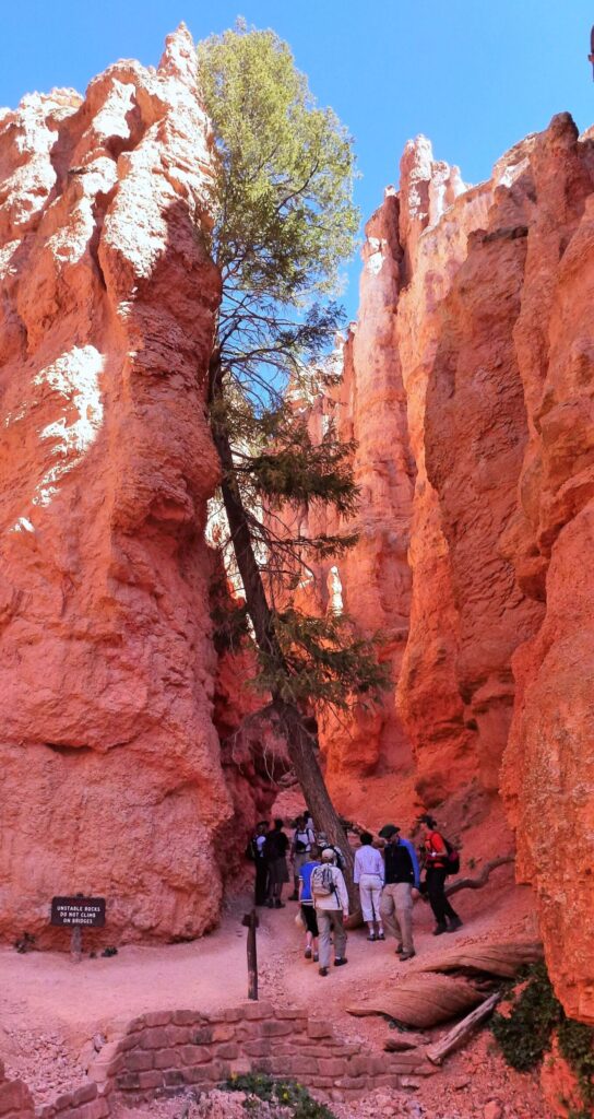
The Queen’s Garden and Navajo combination loop is Bryce’s signature walk. It is 2.9 miles, takes two to three hours, climbs 625 feet and rates as moderate. Hike it clockwise. Go down Queen’s Garden and up the Navajo Loop, so the amphitheater is in front of you on the descent.
The Wall Street side of the Navajo Loop closes in months when precipitation combines with freezing overnight temperatures. The Two Bridges side stays open year-round. Save your water for the climb back out, which is the hard part.
The Rim Trail is the easy alternative. It runs from 1.0 to 11.0 miles, depending on how far you choose to walk, and rates easy to moderate. The half mile between Sunrise and Sunset Points is paved. I would hand it to anyone who wants the views without the climb back up.
Zion elevation vs Bryce Canyon
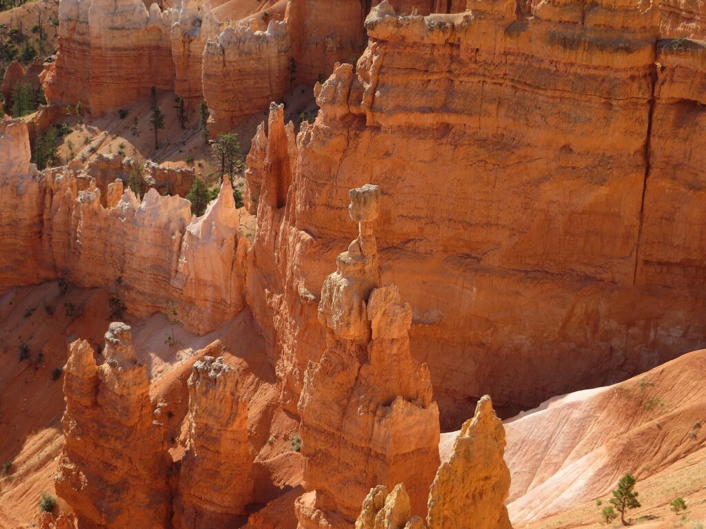
Bryce sits about 4,000 feet higher than the visitor centers at Zion. NPS puts its elevations at an average around 8,000 feet, reaching over 9,000. At 8,000 feet, effective oxygen is about 75% of the sea-level amount. A flat mile feels longer there, so build in slow mornings.
Why is Bryce Canyon colder than Zion?
Elevation is the whole answer. Zion’s seasons page says summer temperatures regularly top 100°F. Bryce lists June highs in the high 60s to low 70s. July and August highs run in the high 70s to low 80s. From October to May, Bryce falls below freezing nearly every night, and October snowstorms are not unusual.
Zion and Bryce Canyon in winter
Zion winter days run from 50 to 60°F, with nights well below freezing. Bryce’s average winter highs are 36 to 38°F, and the lows are 15 to 17°F. The coldest and snowiest stretch runs December through February. Snowshoeing is allowed on all Bryce trails, and cross-country skiing runs above the rim.
Roads add a wrinkle. Zion lists the Zion-Mt. Carmel Highway as subject to seasonal closures from snow, ice and rockfall. Kolob Terrace Road usually closes for several months. For a winter trip with one park, I would pick Zion.
Zion and Bryce Canyon where to stay
Zion Lodge has 76 rooms, 6 suites and 40 cabins. It is the only place inside the park that serves food. Watchman Campground is open year-round, while South and Lava Point campgrounds open seasonally. Outside the gate, the park lists lodging in Springdale, Rockville, Mt. Carmel Junction, Hurricane, St. George and Kanab.
I would base in Springdale for Zion, because the shuttle line runs through town. Our Zion two-day itinerary builds the days around that choice.
Bryce has the Lodge at Bryce Canyon, with 114 rooms, dining and a gift shop. The park says reservations are highly recommended. For beds outside the park, NPS points to the Garfield County Tourism Bureau. Bryce Canyon City sits just beyond the entrance.
What is better Bryce Canyon or Zion?
I would pick Zion for a first trip and add Bryce Canyon as the second stop. Zion gives you the bigger menu of hikes, a mild shoulder season and a shuttle that does the driving. Bryce gives you a huge view for very little effort. Here is how I would split it by trip type.
- First trip: Zion, with Bryce as a half-day add-on if you have a third day.
- Hikers: Zion for Angels Landing and the Narrows, Bryce for the Queen’s Garden and Navajo loop.
- Photographers: Bryce for the rim views, Zion for river light between canyon walls.
- Families with nieces and nephews: Bryce for short legs, since a viewpoint and a paved walk beat a long trail; Zion for older ones with stamina.
- Winter: Zion, with Bryce reserved for snowshoes and a warm jacket.
If the trip stretches beyond these two, the Utah Mighty 5 road trip strings them together. Canyonlands and Arches are the other big names on that loop. Pack for both seasons with our national park road trip packing list.
Zion National Park questions
How far is Bryce Canyon from Zion?
The drive takes about 1.5 to 2 hours by Utah 9 and US 89. Utah 9 runs through the Zion-Mt. Carmel tunnel. NPS’s large-vehicle page sets single-vehicle limits of 7 feet 10 inches wide and 11 feet 4 inches tall. Bigger rigs go through the tunnel pass and escort system, so read that page before you drive an RV east.
Can you do Bryce Canyon and Zion in one day?
Technically, but you would spend most of the day in the car. With the drive each way and a stop in each park, you see viewpoints and not much else. I would give each park its own morning.
Is the Narrows open in Zion?
It depends on the day. The park closes the Narrows above 150 CFS. It also closes under a National Weather Service Flash Flood Warning, plus at least two hours after the warning lifts. Check the Zion conditions page the morning you go.
Does the America the Beautiful pass cover Zion and Bryce Canyon?
Yes. The pass covers entrance and standard amenity fees at lands managed by six federal agencies, including the National Park Service. It covers one private vehicle fee or four per-person fees.
Prices are approximate, current as of publication, and change frequently — confirm the latest price with the retailer before buying.
Published October 18, 2026.
Photo credits: (1) featured, Hoodoos in the Bryce Amphitheater in Bryce… — “Jon Zander (Digon3)”, CC BY-SA 3.0, via Wikimedia Commons; (2) Towers of the Virgin rock peaks under a… — NPS / Jesse Nelson, U.S. Government work, public domain, via National Park Service; (3) Zion Canyon Visitor Center area with cliffs… — NPS, U.S. Government work, public domain, via National Park Service; (4) Virgin River running between tall orange… — NPS, U.S. Government work, public domain, via National Park Service; (5) Hikers on a trail between tall red rock… — Pierre André Leclercq, CC BY-SA 4.0, via Wikimedia Commons; (6) Thor's Hammer hoodoo seen from the Rim… — Ken Lund from Reno, Nevada, USA, CC BY-SA 2.0, via Wikimedia Commons.