

Some links on our site may earn us a commission at no extra cost to you. Learn more.
Big Bend National Park is a remote desert, river and mountain park in far West Texas. It rewards a plan more than most parks. Entry is $30 per vehicle for seven days, and the nearest airports sit 235 and 330 miles from park headquarters. Take the three districts one per day.
We have done long desert drives with nieces and nephews along. The lesson carries over: in a remote park, the fuel gauge and the water bottles run the plan. I would fill the tank before leaving pavement and carry more water than feels sensible. I would book the bed before the flights. Everything below was checked against the park’s own pages on October 3, 2026, and anything that can change before you arrive is dated.
How to get to Big Bend National Park
Big Bend sits at the bottom of a long, empty stretch of West Texas. Getting there is part of the trip. The park lists Midland/Odessa as 235 miles from park headquarters and El Paso as 330 miles, both with rental cars. Amtrak and Greyhound stop at Alpine, which the park puts at 100 miles away.
The park’s directions page names three routes in. TX 118 runs from Alpine to Study Butte. FM 170 runs from Presidio to Study Butte, then 26 miles east to headquarters. US 90 or US 385 reaches Marathon, then it is 70 miles south. The page gives no drive times. I would pad any map-app estimate and plan a fuel stop before the last town.
Park entrances are open 24 hours daily. Fee stations and visitor centers may close after normal hours. A late arrival works if the lodge or campsite knows you are coming.
Big Bend National Park entrance fee
The park’s fees page lists $30 for one private vehicle, $25 for a motorcycle and $15 for one person on foot or bicycle. Each is valid for seven days. The annual pass is $55 and runs one year from purchase. No cash is accepted, only credit or debit cards.
Developed campgrounds cost $16 per night per site. A backcountry use permit costs $10 per night. The same page lists two fall fee-free entrance days this year, October 27 for Theodore Roosevelt’s birthday and November 11 for Veterans Day.
Best time to visit Big Bend National Park
Spring is warm and pleasant, and it is the park’s busiest season, according to the weather page. Fall and winter are mild and usually sunny. Freezing temperatures can happen, and snow is rare and light. I would aim for that fall-to-spring stretch.
Summer is the season to plan around. May through August is extremely hot. The desert floor regularly passes 100°F by late morning, and the Chisos Mountains run 10 to 15 degrees cooler. Average summer highs are 106°F at Rio Grande Village, 94 to 95°F at Panther Junction and 87 to 88°F in the Chisos Basin.
Rain comes July through September, with locally heavy thunderstorms and some flash flooding. On the date checked, October 3, 2026, the Alerts and Conditions page listed six road closures from flash flooding, until further notice. They were River Road east and west, Old Maverick Road, Hot Springs Road, Black Gap Road and Glen Spring Road south of Rice Tanks Campsite. The paved road between Cottonwood Campground and Santa Elena Canyon was on the list too. Treat that as a snapshot and read the page again before you drive in.
Big Bend National Park three day itinerary
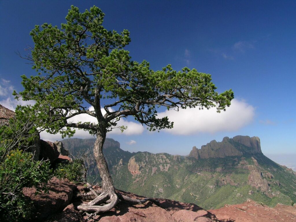
Day one goes to the Chisos Basin. The Ross Maxwell Scenic Drive and Santa Elena Canyon fill the second day, and Rio Grande Village takes the third. That mirrors the park’s own suggested three-day plan and keeps each day inside one district. The park’s pages give distances but not drive times, so the table sticks to distances.
| District | Stops | Distance the park lists | Notes |
|---|---|---|---|
| Chisos Mountains | Basin visitor center, Lost Mine and Window trails, the lodge | Chisos Basin Road, 6 miles | Climbs more than 2,000 feet; not recommended for trailers over 20 feet or RVs over 24 feet |
| Ross Maxwell Scenic Drive | Sotol Vista, Mule Ears Overlook, Castolon, Santa Elena Canyon | 30 miles | Paved road to the canyon was listed closed on October 3, 2026 |
| Rio Grande Village | Dugout Wells, Langford Hot Springs, Boquillas Canyon, the nature trail | 21 miles from Panther Junction | Store, fuel and campground; seasonal visitor center |
| North entrance | Dog Canyon, Devil’s Den, Fossil Bone Exhibit | Persimmon Gap to Panther Junction, 28 miles | Persimmon Gap visitor center is seasonal, November through April |
Santa Elena Canyon
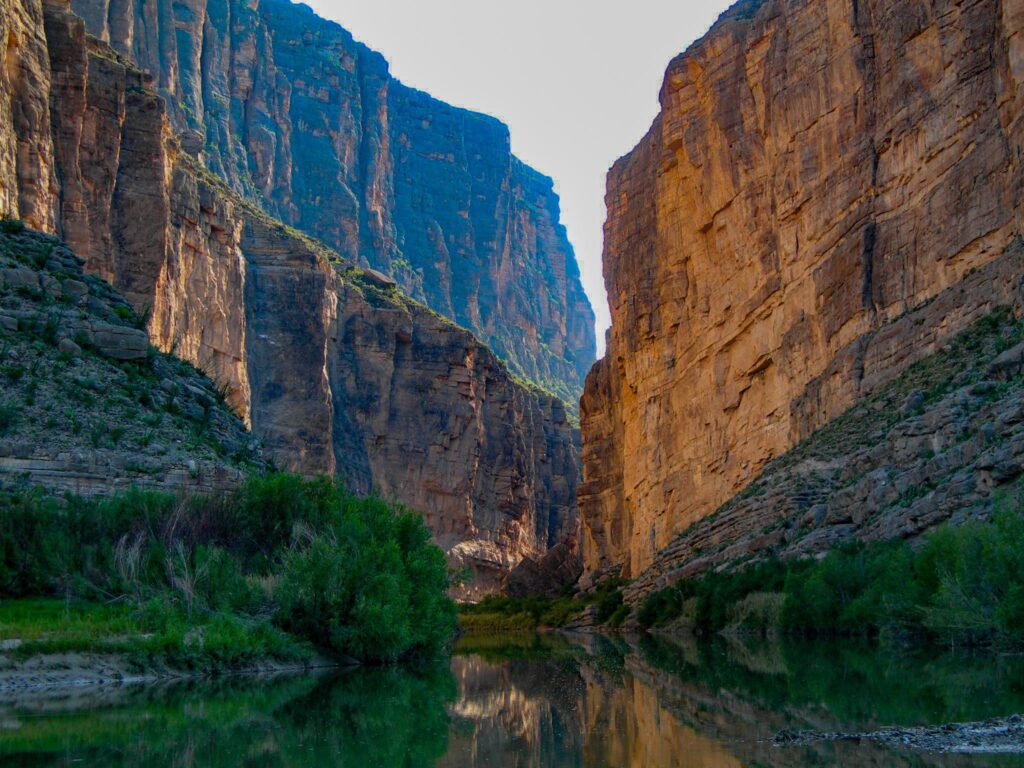
The Santa Elena Canyon trail is 1.7 miles round trip and rated moderate. The canyon walls are limestone cliffs about 1,500 feet high. You cross Terlingua Creek first. It can be dry sand, thick mud or running water, depending on recent rain.
The park says the trail is impassable when the creek floods. If the water is too high, it says not to attempt the crossing. I would take that literally. Given the closure on the date checked, confirm the road is open before you build a day around this canyon.
Boquillas border crossing
The Boquillas Port of Entry is the park’s crossing into Mexico. On the date checked, the conditions page listed it open Friday through Monday, 9 am to 4 pm. The park’s hours page says the crossing is seasonal and its hours change through the year. It also says a valid passport is required. I would confirm hours and documents with the park and with CBP before planning around it.
On the US side, the Boquillas Canyon Trail is 1.4 miles round trip and moderate. It climbs to a cliff above the Rio Grande, where the park points out ancient mortar holes. Then it drops to the canyon, where the walls meet the river.
River Road
The park counts more than 100 miles of paved road and 150 miles of dirt. River Road runs 51 miles and is the most isolated. Old Ore Road runs 25 miles. Both are primitive dirt roads that need a high-clearance, four-wheel-drive vehicle.
The park defines that as a street-legal SUV or truck. It needs at least 15-inch rims, a low-gear transfer case, 8 inches of ground clearance and mechanical 4WD. A disabled vehicle out there can become life-threatening, and the roads are rarely patrolled. Carry water, a jack and a good spare. River Road was among the closures on the date checked.
Langford Hot Springs
A two-mile gravel road down a rough, narrow wash leads to the trailhead. The walk to the spring is 0.5 mile round trip. The park’s hot springs page puts the water at 105°F. It is for soaking only: no soap, no glass, no alcohol. The park does not recommend swimming in the river because the currents are unpredictable. Hot Springs Road was listed closed on the date checked.
Big Bend hikes
The park lists more than 150 miles of trails. The lengths and ratings below come from its mountain hikes page and its river hikes page. Where the suggested-itinerary page rounds differently, I used the trail pages.
| Trail | Round trip | Rating | What to know |
|---|---|---|---|
| Window View Trail | 0.3 mile | Easy | Paved, wheelchair accessible, benches |
| Lost Mine Trail | 4.8 miles | Moderate | Good first look at Chisos plants and wildlife |
| Window Trail | 5.6 miles | Moderate | Slickrock pour-off with no railings; the return is uphill |
| South Rim | 12 to 14.5 miles | Strenuous | About 2,000 feet of climb; parts closed for falcon nesting |
| Emory Peak | 10.0 miles | Strenuous | Last 25 feet is an exposed scramble |
| Boquillas Canyon Trail | 1.4 miles | Moderate | Cliff overlook above the river |
| Santa Elena Canyon Trail | 1.7 miles | Moderate | Impassable when Terlingua Creek floods |
| Rio Grande Village Nature Trail | 0.75 mile loop | Easy | First 100 yards is an accessible boardwalk |
I would do Lost Mine early, while the Basin is cool. The Window Trail can wait for later in the day. Take the slickrock edge slowly. The park also runs free guided hikes, Lost Mine among them, and its calendar shows the current schedule.

Where to stay in Big Bend National Park
The only lodging inside the park is the Chisos Mountains Lodge. Aramark runs it at 5,400 feet in the Chisos Basin. It has rooms and cottages and takes bookings through its own site or phone line. With one lodge in the park, I would reserve before buying flights.
The park runs three campgrounds. Its concessioner runs an RV park with 25 full-hookup sites, 38 feet maximum. On the date checked, Chisos Basin and Rio Grande Village were open with reservations required through recreation.gov. Cottonwood was closed for the summer and listed to reopen November 1.
Our national park camping checklist and road trip packing list cover the gear side. Backcountry camping needs a permit from the Chisos Basin or Panther Junction visitor center.
Big Bend gas stations
Fuel inside the park is at Panther Junction, with gas, diesel and groceries. Rio Grande Village has the same plus propane. Outside the park, the park lists Study Butte, Lajitas, Terlingua and FM 2627 north of the park. Fill up at every chance.
Convenience stores run year-round at Rio Grande Village, the Chisos Basin and Castolon. They stock basic camping supplies. On the date checked, the lodge’s main restaurant was closed. A food truck ran daily from 7 am to 3 pm, closed 10 to 11 am. I would pack real groceries and treat the store as backup.
Panther Junction Visitor Center was open daily 8:30 am to 5 pm. The Chisos Basin center ran 8:30 am to 4 pm, closed for lunch. Rio Grande Village, Castolon and Persimmon Gap were closed for summer; they run seasonally from November through April, so check the hours page for the reopening date.
Big Bend dark sky
Big Bend became an International Dark Sky Park in 2012. The park’s stargazing page says NPS measurements show the darkest night skies of any national park in the lower 48 states. With Big Bend Ranch State Park, the protected area covers 1,112,000 acres.
The park offers free night-sky programs, including star parties and moonlight walks. For a do-it-yourself night, bring binoculars and find a spot away from the developed areas. Fall and winter nights get cold, so pack a jacket even if the afternoon was warm.
Big Bend National Park safety
Carry at least one gallon of water per person per day. Springs cannot be relied on. Wear a hat, long sleeves and sunscreen. Tell someone your route and your expected return time before you leave pavement. Our Death Valley National Park guide covers the same desert-heat habits.
Avoid narrow canyons and dry washes during thunderstorms. Flash floods can arrive under a clear sky overhead. Cell service is limited throughout the park, so download maps first.
If you meet a bear or mountain lion, the park says do not run. Back away to get out of range. The backcountry page warns that black bears, javelina and other animals will explore a campsite for scraps, and the food storage rules are strictly enforced. Venomous snakes, scorpions and spiders are active in warmer months. Shake out your shoes.
Is Big Bend National Park worth it?
I think Big Bend is worth the drive if you want a park that is mostly sky, rock and river. I would skip it for a short trip with easy logistics. Give it three days, and book the lodge or a campsite early. A weekend with a flight is better spent somewhere with easier logistics, such as our Austin weekend itinerary. If you are building a longer desert-parks loop, our Utah Mighty 5 road trip is the closest match in spirit.
For the budget side, see our national park road trip cost breakdown.
Big Bend National Park facts
How many days do you need in Big Bend National Park?
Three days is the practical minimum. The park says Big Bend is too big to see in a single day. Its suggested three-day plan gives one area to each day: the Chisos Basin, the Ross Maxwell Scenic Drive side and Rio Grande Village. A week lets you add the dirt roads and the longer mountain trails.
How much does it cost to get into Big Bend National Park?
The park’s fees page lists $30 for one private vehicle, $25 for a motorcycle and $15 for one person on foot or bicycle. Each is valid for seven days. The annual pass is $55. The park takes credit and debit cards only, no cash.
Can you cross into Mexico from Big Bend National Park?
Yes, at the Boquillas Port of Entry, with a valid passport. The crossing is seasonal and its hours change through the year. On the date checked, October 3, 2026, the conditions page listed it open Friday through Monday, 9 am to 4 pm.
Is there cell service in Big Bend National Park?
Very little. The park’s safety page says cell phone service is limited throughout the park. Wifi is listed at the Chisos Mountains Lodge, the Rio Grande Village store and several visitor centers. Download your maps before you drive in.
Prices are approximate, current as of publication, and change frequently — confirm the latest price with the retailer before buying.
Published October 15, 2026.
Photo credits: (1) featured, Chisos Mountains rising above the desert in… — NPS / B. Trester, U.S. Government work, public domain, via National Park Service; (2) Top of the Lost Mine Trail in the Chisos… — NPS / B. Trester, U.S. Government work, public domain, via National Park Service; (3) Santa Elena Canyon cliffs above the Rio… — NPS / B. Trester, U.S. Government work, public domain, via National Park Service; (4) View from the South Rim of the Chisos… — NPS, U.S. Government work, public domain, via National Park Service; (5) The Rio Grande winding through desert in… — NPS, U.S. Government work, public domain, via National Park Service.