

Some links on our site may earn us a commission at no extra cost to you. Learn more.
A good Olympic National Park itinerary takes three days and treats the park as four separate trips. They are the mountains at Hurricane Ridge, the lakes and hot springs on the north side, the Hoh Rain Forest, and the Pacific beaches. There is no loop road, so you drive out and back from Port Angeles or Forks. A private vehicle pays $30 at the gate, good for seven consecutive days.
We have done big national park days with nieces and nephews along. The lesson carries to every park: the drive is the plan. On the Olympic Peninsula that is doubly true. I would build each day around one side of the park and refuse to zigzag. The distances on the map look short, and the highway does not agree.
Olympic National Park entrance fee
The park’s fee page lists $30 per private vehicle, $25 per motorcycle and $15 per person on foot or bike. Each is good for seven consecutive days. That is what it listed in early October 2026. Children under 16 enter free. The park does not accept cash, so bring a card.
The Olympic annual pass is $55, and the America the Beautiful annual pass for residents is $80. The fee page also lists eight fee-free dates for 2026, including Veterans Day on November 11. For a wider budget that covers gas, lodging and food, our national park road trip cost guide has the framework.
Olympic National Park road closures
Check the alerts page before you load the car, because several closures mattered this fall. The park’s alerts and conditions page listed Mora Road as closed to all traffic for construction from July 8 to October 15, 2026, which cuts off Rialto Beach while it lasts.
In early October 2026 the same page listed Elwha/Olympic Hot Springs Road as closed to vehicles at the Madison Falls parking area because of a washout. South Shore Road at Quinault was closed at mile 8. Hurricane Ridge Road and Obstruction Point Road were open. The park also listed US 101 at the Hoh River Bridge, south of Forks, as closed in six-day stretches for WSDOT work. The last one was due to end at noon on October 13, with single-lane alternating traffic after each inspection, so allow extra time on that stretch. Construction dates slip and washouts take time to repair, so confirm each road before you drive, including whether Mora Road reopened on schedule. The park’s recorded road and weather line is (360) 565-3131.
Olympic National Park itinerary 3 days
Day one is Hurricane Ridge and Lake Crescent. Sol Duc and the drive to Forks fill day two, and the Hoh and the south coast fill day three. Rialto Beach slots into the end of day two if Mora Road is open. If it is not, skip it and let Ruby Beach on day three be the coast stop. The table lists each area with its distance from Port Angeles as the park describes it.
| Area | Key stop | Distance from Port Angeles | Fee or reservation |
|---|---|---|---|
| Hurricane Ridge | Meadows and ridge views | 17 miles south | Park entrance fee; winter road open Friday to Sunday |
| Lake Crescent | Marymere Falls, 0.9 mile one way | About 18 miles west | Park entrance fee |
| Sol Duc | Sol Duc Falls and hot springs | About 40 minutes west | Park fee; pools $19 adult, reservation required |
| Hoh Rain Forest | Hall of Mosses, 0.8-mile trail | About two hours | Park fee; campground reservations on Recreation.gov |
| Rialto Beach | Hole-in-the-Wall at low tide | About 75 miles | Park fee; Mora Road construction closure listed through Oct. 15, 2026, so confirm it reopened |
| Ruby Beach | Sea stacks, 735-foot path to sand | Past the Hoh turnoff on US 101 | Park entrance fee |
Hurricane Ridge
Hurricane Ridge is 17 miles south of Port Angeles on a paved road. It climbs into subalpine meadow with the Olympic range spread out in front. I would go up in the morning, before the lot fills and the day-trippers arrive. The snow stays long on the ridge: the park puts annual snowfall at 30 to 35 feet.
In summer the road stays open. The winter schedule generally starts in late November and runs Friday through Sunday and some holidays, if weather and road conditions permit. The road is usually open to uphill traffic from 9 a.m. to 4 p.m. It is closed on December 25. All vehicles, four-wheel drive included, must carry tire chains from November 1 through April 1. Obstruction Point Road runs mid-June through October 15 and is not suitable for RVs, trailers or buses.
Lake Crescent and Marymere Falls
Lake Crescent sits about 18 miles west of Port Angeles, a deep, glacially carved lake. The classic stop is Marymere Falls, a 90-foot drop at the end of a 0.9-mile trail through old-growth forest. The trail starts at the Storm King Ranger Station or from Lake Crescent Lodge.

Lake Crescent Lodge is generally open from late spring until early fall. A late-fall trip may find it closed, so check with the lodge first.
Sol Duc Falls and hot springs
The Sol Duc valley is about 40 minutes west of Port Angeles. From the road end, the walk to Sol Duc Falls is under a mile through old-growth forest on a relatively level path. The hot springs resort sits on the same road. It is a private concession, generally open late March through the last weekend in October. After that the pools stay closed until spring, so check the resort’s dates before a late-fall trip.
The resort’s own page lists 1.5-hour mineral pool sessions at $19 for adults 12 and over. Children 4 to 11 pay $15, and towels are $5. The page says reservations are required. Fall sessions run 8:00 a.m. to 7:30 p.m. I would book the slot before the trip, then plan the falls walk around it.
Hoh Rain Forest
The Hoh is the rain forest side of the park, reached by the Upper Hoh Road off US 101. It is about a two-hour drive from Port Angeles and under an hour from Forks. The Hoh Rain Forest page gives 140 inches of precipitation a year.
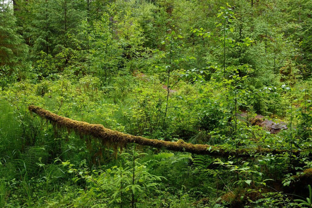
Two short trails do the job. The Hall of Mosses is 0.8 mile and the Spruce Nature Trail is 1.2 miles. Parking is limited in summer, and the park recommends arriving before 8 a.m. or after 5 p.m. to avoid waits of up to two hours. The visitor center is open daily in summer and generally Friday through Sunday in spring and fall.
Rialto Beach
Rialto is the driftwood beach, with giant drift logs and sea stacks offshore. Hole-in-the-Wall, a sea-carved arch, sits about 1.5 miles north along the sand. Some headlands on this stretch cannot be rounded at higher tides. The park warns that you can be stranded when the tide rolls in.

The park advises checking NOAA tide predictions and carrying a tide table and a topographic map that shows the headlands. Strong winds or storms can raise tides well above the table, mostly in fall, winter and spring. Stay off the big logs near moving water, because wet driftwood rolls.
Ruby Beach
Ruby Beach is the easy coast stop, in the Kalaloch area on US 101. The path from the parking lot is about 735 feet and steep, with drainage dips. It ends at sea stacks and tide pools. Winter swells rearrange the logs on the sand, so the beach in photos may not be the one you walk.

Kalaloch, a short drive south, has a wide sandy shoreline, two campgrounds, a lodge and a ranger station. It makes a clean stopping point before the long drive back toward Forks or Port Angeles.
How to get to Olympic National Park
From Seattle, I would plan on roughly three hours to Port Angeles including a ferry crossing. Allow more on a summer Friday. Washington State Ferries run Seattle to Bainbridge Island and Edmonds to Kingston. The wsdot.com site has current fares and sailings. Our Seattle itinerary covers the city days before or after the drive.
The Black Ball Ferry Line’s MV Coho runs from Victoria, British Columbia to Port Angeles in about 90 minutes. In early October 2026 its schedule page listed $25 for an adult passenger. A vehicle and driver 18 feet or under pays $88 each way. Sailing times change by season, so check the schedule for your date; the line is out of service for annual maintenance from January 4 to February 3, 2027.
Where to stay near Olympic National Park
Port Angeles is the base for Hurricane Ridge, Lake Crescent and Sol Duc. Forks is the base for Rialto Beach, less than 30 minutes away, and the Hoh, under an hour away. If you have only two nights, split them: one in each town saves two hours of backtracking.
Camping works too. Heart O’ the Hills campground has 105 sites, open year-round, 5 miles south of Port Angeles. The Hoh campground has 72 sites, released six months ahead on Recreation.gov. Our national park camping checklist covers the gear. If this park is one stop on a bigger trip, our Oregon coast itinerary picks up the shoreline to the south. Crater Lake is the next big park inland.
Olympic National Park weather
Rainfall is the thing to plan around, and the park explains why. Annual precipitation runs 100 to 170 inches along the coast and western valleys. Port Angeles averages only 25 to 30 inches. The mountains hold the rain back, so the north side can be dry while the Hoh is soaked.
Temperatures also vary by 10 to 20 degrees between the coast and the high country. Snow reaches the high elevations by late September. Dress for the place you are standing, not the town where you slept.
What to pack for Olympic National Park
I would still overpack layers, so here is the list that earns its place. Our national park road trip packing list covers the rest of the car.
- A waterproof shell with a hood, not a poncho that flaps in coastal wind
- Warm layers for the ridge, which is colder than the lowlands
- Waterproof shoes with grip for wet rock and slick logs
- A printed tide table and a topographic map for any beach walk
- A warm hat and gloves for Hurricane Ridge mornings
- A swimsuit and a towel for the Sol Duc pools
- A card, because the entrance station takes no cash
The third sweater is the one that stays in the car, and it knows it.
Olympic National Park facts
How many days do you need in Olympic National Park?
I would give it three days. Two days covers Hurricane Ridge, Lake Crescent and Sol Duc on the north side. It leaves out the Hoh and the coast. Each takes most of a day once you count the drive.
Do you need reservations for Olympic National Park?
Not for the park entrance, as far as the fee page shows. It lists a standard entrance fee and recommends buying passes online at Recreation.gov to shorten the wait. Reservations do apply to the Sol Duc hot springs pools and to campgrounds such as the Hoh.
What is the best time to visit Olympic National Park?
July and August bring the most visitors and the most open roads. Snow reaches the high country by late September. For the Hoh, early or late in the day beats midday in summer. Winter works for the coast and the ridge on weekends, with chains in the car.
Is Hoh Rain Forest worth the drive?
Yes, if you have a full day. The trails are short, but the drive from Port Angeles is about two hours. That makes it a day by itself, and it pairs naturally with Ruby Beach.
Prices are approximate, current as of publication, and change frequently — confirm the latest price with the retailer before buying.
Published October 23, 2026.
Photo credits: (1) featured, Alpine meadow and mountain ridgeline at… — National Park Service, U.S. Government work, public domain, via Wikimedia Commons; (2) Lake Crescent ringed by forested hills in… — Adbar, CC BY-SA 3.0, via Wikimedia Commons; (3) Mossy fallen log and thick green… — King of Hearts, CC BY-SA 4.0, via Wikimedia Commons; (4) Sea stacks standing offshore north of… — Ron Clausen, CC BY-SA 4.0, via Wikimedia Commons; (5) Sea stack and rocky shoreline at Ruby Beach… — Ron Clausen, CC BY-SA 4.0, via Wikimedia Commons.