

Some links on our site may earn us a commission at no extra cost to you. Learn more.
Death Valley National Park charges $30 per private vehicle for a pass that lasts seven days, per the park’s fee page. The comfortable seasons are winter and spring, and summer is a different park entirely. Plan to drive between stops, start early, and carry more water than seems reasonable.
We have done desert road days with nieces and nephews along, and the car ends up being the whole packing list. I would carry more water than feels sensible and then add one more bottle, because this park is huge, remote and unmoved by optimism. What follows is the plan in order: cost, season, heat, roads, stops, what to bring, and the fuel and signal gaps.
Death Valley National Park entrance fee
A private vehicle pays $30 for seven days, a motorcycle pays $25, and a person on foot or bicycle aged 16 or older pays $15. All three figures were on the fee page on October 3, 2026. Children under 16 on foot or bicycle do not need a pass.
An annual Death Valley pass is $55 and runs 12 months from the month you buy it. The America the Beautiful annual pass is $80 for residents and $250 for non-residents on the same page. If this is the only federal site on your trip, the park pass is the cheaper one.
Bring a card. The park does not accept cash, and there is no one out there to lend you a twenty. For the rest of the budget, see our national park road trip cost guide.
Best time to visit Death Valley National Park
Winter and spring. The park’s weather page calls both seasons very pleasant, with mild days at low elevation and cool nights that only occasionally reach freezing. Higher ground is cooler again, with temperatures dropping 3 to 5°F for every thousand vertical feet.
Summer is the opposite. Temperatures often top 120°F in the shade, and overnight lows dip into the 90s. The hottest air temperature ever recorded at Furnace Creek was 134°F on July 10, 1913.
The annual average high at Furnace Creek is 91°F and the average low is 63°F. Rain averages under 2 inches a year, so a wet day is a surprise and a reason to read the flash flood warning below.
Wildflowers follow elevation. Low elevations bloom from mid February to mid April, mid elevations from mid April to early May, and the high country from early May to mid July. A bloom depends on the winter rain, so the park’s wildflower page is worth a look the week you go.
Death Valley heat
Drink at least one gallon (4 liters) of water per day and more if you are active, says the park’s summer visit guide. It also tells summer visitors to stay on paved roads and, if the car breaks down, to stay with it until help comes. Walking off for help is how a bad day turns worse.
The same guide advises against hiking at low elevations in summer. If you hike, start and end before 10 a.m. and choose higher trails. It warns that heat can be deadly even in the 80s and 90s, so dizziness, nausea or a headache means shade and water now.
Flash floods are the other desert surprise. The park’s safety page says they occur quickly, are unpredictable and often carry large debris such as rocks and branches. Stay out of canyons during a rainstorm or when rain is forecast. Occasional thunderstorms, especially in late summer, can set them off.
Death Valley National Park road conditions
On October 3, 2026, the park’s road conditions page, last updated October 2, listed Bonnie Clare Road and Scotty’s Castle as closed for flood recovery, with no access permitted and no reopening date. It marked North Highway as a caution road for loose gravel and missing shoulders from flood damage. Southern Badwater Road was listed for loose gravel, soft shoulders, dust and unpaved sections.
Treat that as a snapshot, not a forecast, because flood repairs and new washouts change the list. Open the park’s road page on the morning you drive. A closed road reorders the whole day, so I would check it again before each new loop.
The same page flagged Harry Wade Road for deep sand and Lower Wildrose Road for rough gravel, with vehicles over 25 feet prohibited. Skip the dirt roads on a first visit. The paved roads reach the famous stops.
Death Valley National Park stops
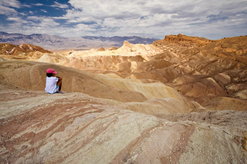
Start at Furnace Creek, where the drive times below begin. Save Dante’s View and Zabriskie Point for sunrise or sunset, since both are popular for the light, and keep the long walks for the first hours of the day.
| Stop | Drive from Furnace Creek | Effort | Best hour |
|---|---|---|---|
| Zabriskie Point | About 10 minutes east on CA-190 | Viewpoint | Sunrise or sunset |
| Dante’s View | 45 minutes | Viewpoint, no hike | Sunrise or sunset |
| Badwater Basin | 30 minutes, 17 miles | 1.5 to 2 miles round trip to the salt polygons | Early, before 10 a.m. in summer |
| Artists Drive | About 30 minutes as a detour off Badwater Road | One-way loop, 25 ft vehicle limit | Sunrise or sunset |
| Mesquite Flat Sand Dunes | Just east of Stovepipe Wells Village | 2 miles round trip to the tallest dune, 185 ft of climb | Sunrise or sunset |
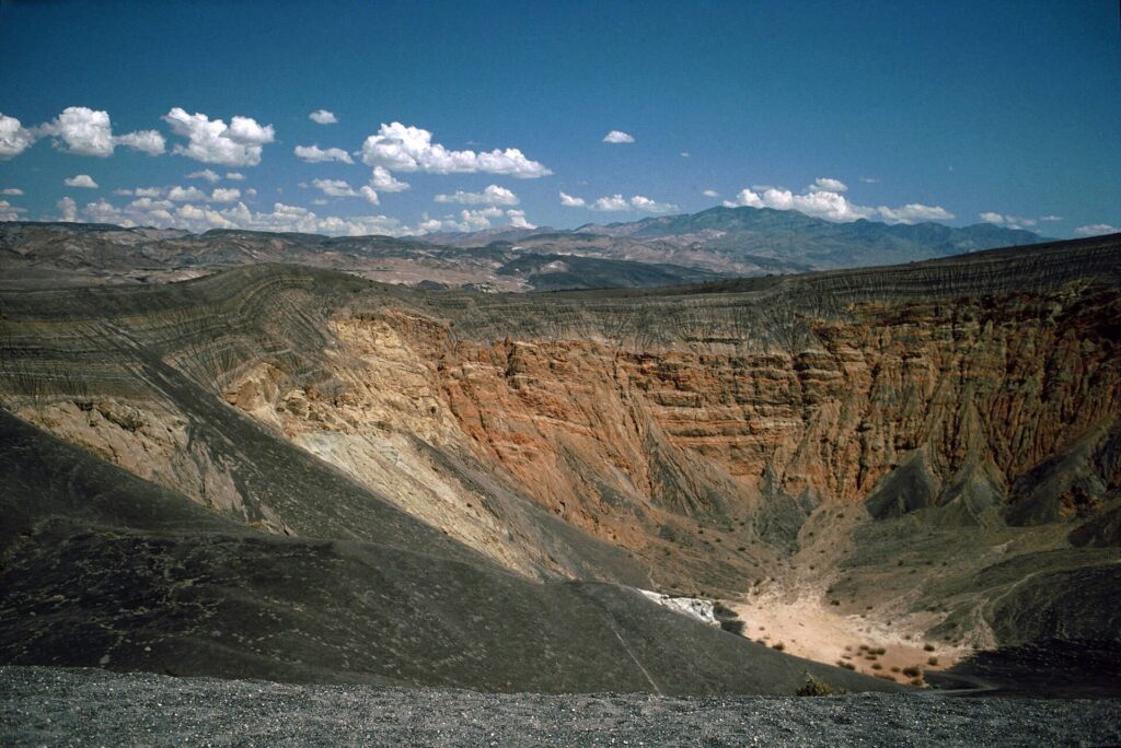
| Ubehebe Crater | About 1 hour | 1.5-mile rim trail, moderate | Morning, and expect wind |
| Harmony Borax Works | 1 mile west on CA-190 | 0.4-mile paved loop, about 30 minutes | Any cool hour |
Badwater Basin sits 282 feet below sea level, and the walk out onto the salt is flat and shadeless. The park advises against hiking there after 10 a.m. in summer, and the same warning applies at the dunes. Dante’s View is a good place to stay for the stars, since the park is an International Dark Sky Park.
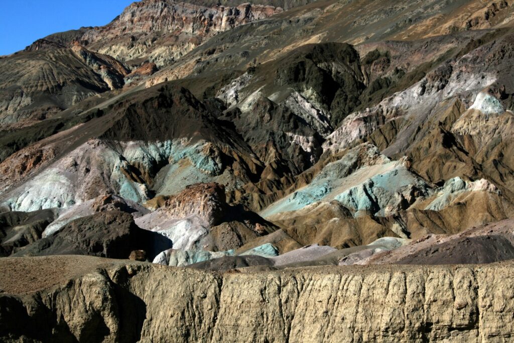
Artists Drive is the easiest win. The hills show red, orange, yellow, blue, pink and green from iron oxides and chlorite, and the loop is short enough to add to the Badwater run. Ubehebe Crater and the dunes sit on the northern side, so they make a second day.

What to bring to Death Valley
This is the list I would pack for a desert day, with the over-packing trimmed. Everything on it earns its place in the trunk.
- Water: at least a gallon (4 liters) per person for the day, plus extra in the car in case of a breakdown.
- Salty snacks or an electrolyte drink: the park’s summer guide recommends them to replace what sweat takes.
- Shade: a wide-brim hat, sunglasses and a light long-sleeve shirt.
- Layers: winter and spring nights are cool, and a viewpoint at higher elevation is colder than the valley floor.
- A paper map: the park warns against relying on vehicle GPS alone.
- A full tank and a card: fuel stops are few and the park does not accept cash.
Leave the third outfit for the weather that will not happen, and leave the dog at home, since pets are barred from park trails. Skip anything that needs a signal to work. Our national park road trip packing list covers the rest of the trunk.
Death Valley cell service
Expect little to none. The park’s directions page says most park roads have no cell service and there is no public transportation, so plan to be self-sufficient. It also says not to depend only on a vehicle GPS, since units frequently send visitors to wrong places and closed roads.
Download your maps before you leave a town. Our guide to offline maps for a road trip walks through it step by step. The fastest route from Las Vegas runs through Pahrump, Nevada, about 120 miles and 2 hours.
Water stations are at Furnace Creek, Stovepipe Wells and Panamint Springs. Treat them as the places to top up bottles, not as a reason to pack less.
Death Valley gas stations
Three gas stations operate inside the park. Furnace Creek and Panamint Springs sell gasoline and diesel, and Stovepipe Wells sells 87-octane gasoline only. Fill up when you reach one, because stations are few and the distances are long.
Electric vehicle chargers are limited, with a few at Furnace Creek and Stovepipe Wells. The nearest rapid chargers are 43 miles away in Beatty, Nevada. Restaurants and general stores are at Furnace Creek, Panamint Springs and Stovepipe Wells, and lodging runs from hotels to tent cabins.
Death Valley National Park facts
Can you drive through Death Valley National Park?
Yes. Highway 190 enters from Death Valley Junction on the east side and from Olancha on the west side. The park also lists paved entrances at Beatty, Shoshone, US 95 in Nevada and Trona.
How long do you need in Death Valley National Park?
A short loop of the Devils Golf Course, Badwater and Artists Drive takes about 1½ hours round trip on the way back to Highway 190. One full day covers the southern stops and a second adds Ubehebe Crater and the dunes. If you only have a day for a desert park, our Joshua Tree day trip itinerary is the shorter drive.
Is Death Valley safe in summer?
It can be, if you are prepared. That means at least a gallon of water per person per day, paved roads only, and hikes finished before 10 a.m. The park describes heat illness as severe and sometimes deadly, so the rule is to turn around early.
Are dogs allowed in Death Valley?
Yes, on a leash or confined, but not on any park trail and never left unattended in campgrounds. Wildlife is the other rule, since feeding animals makes them aggressive. The animals you will most likely see are coyotes, ravens, roadrunners, ground squirrels and lizards.
Prices are approximate, current as of publication, and change frequently — confirm the latest price with the retailer before buying.
Published October 13, 2026.
Photo credits: (1) featured, Salt deposits forming a wide pale path… — Tuxyso, CC BY-SA 3.0, via Wikimedia Commons; (2) Manly Beacon and the eroded badlands seen… — Luca Galuzzi (Lucag), CC BY-SA 2.5, via Wikimedia Commons; (3) Colorful volcanic hillside at Artist's… — Brocken Inaglory, CC BY-SA 4.0, via Wikimedia Commons; (4) Sand dunes at Mesquite Flat in Death Valley… — NPS, U.S. Government work, public domain, via National Park Service.