

Some links on our site may earn us a commission at no extra cost to you. Learn more.
Mingo Falls is a waterfall of roughly 120 feet on Big Cove Road in Cherokee, North Carolina, reached by 161 steep steps from the parking lot. The Eastern Band of Cherokee Indians’ tourism site gives that height and lists the falls as free and open to the public (visitcherokeenc.com, read October 3, 2026). Go in the morning, wear shoes with grip, and plan the day around the stairs.
We have done short waterfall walks with nieces and nephews along, and the lesson is that a short trail is not the same as an easy one. A quarter mile with 161 steps in it is a different afternoon than a quarter mile of flat gravel. I would plan Mingo Falls around the steps and keep everything else on the day loose.
How to get to Mingo Falls
Start in downtown Cherokee. From the Saunooke Village shopping area, drive north on Big Cove Road for about 5 miles, past the KOA Campground, to the Mingo Falls parking lot. Those are the tourism page’s directions, and there is no second turn to remember.
Mountain valleys are where phone signal goes patchy, so save the route before you leave town. Our offline maps guide walks through it. A missed turn on a back road costs more than the quarter-mile hike does.
Coming over from the Tennessee side, Newfound Gap Road drops you out of the park at the Cherokee end, and the falls are a short detour from there. Our Newfound Gap Road guide covers that drive. Coming up from Asheville, the Blue Ridge Parkway from Asheville to Cherokee is the scenic way in, and it ends right at the park’s Oconaluftee entrance.
Check the Parkway before you go. The Blue Ridge Parkway page says its road status is updated daily, with open and closed sections listed. On the date I checked, the home page (last updated April 24, 2026) still carried a Hurricane Helene recovery section, and the construction list dated June 17, 2026 named no project near Cherokee. That is dated history, so read the live page the morning you drive.
Mingo Falls trail
The trail is short and almost all of it is stairs. The table below lays out the pieces in order, with the park-side stops that pair well with it.
| Stop | Distance or time | Surface | Notes |
|---|---|---|---|
| Saunooke Village to the lot | About 5 miles north on Big Cove Road | Road | Past the KOA Campground; start in downtown Cherokee |
| Lot to the falls | A quarter mile | 161 steep steps | Slippery after rain; take your time |
| Viewing bridge | At the top of the steps | Wooden bridge | Crosses Mingo Creek directly before the falls |
| Mingus Mill | 2 miles north of Cherokee on US 441 | Road | Marked temporarily closed for rehabilitation on the date checked |
| Mountain Farm Museum | At Oconaluftee, inside the park | Self-guided walk | Tour booklet describes the buildings |
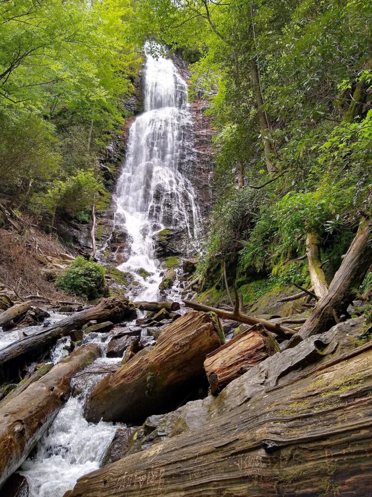
The tourism page says the water runs down nearly 200 feet of rock face and boulders, and that recent rain makes the falls larger and more exciting. That is true, and the steps get wetter along with it. Pick the day by whether you want a bigger waterfall or a drier staircase.
The page also passes along what locals say about timing: go in the morning to avoid crowds and to catch the falls in morning fog. I would be there early for the same reason. A free, well-known waterfall draws a crowd in peak season, and a staircase is a poor place to pass strangers.
Budget the day in a loose way. The walk is short, but the photos at the bridge and the slow trip back down add time. I would not book anything tight for the hour after Mingo Falls, and I would let the youngest or slowest walker set the pace for the whole group.
Mingo Falls steps
The page calls them steep, and it means it. You climb 161 steps to a wooden viewing bridge that crosses Mingo Creek just before the falls. The page’s advice is to take your time and not rush, because the steps can be slippery after rain.
Think of the climb as 161 chances to stop. Pause on the way up, let faster people pass, and save the photos for the bridge. The way down needs more care than the way up when everything is wet.
The page says seniors, children and people with disabilities should be very careful on the stairs and should be accompanied by friends or family. With younger kids along I would keep them within arm’s reach on the way down. Our Smoky Mountains with kids guide has more on pacing short walks for small legs.
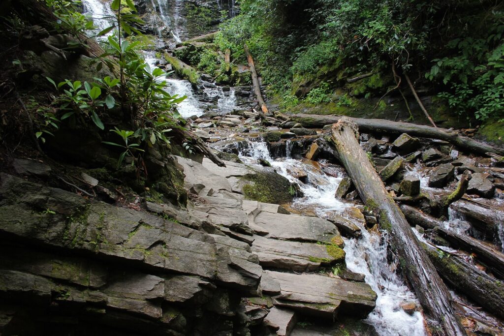
Here is the short list for a quarter-mile walk. It fits in one small bag, and the cooler stays in the car.
- Bring: shoes with real tread, a bottle of water, a light rain layer and one free hand for balance.
- Bring: a phone in a zipped pocket, for the bridge photos only.
- Leave: sandals and flip-flops. The sandals crowd is the one group I would warn off, because wet steps do not forgive thin soles.
- Leave: the picnic basket, the speaker and anything you cannot carry with one hand.
Is Mingo Falls in Great Smoky Mountains National Park?
No. The tourism page places the falls on Big Cove Road in Cherokee, about five miles from the national park. It sits on the Cherokee side of the line.
That matters for the parking tag. The park’s fee page lists the tag at $5 a day, $15 a week or $40 a year, and says it is required for vehicles parked in the park for longer than 15 minutes. The tourism page mentions no tag for the Mingo Falls lot. If you add a stop inside the park, the tag rule applies there, and our parking tag guide has the details.
Look at the park’s conditions page too. On October 3, 2026 it showed a last-updated date of August 17, 2026, and listed closures for the Laurel Falls Trail and the Bullhead Trail. It said nothing about Newfound Gap Road, Oconaluftee or Smokemont. Treat that as dated history and read the live page before you go.
The park itself is open 24 hours a day, 365 days a year, per its hours page. Visitor centers, some secondary roads and historic sites follow seasonal schedules and operating hours, so check the current hours before you plan around the Oconaluftee Visitor Center.
Things to do near Mingo Falls
Cherokee has more to fill a day than one waterfall, and our things to do in Cherokee NC guide covers the town. Here I will stay with the park-side stops that make sense before or after the stairs.
Oconaluftee is the first. NPS calls it the southern gateway to the Smokies, next to Cherokee, and lists a visitor center, a campground, a picnic area, a riding stable and many trails and historic structures. It is also home to one of the park’s two main elk herds, per the Oconaluftee page. That page names the Museum of the Cherokee People as a draw just outside the park.
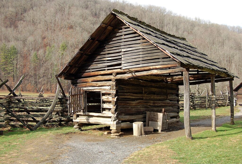
The Mountain Farm Museum is the easy walk. NPS offers a self-guiding booklet that describes the history and buildings. Mingus Mill sits 2 miles north of Cherokee on US 441, and on the date checked the park’s visitor centers page marked it temporarily closed for preservation and rehabilitation work.
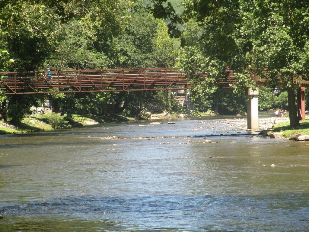
A day that works for a family, in order:
- Mingo Falls first thing, before the lot fills and while the steps are drier.
- Lunch in Cherokee.
- Oconaluftee in the afternoon, starting with the visitor center and the farm museum.
- Newfound Gap Road over the mountain if energy is left, ending on the Gatlinburg side. Our Gatlinburg things to do guide picks it up from there.
Save Kuwohi (Clingmans Dome) for another day. It is its own trip, and tacking it onto a waterfall morning makes both of them worse.
Where is Mingo Falls located?
On Big Cove Road in Cherokee, about 5 miles north of the Saunooke Village shopping area and past the KOA Campground. The tourism page gives those directions.
How many steps are there to the viewing bridge?
The Cherokee tourism page counts 161 steep steps up to a wooden viewing bridge. The bridge crosses Mingo Creek directly before the falls.
Is Mingo Falls worth visiting?
Yes, I would make time for it, especially on a day when you are already in Cherokee. A waterfall of about 120 feet for a quarter-mile walk is a good trade. I would skip it on a day when the steps are soaked and anyone in your group is unsteady on stairs.
How long is the hike?
The tourism page puts the hike at a quarter mile. Give yourself extra time for the steps, because the same page tells visitors not to rush them.
Is Mingo Falls free?
Yes. The tourism page lists the falls as free and open to the public. That is separate from the park’s parking tag, which only matters if you also stop inside the national park.
Prices are approximate, current as of publication, and change frequently — confirm the latest price with the retailer before buying.
Published October 10, 2026.
Photo credits: (1) Mingo Falls streaming down a rock face in… — P. Hughes, CC BY-SA 4.0, via Wikimedia Commons; (2) Mingo Falls in a wide frame with water… — hakkun, CC BY-SA 3.0, via Wikimedia Commons; (3) Log corn crib with an attached shed at the… — Galen Parks Smith, CC BY-SA 3.0, via Wikimedia Commons; (4) Pedestrian bridge crossing the Oconaluftee… — Billy Hathorn, CC BY 3.0, via Wikimedia Commons.