

Some links on our site may earn us a commission at no extra cost to you. Learn more.
Five days is enough to drive the Oregon coast from Astoria to the Boardman corridor. Sleep in a new town each night and keep every day to one headline stop and one beach. The plan runs north to south on Highway 101, from Cannon Beach to Brookings. Budget for a state parking permit, because several of the famous stops charge one.
I have done long coastal drives with nieces and nephews along. On this coast I would plan around the tide table before the restaurants. The water is colder than it looks. Fog that hides a headland at breakfast can burn off by lunch, so I would leave slack in every day.
Oregon Coast Road Trip
Each day has a base town, a headline stop and a drive short enough to leave room for fog and photo pullouts. Day 5 is the longest drive by far. Treat it as a travel day with one great stop.
| Day | Base | Stops | Drive time |
|---|---|---|---|
| 1 | Cannon Beach | Astoria Column, Ecola State Park, Haystack Rock | Under 1 hour |
| 2 | Depoe Bay | Oswald West State Park, Tillamook Creamery | 2 to 3 hours |
| 3 | Yachats | Depoe Bay whale watching, Yaquina Head, Newport | About 1 hour |
| 4 | Florence | Cape Perpetua, Heceta Head, Sea Lion Caves, Oregon Dunes | About 1 hour |
| 5 | Brookings | Samuel H. Boardman corridor | About 4 hours |
Oregon Coast Parking Permit
Oregon State Parks charges $10 a day for residents and $12 for non-residents at parks that require a permit. The parking permit page also lists a 12-month permit at $60 for residents and $75 for non-residents. One daily permit covers every permit-required state park that day. I would buy it at the first fee machine.
Ecola, Oswald West and Heceta Head each list a day-use permit on their park pages. Walk, bike, take the bus or get dropped off and there is no fee. Federal passes such as the America the Beautiful pass do not work at state parks.
| Stop | Fee | Hours |
|---|---|---|
| Astoria Column | $10 parking per vehicle, good for one year; climbing is free | Open 5 am to 10 pm daily |
| Tillamook Creamery | Check the visitor page for tours and tasting | 10 am to 6 pm, 7 days |
| Yaquina Head | $7 per vehicle, 3-day pass | 8 am to 6 pm Mon to Thu; to 7 pm Fri to Sun |
| Cape Perpetua and Devils Churn | $5 per vehicle per day | Visitor center 10 am to 4 pm |
| Sea Lion Caves | $18 adults, $17 seniors, $12 ages 5 to 12, free for 4 and under | 9 am to 5 pm daily |
Fees and hours above are as each operator listed them in early October 2026. Some shorten their hours in winter, so confirm before you go.
Cannon Beach Oregon
Start in Astoria at the Astoria Column, a painted tower above the Columbia River. Climbing it is free. Go early, then drive about half an hour south to Cannon Beach.
Ecola State Park is the headline. The road up is tight with many turns, and the park advises against motorhomes and trucks pulling trailers. Indian Beach is the sandy cove with surfers and tide pools. In early October 2026 the park page listed the west section of the Clatsop Loop Trail as closed for an active landslide. Check before you plan that hike.

Haystack Rock is the postcard stop. It is best at low tide, when the pools at its base open up. Pull up the NOAA tide predictions for the coast before you leave your room. The Haystack Rock Awareness Program prohibits climbing above the barnacle line. Dogs stay leashed at the Marine Garden, and harvesting marine life is banned.
Tillamook Creamery
Day 2 begins at Oswald West State Park, a few miles south of Cannon Beach. Short Sand Beach is a half-mile walk through the woods from the main lot. A creek crossing is on the way. The park does not offer camping, drones are not allowed, and a day-use permit is required.
Tillamook Creamery is the easy lunch stop, at 4165 N Highway 101. Its visitor page lists 10 am to 6 pm seven days a week. Check that page for the current tour and food options. I would eat here rather than in Depoe Bay, then spend the afternoon driving south with the windows down.
Sleep in Depoe Bay or Lincoln City tonight. You want to be in Depoe Bay before the whale center opens in the morning.
Oregon Coast Whale Watching
Depoe Bay is one of the easiest places on the coast to look for a whale from shore. Whale Watching Spoken Here lists the Depoe Bay Whale Watching Center at 119 S Highway 101, open 10 am to 4 pm Wednesday through Sunday, and says about 200 gray whales stay along the coast all year. It lists Winter Whale Watch Week for December 27 to 31, 2026. Spring Whale Watch Week runs March 20 to 28, 2027.
The same page says roughly 30 whales an hour pass at the southbound peak, against about 6 an hour heading north. Bring binoculars and look for the spout, then give it a few minutes.
Drive on to Newport and Yaquina Head, a Bureau of Land Management site with a lighthouse. The tide pools sit at Cobble Beach and Quarry Cove. Seal pupping from mid-May to mid-June and seabird nesting from May through September can limit access. The interpretive center is open 10 am to 4 pm daily.

Spend the night in Yachats, a small town just south of Newport and right at the foot of Cape Perpetua.
Cape Perpetua
Day 4 is the best driving day on the trip, so start early. The Forest Service lists 26 miles of trail in the Cape Perpetua Scenic Area. The visitor center is open 10 am to 4 pm daily in summer and Tuesday through Sunday in winter. When the center is closed, the trails stay open from dawn to dusk.
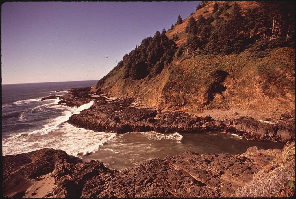
Devils Churn is the stop everyone photographs. The lot takes cards only, no cash, and it can fill quickly on weekends. Stay well back from the edge. Wet rock and moving water is a bad place to lose your footing.
Heceta Head Lighthouse
Heceta Head Lighthouse is a half-mile walk that climbs 150 feet from the parking area. The state park page lists the ground floor as open 11 am to 3 pm from March through October and 11 am to 2 pm in winter, and the upper levels are closed to the public. A day-use permit is required, and drones are not permitted.

Sea Lion Caves is a few minutes south, at 91560 Highway 101 north of Florence. It bills itself as America’s largest sea cave, and Steller sea lions live there year round. No reservation is needed for the self-guided visit. Extreme weather can close the entrance, so call ahead on a stormy day.
Finish in Florence. The dunes start here, and our Oregon Dunes ATV guide covers riding them, so it is not repeated here.
Samuel H. Boardman State Scenic Corridor
Day 5 is a drive south to Brookings, with the Boardman corridor as the reward. Oregon State Parks describes 12 ocean-hugging miles between Brookings and Gold Beach, open for day use year round. Viewpoints include Cape Ferrelo, House Rock, Whaleshead Beach, Natural Bridges and Arch Rock.
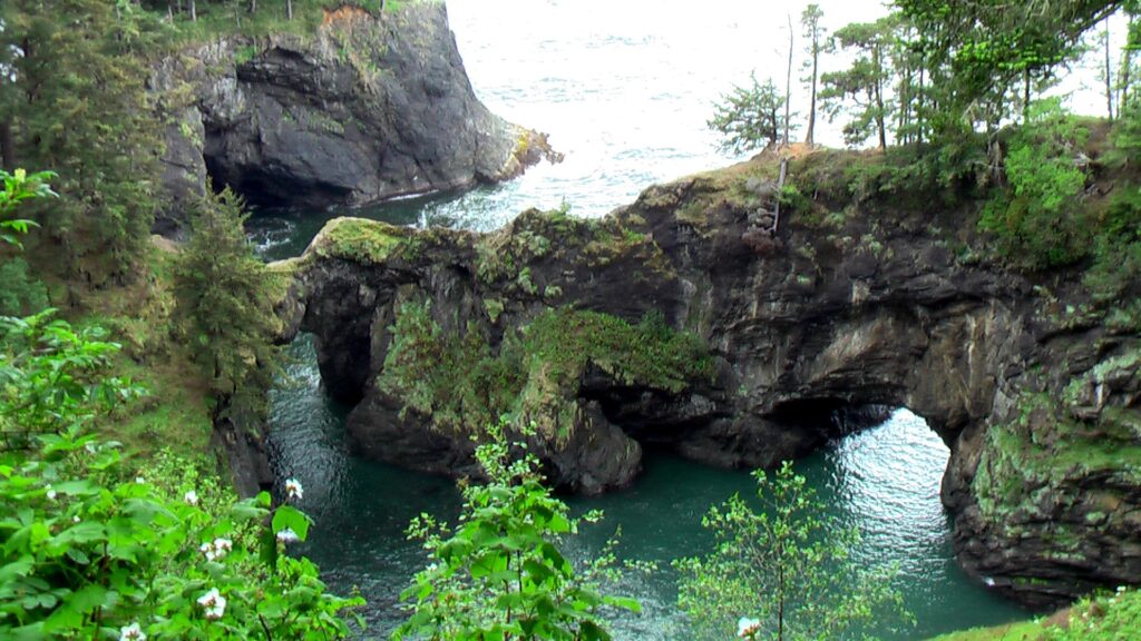
Pick three viewpoints instead of trying to stop at all of them. The walk to Cape Ferrelo is a mile. The trail between Cape Ferrelo and House Rock is four miles. Both are part of an 18-mile stretch of the Oregon Coast Trail. Buy the daily state permit at the first fee machine if a lot asks for one. Highway 101 runs on south from Brookings into California, and our Redwood National Park guide covers the next big stop on that road. For the longer version, our Pacific Coast Highway road trip itinerary picks up where Oregon ends. For the California side of this same drive, our Big Sur itinerary is the next stop south.
With a sixth day, turn inland for Crater Lake National Park or the waterfall hike at Toketee Falls.
Oregon Coast Beach Safety
Oregon’s beaches belong to everyone. The state park FAQ says the state owns the ocean shore up to the vegetation line. It allows small amounts of driftwood, shells and agates for personal use. Dogs are not permitted on some beaches or at certain times of year, to protect western snowy plovers.
Never turn your back on the ocean, a line the National Weather Service repeats for all dangerous waves. A sneaker wave runs far higher up the beach than the waves before it. The cold water makes a fall dangerous. Stay off driftwood logs near the surf, keep children well back, and keep your eyes on the water.
Check the NWS Portland forecast the night before. Use the state’s TripCheck site for road conditions and closures. Highway 101 can close in a slide or a storm, and the detour is rarely short.
Oregon Coast Facts
How long does it take to drive the Oregon coast?
Without stops it is a long day at the wheel on Highway 101. With the stops above, plan on five days. Day 5 alone is about four hours between Florence and Brookings, so do not schedule anything else that morning.
What is the best month to visit the Oregon coast?
It depends on what you want. For whales, the program lists peak weeks in late December and late March. Tide pools depend more on the tide table than the month. For a clear beach walk I would aim for late summer or early fall. I would still pack a rain layer.
Can you pump your own gas in Oregon?
Yes, at many stations, with rules that vary by county. The State Fire Marshal’s page lists full self-service in Clatsop, Tillamook and Curry counties. Lincoln, Lane, Coos and Douglas counties get partial self-service. Stations there must keep attended service at the other 50% of their pumps.
Are Oregon beaches public?
Yes. The state owns the ocean shore up to the vegetation line, so you can walk any beach. A parking permit applies to the lot at some parks, and it is separate from your right to the sand.
Prices are approximate, current as of publication, and change frequently — confirm the latest price with the retailer before buying.
Published October 22, 2026.
Photo credits: (1) featured, Haystack Rock rising from the beach at… — M.O. Stevens, CC BY-SA 3.0, via Wikimedia Commons; (2) Sunset over the beach at Indian Point in… — Gary Halvorson, Oregon State Archives, CC BY 4.0, via Wikimedia Commons; (3) Yaquina Head Lighthouse standing above the… — CarlsJr10, CC BY-SA 3.0, via Wikimedia Commons; (4) Cape Perpetua headland and surf on the… — U.S. Government, U.S. Government work, public domain, via Wikimedia Commons; (5) Heceta Head Light on its headland north of… — Anita Ritenour from Santa Maria, CA, USA, CC BY 2.0, via Wikimedia Commons; (6) Natural Bridges Cove with sea arches along… — Rick McCharles, CC BY 2.0, via Wikimedia Commons.