

Some links on our site may earn us a commission at no extra cost to you. Learn more.
A Missouri Ozarks road trip strings together the state’s best spring-fed rivers and granite parks into one loop. Most people run it over five to seven days out of St. Louis. Meramec State Park and Onondaga Cave come first. Elephant Rocks, Johnson’s Shut-Ins, the Eminence float country, and Montauk State Park follow before the drive back. Every stop sits within two hours of the next, so the loop works as a long weekend cut short or a full week done right.
We grew up spending summers on a farm not far from this part of the state. The Ozarks were always where my family drove when the humidity got unbearable at home. We’ve floated the Jacks Fork and the Current more times than I can count. We’ve also camped inside the Riverways on trips that ran longer than planned. What surprised me on the first trip wasn’t the scenery — plenty of rivers are pretty. It was the water. Cold and clear even in August, with every spring along the way pushing in more of it.
Where in Missouri Is the Ozarks?
The Ozarks cover the southern third of Missouri — a plateau of oak forest, sinkholes, and spring-fed rivers. The region starts an hour or so south of St. Louis and runs almost to the Arkansas line. This loop stays inside the eastern core, from Franklin County down through Oregon County. Branson and the Lake of the Ozarks sit further west, and make their own separate trip. St. Louis and its Gateway Arch are the natural starting point for anyone driving in from the Midwest. Readers coming down from Chicago sometimes pair this loop with a stop at Starved Rock State Park on the way south.
What to Do in the Missouri Ozarks
Every stop on this loop centers on water or rock. Float trips on four different rivers — clear, cold, spring-fed — fill most of the days. Two show caves break up the floating: Onondaga’s flowstone rooms and a walk through the boulders at Elephant Rocks. Johnson’s Shut-Ins adds a scramble through pink rhyolite chutes, closer to a water park carved by the East Fork Black River than a hike. Montauk closes the loop with a working trout hatchery and the actual headwaters of the Current River. None of it requires technical gear. A rental canoe, a pair of water shoes, and a full cooler cover most of it.
This loop covers the eastern Ozarks specifically. For rivers outside this route — the Niangua, the Big Piney, the Black River — see our full guide to float trips in Missouri.
Missouri Ozarks Road Trip
Six days covers the loop without rushing. Five works if you shorten Eminence or skip the Eleven Point detour. The table below is the fast version — where to sleep, what to see, how far the next stop runs — before the day-by-day detail. Drive times are rounded estimates.
| Day | Base | Stops | Drive Time |
|---|---|---|---|
| 1 | Sullivan / Meramec | Meramec State Park, Onondaga Cave | ~70 mi, 1 hr 15 min from St. Louis |
| 2 | Ironton / Graniteville | Elephant Rocks, Johnson’s Shut-Ins, Taum Sauk Mountain | ~55 mi, 1 hr from Meramec |
| 3 | Eminence | Jacks Fork River, Alley Spring | ~75 mi, 1 hr 45 min from Ironton |
| 4 | Van Buren | Current River, Big Spring | ~30 mi, 40 min from Eminence |
| 5 | Alton / Thomasville | Eleven Point River, Greer Spring | ~45 mi, 1 hr from Van Buren |
| 6 | Salem, then St. Louis | Montauk State Park, drive home | ~45 mi to Montauk, ~135 mi back to St. Louis |
Meramec State Park
Meramec State Park sits about an hour southwest of St. Louis, the easiest first stop on this loop. Fisher Cave tours run daily in season. The park’s own stretch of the Meramec River is calm enough for a short paddle before lunch. Fifteen minutes further is Onondaga Cave State Park. The tour there walks through flowstone formations lit well enough to actually see them — no headlamps required. Between the two parks, this is a half-day stop at most, leaving the afternoon open for the drive to Ironton.

Elephant Rocks State Park
Elephant Rocks is a quick stop — most people spend an hour, two if kids want to climb every boulder along the way. Missouri State Parks dates the granite formations here at roughly 1.5 billion years old. A short paved loop, one of the more accessible trails in the state park system, runs right through them. There’s no camping at Elephant Rocks, so this works best as a morning stop before Johnson’s Shut-Ins, fifteen minutes south. Our Elephant Rocks State Park guide has the details.
Johnson’s Shut-Ins State Park
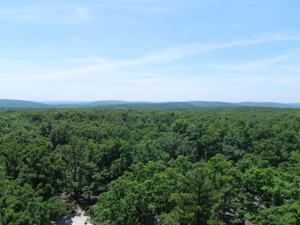
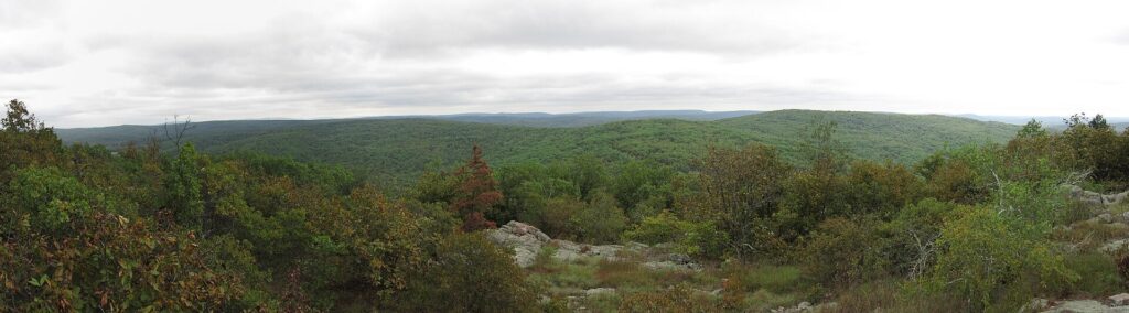
Johnson’s Shut-Ins is where the East Fork Black River squeezes through pink rhyolite rock. Wading and scrambling through the chutes is the entire point of the stop. Taum Sauk Mountain, the highest point in Missouri, sits ten minutes up the road. The overlook is worth the short detour even if you skip the hike down to Mina Sauk Falls. The Ozark Trail threads through this stretch of the Arcadia Valley, connecting Taum Sauk to the Bell Mountain Wilderness. Several other stops on this loop link up with it too, for anyone extending the trip into a longer backpacking route. Base yourself in Ironton or Graniteville — neither is more than a few minutes from the park gate. Read the full Johnson’s Shut-Ins State Park guide before you go; the swimming rules and high-water closures are worth knowing ahead of time.
Things to Do in Eminence MO
Eminence is the base for two rivers, not one. The Jacks Fork River merges with the Current just downstream. Both sit within a ten-minute drive of town. This is the shortest, clearest paddle on the whole loop, and the one we point first-timers toward. Alley Spring, with its red mill against blue-green water, sits right on the way in. Restaurants and outfitters cluster around the town square, and most run their own shuttle service. A canoe trip here means showing up and paddling, not managing logistics. Read the full Eminence guide for outfitter details and the mill’s hours.
Current River Missouri
From Eminence, the Current River runs south past Round Spring and down to Van Buren, the small river town that marks the halfway point of this loop. Big Spring, just outside town, is the largest spring in Missouri. The National Park Service lists it among the largest in the country, and the flow alone is worth the stop even without getting in a boat. Van Buren itself is worth a slow afternoon. There’s an old red-roofed train depot downtown, a handful of outfitters, and a bluff-top view of the river from the overlook above town. The Current River is the busiest water on this loop. Our Ozark National Scenic Riverways guide covers both it and the Jacks Fork under the same National Park Service unit.

Eleven Point River
The Eleven Point is the quiet answer to the Current’s crowds. It runs colder and narrower, inside Mark Twain National Forest rather than the park service land to the north. Greer Spring, which the U.S. Forest Service lists as the second-largest spring in Missouri, roughly doubles the river’s flow partway down the run. The float from Thomasville to the Highway 142 bridge takes most of a full day. Fewer outfitters work this stretch, and reservations matter more here than anywhere else on the loop. Read the full Eleven Point River guide for access points and float times before booking a shuttle.
Montauk State Park
Montauk closes the loop about ninety minutes from Salem, and it’s worth the detour even for non-anglers. This is the actual headwaters of the Current River, fed by Montauk Spring. Missouri State Parks lists the trout season here as running March 1 through October 31. A shorter catch-and-release season runs through the winter. The old gristmill and a handful of cabins make it an easy overnight before the drive back to St. Louis. Read the full Montauk State Park guide for hatchery details and current season dates. From here, it’s a straight shot north on Highway 19 and I-44 back to St. Louis, closing the loop.
Best Time to Visit the Ozarks Missouri
Late spring and early fall are the sweet spot. Water levels are up after winter and spring rain, the heat hasn’t peaked yet, and the rivers haven’t filled with the holiday-weekend crowds that pack the Current and the Meramec every July. Summer is still the most popular season, and for good reason: warm water, long days, and every outfitter open. Just expect gravel bars three-deep with coolers on the Fourth of July and Memorial Day. Fall brings the best color of the year to the overlook at Taum Sauk Mountain, usually peaking in late October. By then the rivers empty out enough that a weekday float can feel like it belongs to you alone.
Camping in the Missouri Ozarks
Every major stop on this loop has camping within a few miles, and most of it books up fast on summer weekends. State park campgrounds at Meramec, Johnson’s Shut-Ins, and Montauk take reservations through Missouri State Parks. Sites near Eminence and Van Buren run through the National Park Service for Ozark National Scenic Riverways, or through the private campgrounds that cluster around every outfitter in town. Cabins are available at Montauk and a few private operators near Eminence. That’s an easy option for anyone who’d rather skip the tent after a full day on the water. Book ahead for anything between Memorial Day and Labor Day — the good gravel-bar sites go first.
What to Pack for the Ozarks
Pack less than you think you need, then take half of it back out of the car. That’s the advice I give myself every year and ignore every year. What actually earns its spot on an Ozarks float trip:
- Water shoes or old sneakers — the gravel riverbeds are sharp in places, and bare feet don’t last
- A dry bag for phones, keys, and anything else that shouldn’t end up in the river
- Sunscreen and a hat — there’s little shade once you’re actually on the water
- A cooler that straps into the canoe, not one that rides loose and tips
- A full change of clothes left in the car for the drive to the next stop
Layers matter more than people expect in spring and fall. A cool morning on the water can turn warm by afternoon, then cool again by the time you’re setting up camp.
Road Trip FAQ
What is the best route for a Missouri Ozarks road trip?
Starting and ending in St. Louis, run the loop counterclockwise: Meramec and Onondaga first, then Elephant Rocks and Johnson’s Shut-Ins, then Eminence, Van Buren, and the Eleven Point River, finishing at Montauk before the drive back north.
How many days do you need for a Missouri Ozarks road trip?
Six days covers the full loop without rushing. Five works if you cut either the Eleven Point detour or the second night near Eminence.
Is the Missouri Ozarks worth visiting?
Yes. The rivers here run clearer and colder than almost anywhere else in the Midwest, and the loop packs caves, granite formations, and float trips into a few hundred miles.
What is the best time of year for a Missouri Ozarks road trip?
Late spring and early fall, after water levels rise and before summer crowds peak. Fall adds good color at higher overlooks like Taum Sauk Mountain.
Published September 28, 2026.
Photo credits: (1) A large cave formation inside Onondaga Cave… — Grey Wanderer, CC BY-SA 3.0, via Wikimedia Commons; (2) View from the lookout tower atop Taum Sauk… — Fredlyfish4, CC BY-SA 3.0, via Wikimedia Commons; (3) Forested ridgeline of Bell Mountain… — Chris M Morris, CC BY 2.0, via Wikimedia Commons; (4) The historic train depot in Van Buren… — Brandonrush, CC BY-SA 3.0, via Wikimedia Commons.