

Some links on our site may earn us a commission at no extra cost to you. Learn more.
The Eleven Point River runs 44 protected miles through the Mark Twain National Forest. It starts at Thomasville and ends at the Highway 142 bridge. The water is spring-fed and stays cold, even in August. It also sees a fraction of the traffic that piles onto the Current River on a summer weekend. Most people come for a half-day float from Greer Crossing, or a two-day run down to Riverton.
I’ve floated enough Ozark rivers — the Jacks Fork, the Current — to know the drill by heart. Load the cooler low in the canoe. Expect the water to run colder than the air, no matter the month. Don’t plan much for that evening; sunburn and a long drive home will handle that for you. The Eleven Point runs the same startling green-blue over gravel that those two rivers do. It just holds onto that color longer, because fewer roads ever reach it.
Where Is the Eleven Point River?
The Eleven Point rises in the Ozark hills of south-central Missouri. From there it flows southeast into Arkansas, where it eventually meets the Spring River. The floatable, protected section runs about 44 miles, from Thomasville down to the Highway 142 bridge. All of it sits inside the Eleven Point Ranger District of the Mark Twain National Forest. Congress protected this stretch under the Wild and Scenic Rivers Act in 1968 — one of the first rivers in the country to get that status. The watershed itself is oak-hickory forest, cut by bluffs and gravel bars, a few hours’ drive south of St. Louis.
Alton and Winona are the nearest towns. Neither is much more than gas, groceries, and a diner. Everything else along this river sits on national forest land: boat ramps, float camps, the one developed campground. Expect gravel forest roads, and expect cell service to disappear fast.
Spring brings the highest water and the fastest current — good for a quick trip, rough for a beginner. Summer is when most people come, with steady flows and warm air sitting above cold water. Fall thins the crowds to almost nothing and turns the bluffs to color; that’s when I’d choose to go myself. Winter floating is possible, but it’s mostly for people who already own a drysuit.
Eleven Point River Access Points
Seven access points cover every combination of short paddle and multi-day trip. The Forest Service maintains a boat ramp at each one, and launching is free.
| Access Point | Position on the River | Good For |
|---|---|---|
| Thomasville | Uppermost access | Starting a full-length trip |
| Cane Bluff | Just below Thomasville | Spring-only floating (small, shallow upper river) |
| Greer Crossing | Below Greer Spring’s confluence | Most common put-in; bigger water starts here |
| Turner Mill | Mid-river | Shorter day floats, near the float camps |
| Whitten | Lower-middle | Half-day trips from Greer Crossing |
| Riverton | Near the Arkansas line | Most common take-out |
| Highway 142 | Lowest access | End of the federally protected stretch |
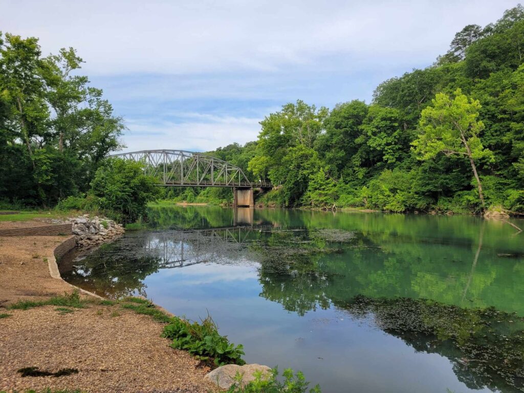
Cane Bluff sits on the smallest, shallowest part of the river. It only floats well in spring, when the water’s up. Below Greer Crossing the river gets noticeably bigger, fed by Greer Spring’s branch, and it stays floatable all summer. Most of these ramps sit at the end of a gravel road. A low sedan isn’t the right vehicle for reaching Cane Bluff or Turner Mill after rain.
Mark Twain National Forest
The Eleven Point sits inside the Mark Twain National Forest — 1.5 million acres spread across 29 counties in southern Missouri. More than 350 miles of streams here are suited to floating, and the Eleven Point is one of the best known. The Ozark Trail threads through the same district, so hikers and paddlers often share a trailhead.
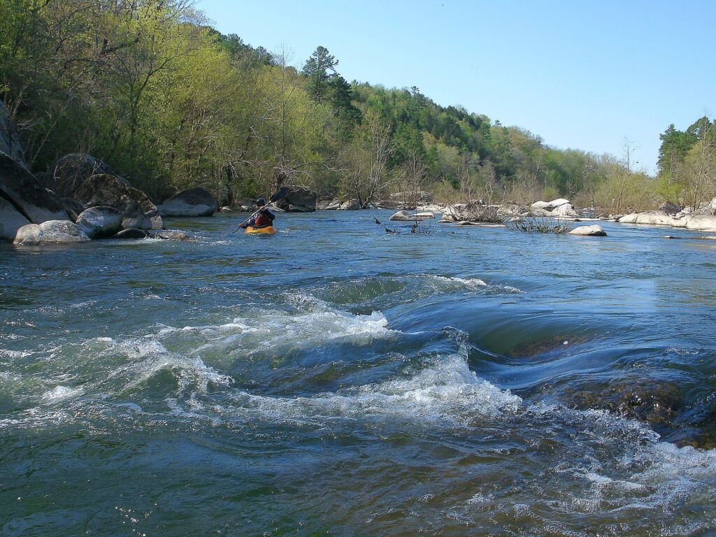
This is national forest, not a state park, so the rules run lighter than at Missouri’s more developed river parks. There’s no entrance fee and no set closing hour. Camping leans toward primitive sites rather than full hookups. Motorized boats are allowed on the river, but the Forest Service caps them at 25 horsepower. That keeps the water quiet, even where a truck can back a boat right up to it.
Greer Spring
Nothing changes this river’s character more than Greer Spring. Its branch joins the Eleven Point just below the Greer Crossing access. Right at that confluence, the water visibly speeds up and cools down. Everything downstream is a bigger, colder river than what you started on.
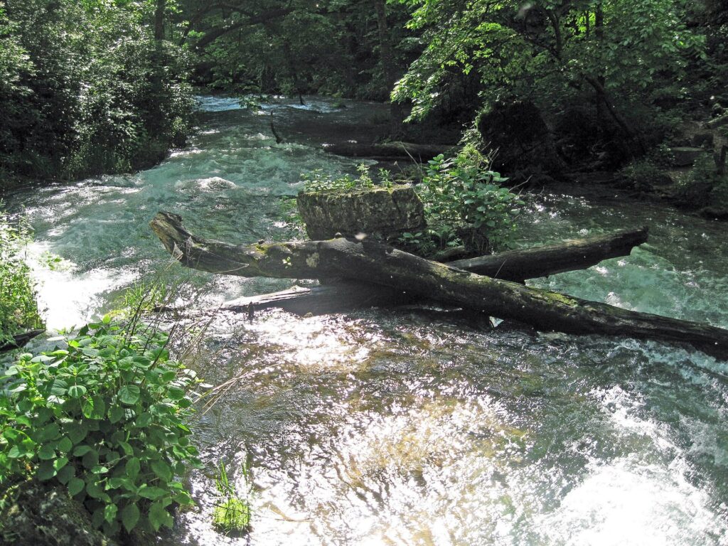
A parking area on Highway 19 marks a short, well-marked walk down to the spring itself. Floaters see the spring branch pouring into the river, not the spring pool, unless they get out and walk in. The spring sits inside a protected natural area. It’s quiet enough that deer and the occasional otter turn up along the path. It’s also a large part of why this stretch earned Wild and Scenic status in the first place.
How Long Is the Eleven Point River?
The protected float section runs roughly 44 miles, but almost nobody paddles all of it at once. The Thomasville-to-Cane Bluff stretch only floats well in spring, so most trips start at Greer Crossing instead. From there, Whitten makes a comfortable half day. Turner Mill and the float camps make a good overnight. Riverton is the natural stopping point for a two-day trip.
Current speed matters more than mileage here. After a wet spring, a stretch that takes five hours in August can take three. Ask whoever rents you a canoe what the river’s doing that week, rather than trusting a fixed hour count off a map. Gravel bars offer almost no shade. Plan around the middle of the day, not a late start that finishes in the heat.
Eleven Point River Camping
Greer Crossing has the only developed campground directly on this stretch: small, primitive-leaning, no hookups, set right where most float trips begin. Sites aren’t guaranteed the way they are at a state park campground, so a busy weekend needs a backup plan. Pack extra water regardless of where you land. Services are sparse this far out.
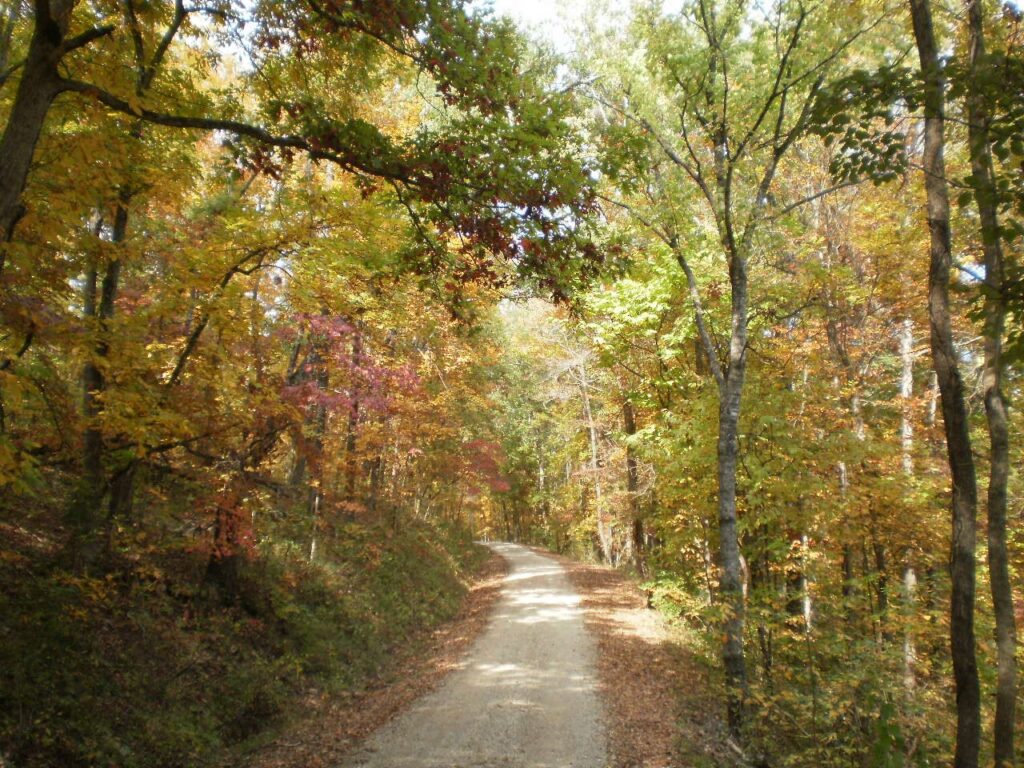
Two float camps extend the options for anyone spending a night on the water. Barn Hollow sits about 10 miles downriver of Greer Crossing, reachable only by boat. Boze Mill Float Camp is built around Boze Mill Spring — a smaller spring the Forest Service itself describes as forming a sparkling blue pool. You can reach it from the river, or by a short walk from a parking area.
Eleven Point River vs Current River
I’ve floated the Current more times than I can count, and the comparison is the first thing everyone asks about. The Current is bigger and busier, and easier to plan around: more access points, more outfitters. The Eleven Point is colder and narrower. It empties out fast once you’re past Greer Crossing.
A crowded gravel bar would ruin my afternoon, so the Eleven Point is my pick for a quiet trip. Want an outfitter to handle the whole shuttle without three phone calls? The Current still wins that fight. I’d send a bigger group, or a first timer who wants company on the water, to the Current instead. Our full Ozark National Scenic Riverways guide covers that river and the Jacks Fork in more depth.
Eleven Point River Outfitters
A handful of small, family-run outfitters work out of Alton and Thomasville. They rent canoes and kayaks and run shuttles between access points. None of them operate at Current River scale. Expect a phone call and a conversation about water levels, not an online booking widget.
Access points sit farther apart here than on the Current, so a shuttle matters more, not less. Book it before you arrive. Don’t count on finding one at the ramp on a Saturday morning. Confirm a life jacket comes with every seat, worn, not just stowed under a bench. Most outfitters offer half-day, full-day, and overnight trips built around the access points on the table above.
Float FAQ
How cold is the Eleven Point River?
Cold enough that most people wear a rash guard or wetsuit top, even in summer. The river is spring-fed and gets a large cold-water boost from Greer Spring. It usually runs cooler than the air, especially downstream of Greer Crossing.
Do you need a permit to float the Eleven Point River?
No permit is required for a private float trip. Large groups should check with the Eleven Point Ranger District first; bigger outings sometimes need special-use coordination that a family trip doesn’t.
Can you fish the Eleven Point River?
Yes. It holds smallmouth bass and other Ozark stream species along most of its length. A Missouri fishing license is required, and the Department of Conservation’s current regulations should be checked before keeping anything.
Is the Eleven Point River good for beginners?
It’s manageable for a beginner paddling with someone more experienced. The current can run faster than it looks after rain, though. A first-time paddler without an experienced partner is usually better off starting on the Jacks Fork instead.
Where does the Eleven Point River start?
The floatable, protected section starts at Thomasville. The upper stretch down to Cane Bluff is small enough that it only floats well in spring. Most trips actually begin at Greer Crossing, once the river has grown.
Prices are approximate, current as of publication, and change frequently — confirm the latest price with the retailer before buying.
Published September 28, 2026.
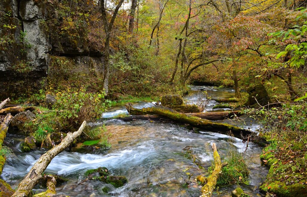
Photo credits: (1) featured, The Eleven Point River flowing through the… — Charlie Llewellin from Austin, USA, CC BY-SA 2.0, via Wikimedia Commons; (2) A river running through the forest at… — Kbh3rd, CC BY-SA 3.0, via Wikimedia Commons; (3) Greer Spring's clear water pool surrounded… — jeff brown, CC BY 2.0, via Wikimedia Commons; (4) Forest road on the way to Turner Mill… — U.S. Forest Service, U.S. Government work, public domain, via Wikimedia Commons; (5) Clear spring water flowing over rock at… — Kbh3rd, CC BY 3.0, via Wikimedia Commons.