

Some links on our site may earn us a commission at no extra cost to you. Learn more.
Fontana Lake is a 10,000-plus-acre reservoir on the edge of the Great Smoky Mountains. TVA dammed it in the 1940s, and national forest lines almost the entire shore instead of houses. The lake has almost no development along its banks, which is unusual this close to a national park. Most visitors come for three things: the dam, a boat ride to the roadless north shore, and the Road to Nowhere. That’s the paved dead end everyone talks about. It sits close enough to Bryson City and Deep Creek to fold into the same Smokies trip.
I’ve pulled off at Fontana Dam more times than I can count. It’s usually on the way in or out of the park’s quieter side, with a dog asleep in the back seat. I’ve driven the highway along the water more than once, windows down, in every season. The water changes color with the season — slate gray in winter, deep green by midsummer. The drop from full pool to the mud flats of a dry fall is dramatic. It’s the kind of lake that still makes me slow the car down at the overlook.
Fontana Lake Access Points
Fontana Lake has a handful of real access points, and each one serves a different trip. Vehicles parked more than 15 minutes anywhere in the park need the paid parking tag. That’s $5 for a day, $15 for a week, or $40 for the year, per the park’s fee page. Match the access point to what you’re actually doing before you drive out. Cell service thins out fast once you leave the main road. Bring a paper map as backup, since a few of these roads lose signal completely.
| Access Point | What It’s For | Facilities |
|---|---|---|
| Fontana Dam Visitor Center | Dam views, the AT crossing | Parking, restrooms, overlook |
| Fontana Village Marina | Boat rentals, north shore shuttle | Marina, boat ramp, small store |
| Lakeview Drive trailhead | Walking to the Road to Nowhere tunnel | Parking, restrooms |
| Twentymile Ranger Station | Twenty Mile Trail, backcountry permits | Seasonal station, small lot |
| Cable Cove boat launch | Boat-in camping, fishing access | Boat ramp, gravel lot |
Fontana Dam
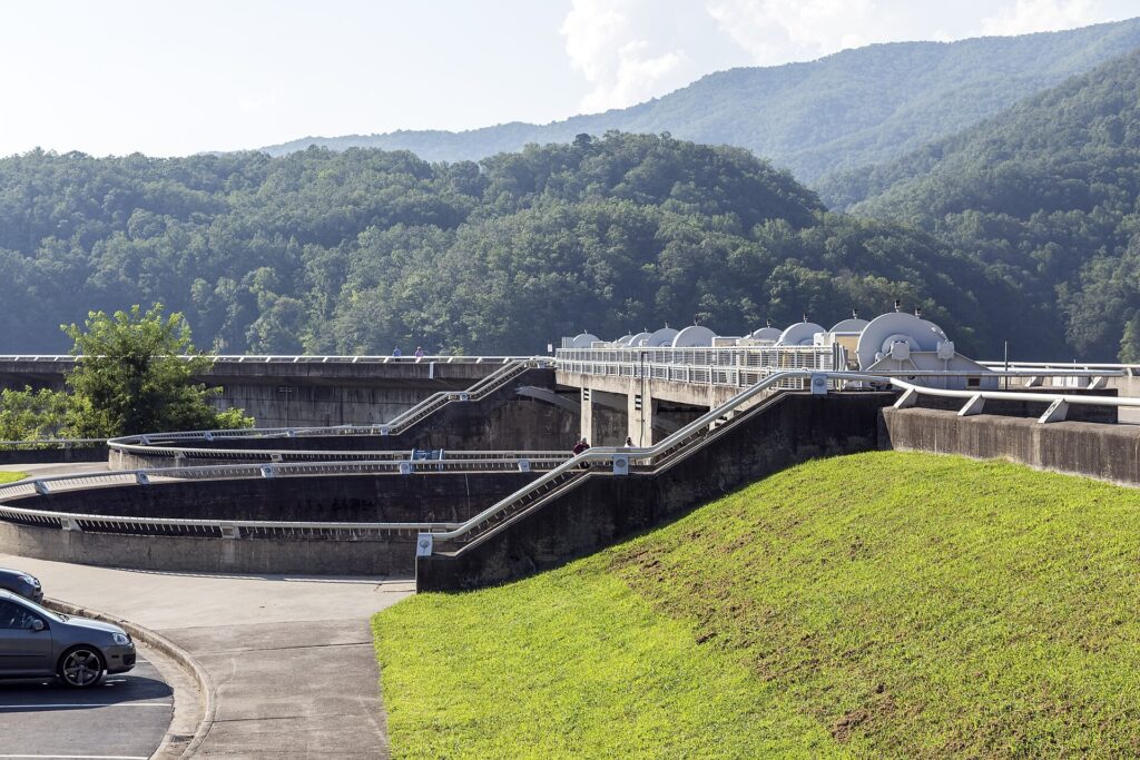
TVA built Fontana Dam between 1942 and 1944. It powered the aluminum smelting that supplied World War II aircraft production. The utility still lists it as the tallest dam in the eastern United States, at 480 feet. The scale is easy to underestimate from a photo. Standing at the base, the spillway blocks out the whole opposite ridge. Bring a wide lens if you want the whole face of it in one frame.
Workers built an entire town, Fontana Village, just to house the construction crews. It’s now the resort most visitors use as a base. The dam itself remains an active TVA hydroelectric facility. The overlook near the visitor center is free and open every day. Walk out onto the dam and the lake opens up on one side, the river dropping away on the other. It’s worth the short walk even if you only have twenty minutes to spare.
How Deep Is Fontana Lake?
Fontana Lake covers more than 10,000 acres and roughly 240 miles of shoreline, counting every cove and creek arm. Depth changes a lot by season. The lake sits close to full pool through summer and draws down sharply by late fall. That’s why the mud flats near the dam look so different in October than in July. A wet spring can push the lake higher than normal for weeks at a time.
That drawdown is routine lake management, not a problem with the dam. It’s also why houseboats and slower fishing boats stick to the main channel once the water starts dropping in autumn. Check the water level before hauling a boat down if you’re visiting in October or November.

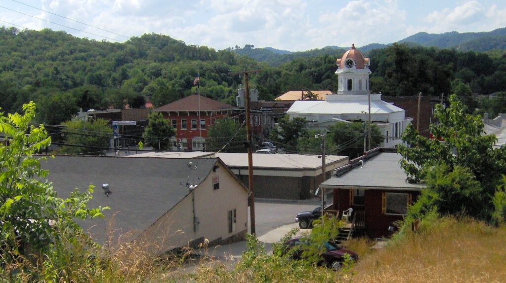
Road to Nowhere Bryson City
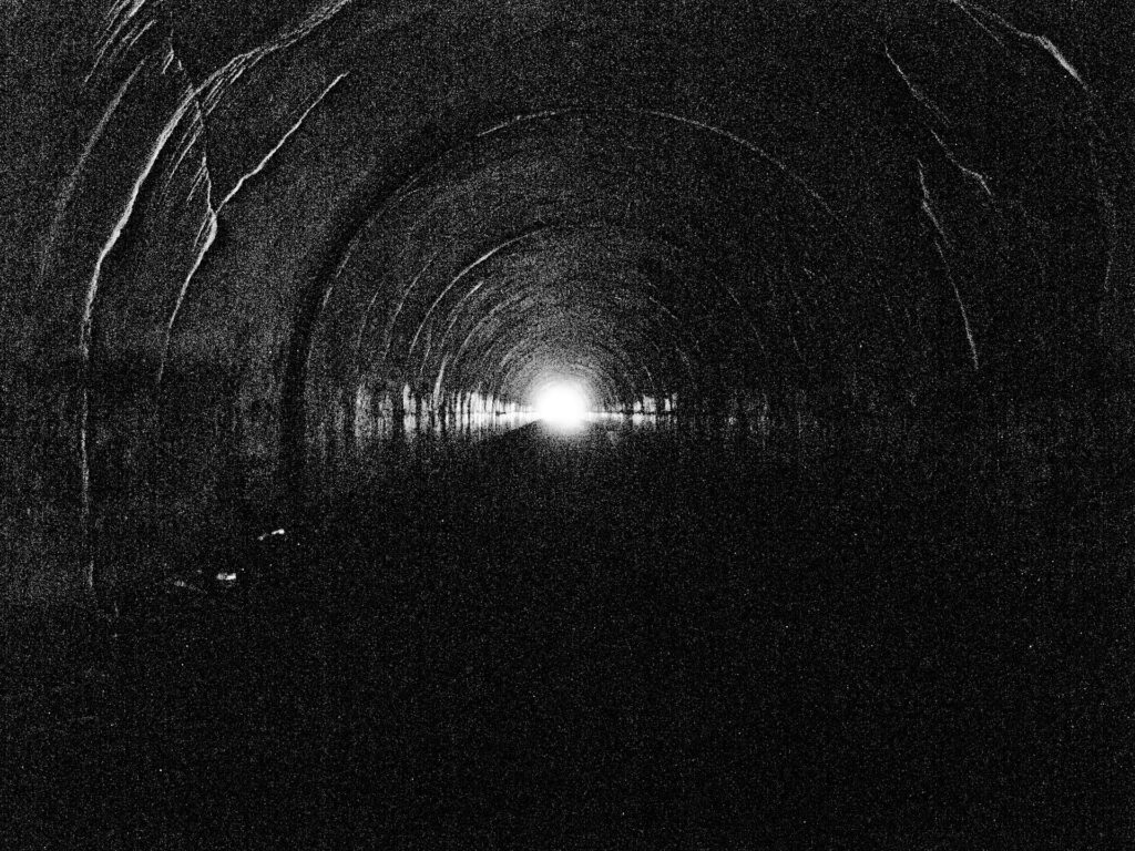
The Road to Nowhere is the local name for Lakeview Drive. The federal government promised to finish it after flooding the old valley routes to build Fontana Dam. Construction stalled partway through in the 1970s, over cost and environmental concerns. The paved road just ends, at a pedestrian tunnel cut into the mountainside. Locals still argue about whether the road should have been finished at all.
Swain County spent decades pushing for the rest of the road. The dispute was settled in 2010 for $52 million to Swain County instead of a finished road, per the Park Service, and the last of that money was paid in 2018. Today the tunnel is the destination. Walk through it and the pavement simply stops on the other side, swallowed by forest. Bring a flashlight if you want to see the far end clearly.
Fontana Lake Camping
The lake’s north shore has no road access at all. It’s the roadless side of the park that the Road to Nowhere was supposed to reach. The boat-in campsites along Hazel Creek and Eagle Creek are reached only by water, or a long hike in. The park’s backcountry office requires a permit for every site back there. Reservations open well in advance for the more popular sites near the creek mouths.
Most people book the passenger shuttle out of Fontana Village rather than run their own boat. That’s especially true on a first trip. Once you’re dropped off, the sites themselves are simple: a fire ring, a bear cable, and a lot of quiet. Pack in everything you’ll need — there’s no store or ranger station out there once the boat leaves. Bugs are worse near the water in early summer, so pack accordingly.

Fontana Lake Boating
Fontana Village runs the main marina on the lake. It rents pontoon and fishing boats through the warmer months. The same marina runs the passenger shuttle that gets hikers and campers to the north shore. Personal boats launch from several public ramps around the lake. Kayaks and canoes work fine here too, especially in the quieter coves off the main channel. Rentals fill up fast on summer weekends, so booking ahead helps.
The shoreline is almost entirely national forest and park land. That means far less private dock clutter than on a typical reservoir. Motorcyclists and sports car drivers know the area for a different reason. The Tail of the Dragon runs along the lake’s western edge, toward Deals Gap. It’s a stretch of US-129 famous for curve after curve. Pair a slow morning on the water with an afternoon on the Dragon and it’s a full day. Either way, plan for slow going on the switchbacks leading down to the water.
Fontana Lake Fishing
Fontana Lake has a reputation among anglers for walleye and smallmouth bass. Catfish and panfish are common too, like most big Tennessee Valley reservoirs. A North Carolina fishing license is required on the water. The state’s wildlife agency sells both short-term and annual licenses online. Early fall is a favorite window for anglers chasing walleye specifically.
Deep water near the dam holds fish even in summer heat. That’s part of why the lake stays busy with boats well after the swimming crowds thin out. Early morning and evening are the better windows on a hot week, before the pontoon traffic picks up. Bring your own bait, since the nearest shop is back in Fontana Village.
Appalachian Trail Fontana Dam
The Appalachian Trail crosses right over Fontana Dam. It’s one of the odder stretches on the whole trail. Hikers walk the top of a 480-foot concrete dam instead of a ridge. Just off the trail sits a large AT shelter. Thru-hikers nicknamed it the “Fontana Hilton,” for its size and, notably, real showers nearby. Hikers heading south toward Georgia often stop here to rest before the next long climb.
It’s a popular resupply stop before hikers head into the park. Fontana Village’s shuttle and small store make it an easy one. You don’t need to be thru-hiking anything to walk the dam yourself. It’s an easy detour even for a day visitor who just wants to see the crossing.
Twenty Mile Trail Smoky Mountains
The Twentymile Ranger Station sits on the lake’s southern edge. It marks one of the quieter ways into the park, away from the traffic around Cades Cove or Newfound Gap. The Twenty Mile Trail climbs from there along Twentymile Creek. Backcountry campsites are strung along the way for hikers willing to walk in. The gravel access road is rough in spots, so a higher-clearance vehicle helps.
It’s a good pick when the goal is fewer people, not one specific waterfall or overlook. The trailhead lot is small and rarely full, even on a busy weekend. The creek crossings make it a poor choice right after heavy rain. Pack bug spray and expect to have most of the trail to yourself.
Fontana Lake pairs naturally with a stop at Deep Creek to the east. It also works with a swing through Cherokee, NC, on the way out. For a longer loop through the park, see our Smoky Mountains trip-planning guide. Each of those guides covers a different piece of the same corner of the park.
Fontana Lake Facts
Can you swim in Fontana Lake?
Yes, but the National Park Service does not recommend swimming or tubing anywhere in park waters. Fontana Lake also has no designated swimming beach. Most swimming happens off a boat, out in open water away from the marina and the dam. Water temperatures also stay cool well into early summer at this elevation.
How big is Fontana Lake?
Fontana Lake covers more than 10,000 acres with roughly 240 miles of shoreline once every creek arm is counted. That shoreline figure is what makes the lake feel much larger than its acreage alone suggests. The lake sits mostly within Swain and Graham counties, wrapped by national forest.
What fish are in Fontana Lake?
Walleye and smallmouth bass are the two most sought-after species, alongside catfish and panfish common to Tennessee Valley reservoirs. A North Carolina fishing license is required to fish here. Muskellunge show up in angler reports too, though they’re less common than bass.
Is Fontana Lake man made?
Yes. TVA built the lake by damming the Little Tennessee River in the 1940s, flooding the valley to create Fontana Dam. There was no natural lake on this site before. The valley beneath the lake once held small farming communities before the flooding.
Prices are approximate, current as of publication, and change frequently — confirm the latest price with the retailer before buying.
Published September 28, 2026.
Photo credits: (1) featured, Fontana Dam seen from downriver in North… — Acroterion, CC BY-SA 4.0, via Wikimedia Commons; (2) View of Bryson City, North Carolina, the… — Brian Stansberry, CC BY 3.0, via Wikimedia Commons; (3) The downstream side of the main spillway at… — Acroterion, CC BY-SA 4.0, via Wikimedia Commons; (4) Morning view across the water of Fontana… — Brian Stansberry, CC BY 3.0, via Wikimedia Commons; (5) The Road to Nowhere tunnel at the end of… — Gerry Dincher from Hope Mills, NC, CC BY-SA 2.0, via Wikimedia Commons; (6) Hazel Creek embayment on the north shore of… — Brian Stansberry, CC BY 3.0, via Wikimedia Commons.