

Some links on our site may earn us a commission at no extra cost to you. Learn more.
Capitol Reef is one of the quieter parks in Utah’s Mighty 5, and one many people drive past on Highway 24 without stopping. Give it one full day for the Scenic Drive, the Fruita orchards and two short hikes. Give it two days if you want a longer canyon walk, a night under dark skies or a rough-road drive into the backcountry.
We have done desert road trips with nieces and nephews along, and the stops that work are the ones with a short walk, a snack and room to run. Capitol Reef has all three. I would plan the Scenic Drive for the cooler end of the day and pack more water than feels sensible, because the park has no restaurants and no gas stations inside its boundary.
Is Capitol Reef worth visiting?
Yes, if you like red rock with space around it. The park protects the Waterpocket Fold, a long wrinkle in the earth’s crust where tilted layers have eroded into cliffs, domes and narrow canyons. Tall walls sit right beside the highway, so you see a lot from the car.
The trade-off is that there is no single icon to queue for. The draw is the whole landscape, plus a pioneer orchard where you can eat fruit in the shade. Skip it if you have only an hour and want one famous view. Stay if quiet pull-offs and short trails sound better than a crowd.
Capitol Reef one day itinerary
Start at the visitor center. The park’s alerts page lists daily hours of 8:00 am to 4:30 pm through the fall, with winter hours starting at the end of November. The same page carries any trail closures and flash flood notices, so read it the morning you go.
Walk Hickman Bridge in the morning, eat at the orchards at midday and save the drive for late. The table below puts that day in order.
| Stop or trail | Kind | Distance or time | What you see |
|---|---|---|---|
| Visitor center | Start here | 8:00 am to 4:30 pm in fall | Park film, road conditions, maps |
| Hickman Bridge | Moderate hike | 0.9 miles one way | A 133-foot natural bridge |
| Fruita orchards and Gifford House | Historic district | Fenced orchards 9:00 am to 5:00 pm | Fruit trees, pies, a one-room schoolhouse |
| Scenic Drive | Paved road | 7.9 miles, about 1.5 hours with both spurs | Cliffs, canyon mouths, Pioneer Register |
| Capitol Gorge | Easy hike | 1.0 mile one way | Historic inscriptions, waterpockets |
| Grand Wash | Easy hike | 2.2 miles one way | A deep canyon with narrows |

Do the narrows only if the sky is clear. The flood section below explains why.
Capitol Reef 2 day itinerary
Day one is the one-day plan without the narrows. Walk Hickman Bridge, spend the afternoon in Fruita and drive the Scenic Drive near sunset. Eat in Torrey that evening, then come back for the stars.
Day two is for the longer walk or the long road. Pick one of the strenuous hikes in the morning, Cassidy Arch being the shortest, and finish with the narrows in Grand Wash if the forecast is dry. Or give the whole day to Cathedral Valley, which takes six to eight hours on its own.
I would not try to do both on the same day. Pair the long hike with an early night and the road with a full tank.
Fruita orchards
The orchards are the part of Capitol Reef most people do not expect. The park’s orchard page counts about 1,900 trees, with cherry, apricot, peach, pear, apple, plum, mulberry, almond and walnut among them. You may pick ripe fruit only where a U-Pick sign is posted, and you pay at a self-pay station with a scale near the entrance.
Never climb the trees. Use the hand pickers and ladders the park provides, and leashed pets are allowed inside. Fenced orchards keep hours of 9:00 am to 5:00 pm, and unfenced orchards are open dawn to dusk.
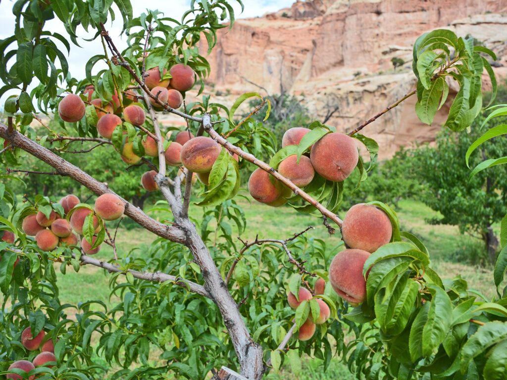
The harvest calendar runs apricots from late June to mid-July, peaches from late July to early September, pears from early August to early September and apples from mid-August to mid-October. On September 30, 2026, the alerts page said several orchards were open for apple harvest and one was closed for irrigation. Orchard status changes week to week, so call the park line at 435-425-3791 before you plan around fruit.
The Gifford House is the other reason to stop. It sells jams, jellies, quilts, candles, locally baked fruit pies and homemade ice cream. The park says it typically opens March 14 and runs to late November, daily from 9:00 am to 4:30 pm, though dates and hours can vary.
Capitol Reef hikes
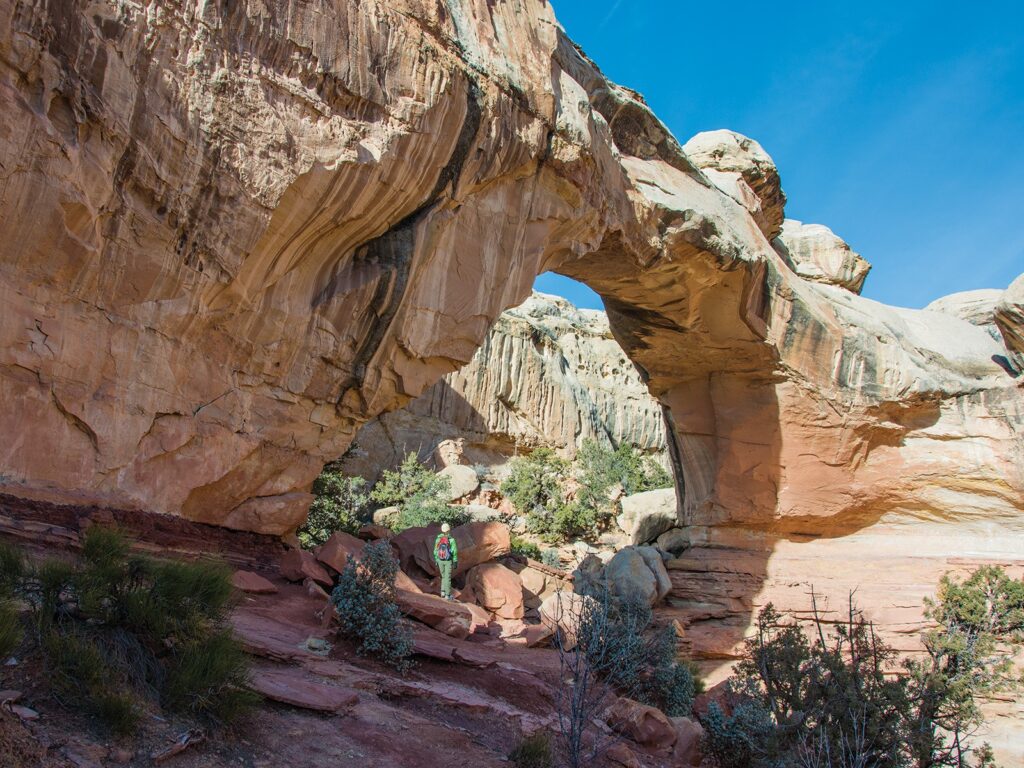
The trail guide sorts the hikes cleanly. Capitol Gorge (1.0 mile one way, 80 feet of climb) and Grand Wash (2.2 miles one way, 200 feet) are easy. Goosenecks (0.1 mile) and Sunset Point (0.4 mile) are viewpoint strolls anyone can manage.
Hickman Bridge (0.9 miles one way, 400 feet of climb) and Cohab Canyon (1.7 miles one way, 440 feet) are moderate. Cassidy Arch (1.7 miles one way, 670 feet) is rated strenuous, as are Rim Overlook (2.3 miles, 1,110 feet) and Navajo Knobs (4.7 miles, 1,620 feet). The 3.6-mile Chimney Rock loop is also strenuous and is the park’s pick for sunset.
Carry a gallon of water per person, and start early. I would take the easy hikes in the hour after sunrise and leave the strenuous ones for a cool day.
Capitol Reef scenic drive
The Scenic Drive is 7.9 miles of paved road that starts near the visitor center and runs south along the cliffs. Two dirt spurs, Grand Wash and Capitol Gorge, leave it and end at trailheads. The park says they are usually fine for passenger cars and for RVs up to 27 feet long.
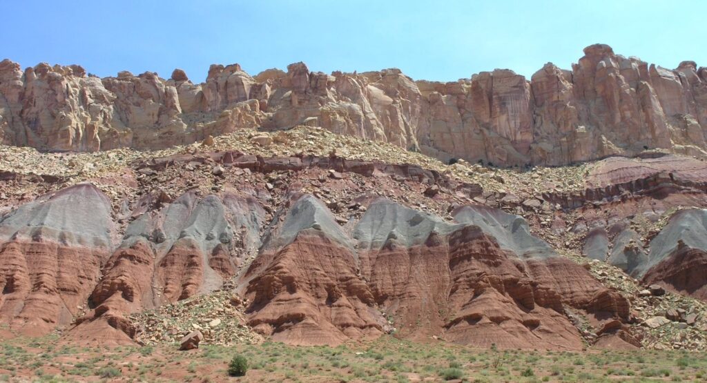
Allow about an hour and a half round trip with both spurs, more if you stop at the 11 numbered pull-offs. The park’s fee page lists $20 for a private vehicle, $15 for a motorcycle and $10 per person on foot or bicycle, with children under 16 free. I would drive it late in the day, when the light is low and the pull-offs thin out.
Flash flood safety
The Scenic Drive spurs run along canyon floors, and that is where the danger is. The park’s flash flood page says cars parked along Grand Wash and Capitol Gorge can be swept away, and that three vehicles washed down Grand Wash and two down Capitol Gorge in June 2022. It also says less than half an inch of rain in an hour can set one off.
Monsoon season runs from mid-June through mid-October. Several paved dips on the Scenic Drive cross washes that can flood, and clearing debris can close the road for hours or days. Check the National Weather Service flash flood potential rating before you go, and I would skip the narrows on any day when storms are in the forecast.
Cathedral Valley
Cathedral Valley is a separate trip into the park’s north district. The Cathedral Valley page puts the start of Hartnet Road 11.7 miles east of the visitor center on Highway 24. The full loop is 57.6 miles and takes about six to eight hours.
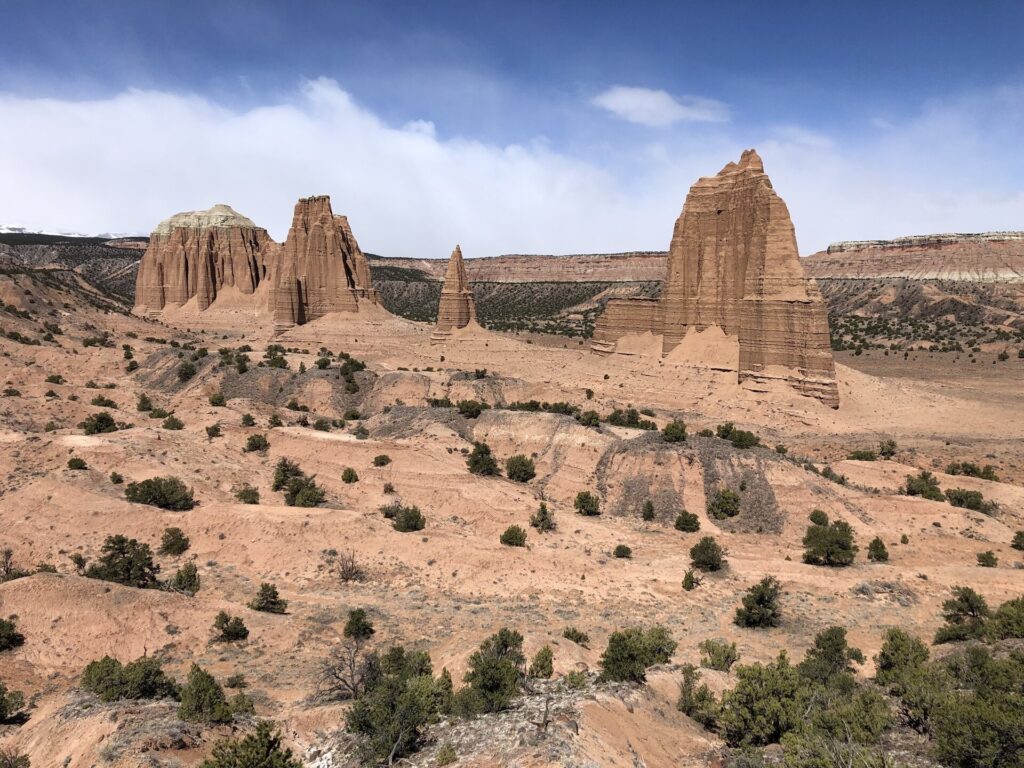
Plan for high clearance. The page says high-clearance vehicles, even without four-wheel drive, can usually manage the roads, but rain and snow can leave them washed out and impassable. The south end crosses the Fremont River with no bridge, normally a foot or less deep, and the park says not to cross in high water.
There is no drinking water out there, and help may take hours or days to arrive. Call 435-425-3791 and press 1, then 4, for road conditions before you leave. On the park’s south side, Notom-Bullfrog Road is paved for 15 miles and then turns to rough dirt.
Capitol Reef camping
The Fruita Campground has 71 sites and is the only developed campground in the park. Sites are $25 a night, or $12.50 for senior and access pass holders, and reservations go through recreation.gov. Cathedral Valley and Cedar Mesa are free primitive campgrounds, first come, first served, and backcountry camping needs a free permit.
Services are thin. The park lists no restaurants or gas stations inside its boundary. Torrey is 11 miles west with gas, restaurants, lodging and seasonal groceries, and Hanksville is 37 miles east with gas and year-round groceries. I would fill the tank and the cooler before entering, and our national park camping checklist covers the rest.
Capitol Reef stargazing
Capitol Reef became an International Dark Sky Park in 2015. The park’s night-sky page calls the skies near-pristine, so the Milky Way is the show on a moonless night. Light painting is not allowed under the park’s rules, so leave the flashlight tricks at home.
Utah Mighty 5 road trip
Capitol Reef sits in the middle of Utah’s five national parks, between Zion and Bryce to the southwest and Arches and Canyonlands to the northeast, and Highway 24 ties it together. Our Utah Mighty 5 road trip lays out the whole loop, so this guide does not repeat it. For the neighbors, see the Zion two-day itinerary and the Arches timed entry guide.
Check Utah’s road site, udottraffic.utah.gov, for Highway 24 before you drive it.
How many days do you need at Capitol Reef National Park?
One full day covers the Scenic Drive, the orchards and two short hikes. Two days add a strenuous hike or a Cathedral Valley loop, plus a night under the stars.
When can you pick fruit in Capitol Reef?
The park’s calendar runs from late June for apricots to mid-October for apples. Peaches and pears fall in between, from late July through early September. Late October is after the last harvest on that calendar.
Do you need a reservation for Capitol Reef National Park?
No. The park says no reservation or timed-entry ticket is needed to enter. Fruita Campground sites are booked through recreation.gov, and overnight backcountry trips need a free permit.
How much does it cost to get into Capitol Reef?
A private vehicle pays $20 and a motorcycle pays $15, per the park’s fee page on the date checked. Visitors on foot or bicycle pay $10 each if they are 16 or older. The Capitol Reef annual pass is $35.
Is there gas in the park?
No. The park lists no gas stations or restaurants within its boundaries. The nearest gas is in Torrey, 11 miles west, with more in Hanksville, 37 miles east, so fill up before you drive in.
Prices are approximate, current as of publication, and change frequently — confirm the latest price with the retailer before buying.
Published October 25, 2026.
Photo credits: (1) featured, Gifford House and Pendleton Barn at Fruita… — NPS Photo, U.S. Government work, public domain, via National Park Service; (2) Cliffs at the mouth of Capitol Gorge in… — Wikimedia Commons contributor, CC BY-SA 2.5, via Wikimedia Commons; (3) Peach orchard in the Fruita Historic… — NPS Photo, U.S. Government work, public domain, via National Park Service; (4) Hickman Bridge, a natural sandstone bridge… — NPS Photo, U.S. Government work, public domain, via National Park Service; (5) Sandstone cliffs rising above the Scenic… — Wikimedia Commons contributor, CC BY-SA 2.5, via Wikimedia Commons; (6) Entrada sandstone monoliths known as the… — National Park Service, U.S. Government work, public domain, via Wikimedia Commons.