

Some links on our site may earn us a commission at no extra cost to you. Learn more.
Congaree is South Carolina’s old-growth floodplain forest, free to enter and about 30 minutes from the Columbia airport by the park’s own directions page. Plan a half day: the 2.6-mile Boardwalk Loop, one longer trail, and a paddle only when the creek is low. Mosquitoes and floods decide almost everything else.
I have spent plenty of time in canoes, kayaks and rafts on Colorado rivers, and that habit shapes how I plan a place like this. Water level comes first and everything else second. A forest that floods about ten times a year is that same lesson on a bigger scale, so I would check the gauges before I committed to a day here.
Is Congaree National Park worth visiting?
I would call it worth a half day for anyone already crossing South Carolina, and a full day if you plan to paddle. It is a quiet, shaded walk among enormous trees, with brown water, cypress knees and almost no one talking. It is not a park for big views or waterfalls.
The money side is easy. The park’s fees page says entrance is free and no pass is needed, which is rare for a national park. Camping and the firefly event are the two places you pay.
Is Congaree National Park a swamp?
The park’s FAQ page calls it a floodplain, meaning low ground that is periodically covered by water. That is why the forest looks the way it does. Floodwater from the Congaree and Wateree Rivers keeps the soil rich, and the trees respond.
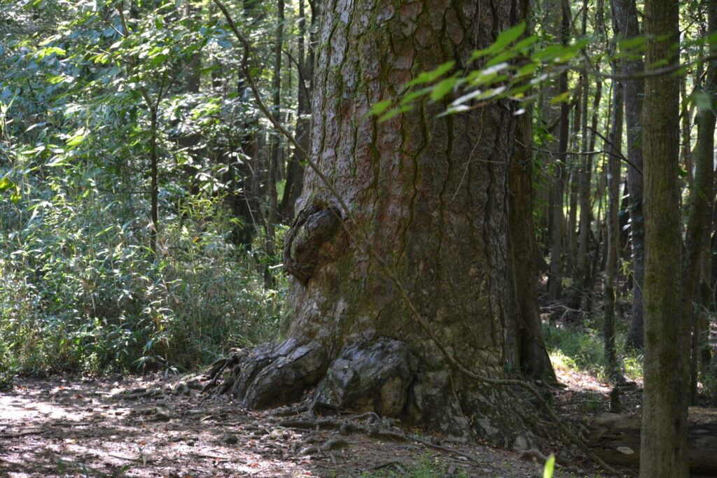
NPS says the forest averages over 100 feet tall and holds one of the highest concentrations of champion-sized trees in North America. The tallest, a national champion loblolly pine, is listed at 170 feet with a 15-foot circumference. The park is also a federal wilderness, a UNESCO biosphere region and an Important Bird Area.
Old-growth bottomland forest once covered about 30 million acres across the Southeast, and only scattered remnants are left. That rarity is the real reason to drive out here.
Congaree National Park itinerary
Congaree works best as a slow half day. Here is the order I would use.
- Arrive at the visitor center and grab the free self-guided boardwalk brochure.
- Walk the Boardwalk Loop first, while you are fresh and before the heat builds.
- Pick one longer trail, such as Weston Lake, if the trail page shows it open.
- Paddle Cedar Creek only if the gauge says the water is low enough.
The park lists the address as 100 National Park Road, Hopkins, SC 29061, and says to use that street address in your GPS rather than the park name. From Interstate 77, Exit 5, the directions page says to drive about 8 miles, then follow Old Bluff Road for 4.5 miles to the entrance. Cell reception inside the park is unreliable, so download directions before you leave.
Harry Hampton Visitor Center
The maps page lists visitor center hours as 9:00 a.m. to 5:00 p.m. every day. Brochures and trail maps sit outside the building 24 hours a day, so an early start is not a problem. Water is available at the visitor center, which matters on a hot day.
Congaree National Park boardwalk
The Boardwalk Loop is 2.6 miles round trip and rated easy on the park’s trail information page. It lifts you off the ground and into the old-growth forest, with bald cypress, tupelo, loblolly pines, oaks, maples and holly along the way. It is wheelchair and stroller accessible, with benches.
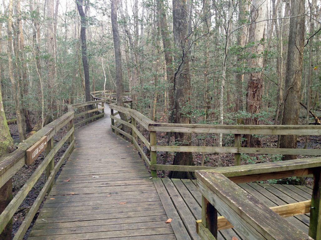
Walk it slowly. Most of the good looking is up, at the canopy, and down, at the knees poking out of the water. The same page says the elevated portion of the boardwalk is not among the trails subject to periodic flooding, but the low stretches can still go under.
Trail status changes after storms and high water, so check that page for the boardwalk before you drive out.
Weston Lake trail
If the boardwalk leaves you wanting more, Weston Lake is the longer walk I would pick. The trail page rates it moderate at 4.5 miles round trip, with views of Cedar Creek where otters and wading birds are regularly seen. You pass a cypress-tupelo slough with knees standing in the water.

The longer trails are a different commitment. Oakridge and Kingsnake carry notes that they may be difficult to follow, and the trail page notes downed trees on some routes after storms. The park tells backcountry hikers to carry a compass, a map and offline GPS tools.
| Trail | Distance (NPS) | Difficulty | What you see |
|---|---|---|---|
| Boardwalk Loop | 2.6 miles round trip | Easy | Old-growth bottomland forest |
| Bluff Trail | 1.8 miles round trip | Easy | Young loblolly and longleaf pine |
| Sims Trail | 3.2 miles round trip | Easy | Old gravel road to Cedar Creek |
| Weston Lake Trail | 4.5 miles round trip | Moderate | Cedar Creek, cypress slough |
| Oakridge Trail | 7.1 miles round trip | Difficult | Old-growth oaks, deer, turkey |
| Firefly Trail | 1.8 miles round trip | Easy | Synchronous fireflies in season |
| Kingsnake Trail | 12 miles | Difficult | Birding along Cedar Creek |
Cedar Creek canoe trail
I would paddle here only when the water level on the NPS page says so. The park’s canoeing page describes a marked trail of approximately 15 miles, from Bannister’s Bridge to the Congaree River. It welcomes novice and experienced paddlers, and the wildlife list includes river otters, deer, turtles, wading birds and alligators.
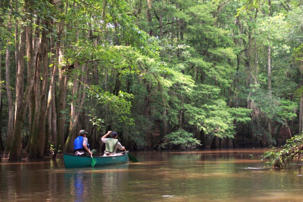
The park does not rent boats. Bring your own or book with an outfitter in Columbia, and the page lists several that run guided three-hour trips meeting at South Cedar Creek Landing. The conditions page warns of numerous portages and log carry-overs, and says the trail is cleared as staffing permits.
Water on Cedar Creek can swing up to 10 feet seasonally, and flood stage is 8 feet. The park says novice paddlers should stay off the creek above that level, because the current is unpredictable and the trail is hard to see. If you have only done calm lakes, book a guide.
Congaree National Park flooding
Flooding is the thing that most often changes a Congaree plan. The conditions page says the park floods roughly ten times a year, and that approximately 80% of it can become inaccessible. All trails except the elevated boardwalk, Bluff, Firefly and Longleaf are subject to periodic flooding.
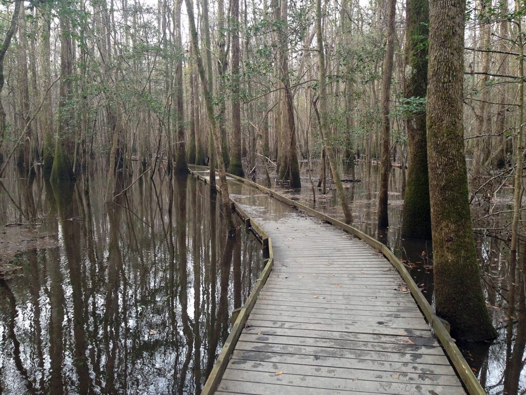
The park links two gauges from its current conditions page. Flood stage is about 8 feet on Cedar Creek and about 15 feet on the Congaree River at the park’s west boundary. The same page carries any alerts and closures, so read it before you leave.

I would look at that page the morning I left, not the week before. A forest that floods ten times a year can look different overnight.
Congaree National Park mosquitoes
The conditions page states that from mid-spring until mid-fall you will encounter mosquitoes in the park. The basic info page adds that they can be quite bothersome in summer and tells you to bring repellent. Plan on long sleeves and a head net in the warm months.
That leaves late fall through early spring as the comfortable window, with one catch. It is also when you want to watch the gauges, because creek levels and trail closures decide what you can walk.
Synchronous fireflies
Congaree is one of the few places where fireflies flash in unison, and the park manages it through a lottery. On the date checked, the firefly page described the 2026 event as running May 13 to 20. It said passes came from Recreation.gov by lottery, with entries April 7 to 14.
Each pass admitted one vehicle with up to eight passengers. It cost a $1 service fee to enter plus a $24 event fee if selected, and the page listed 145 passes per night. Those dates are history by the time this posts, so the 2027 season will need a fresh read of that page.
During the event the page said day-use visitors had to be out of the park by 4:30 p.m., while pass holders entered between 7:00 and 8:30 p.m. Red-light flashlights only, no phone lights, and no pets. Best viewing was listed as 9:00 to 10:00 p.m., along the 1.8-mile Firefly Trail.
Longleaf campground
The park runs two walk-in campgrounds. The camping page lists Longleaf with 10 individual sites at $15 a night and 4 group sites at $25, and says no cars are allowed past the gravel parking lot. Bluff Campground has 6 sites at $10 a night, a mile from Longleaf on a hiking trail with no restrooms or water.
Reserve through Recreation.gov or by phone, since the page says reservations are required. Backcountry camping is free with a permit, requested at least 72 hours ahead, and fires are not allowed there. Tents and hammocks only, so leave the RV at home; our national park camping checklist covers the rest of what to bring.
Congaree National Park from Charleston
Congaree sits in the Midlands near Columbia, not in the mountains, so it pairs with the coast rather than the Smokies. If you are working across the state, a morning here fits between our Charleston weekend itinerary and the Lowcountry beach time in Hilton Head Island things to do.
We have done long road trips with nieces and nephews along, and a boardwalk stop breaks up the highway well. Get out of the car, walk 2.6 miles, and you are back on the road within a couple of hours.
When is the best time to visit Congaree National Park?
Late fall through early spring is the quieter, less buggy stretch, because the park says mosquitoes arrive in mid-spring and stay until mid-fall. Flooding can happen any time, so check the conditions page before you leave. Spring is the only season for the fireflies, and that is a lottery.
Is Congaree National Park free?
Yes. The fees page says entrance is free and no entrance pass is required. Camping and the firefly event pass are the exceptions.
Are dogs allowed in Congaree National Park?
Dogs are allowed on leashes of 6 feet or less and must stay under control, and owners must pick up waste. Pets are not allowed during the firefly event. Bikes are limited to the paved entrance road.
Are there alligators in Congaree National Park?
The park lists alligators among the wildlife paddlers may see on Cedar Creek. Its hiking safety page also calls water moccasins a common sight along trails and waterways. Give any animal room and stay on the boardwalk or marked trail.
Can you kayak at Congaree National Park?
Yes. The marked Cedar Creek canoe trail runs about 15 miles from Bannister’s Bridge to the Congaree River, but the park does not rent boats. Check the gauge first, since flood stage on Cedar Creek is 8 feet.
Prices are approximate, current as of publication, and change frequently — confirm the latest price with the retailer before buying.
Published October 24, 2026.
Photo credits: (1) featured, Old-growth floodplain forest in Congaree… — NPS Photo, U.S. Government work, public domain, via National Park Service; (2) Tall loblolly pine in Congaree National… — NPS Photo, U.S. Government work, public domain, via National Park Service; (3) Elevated boardwalk through the forest in… — Fredlyfish4, CC BY-SA 3.0, via Wikimedia Commons; (4) Bald cypress with knees in Congaree… — National Park Service, U.S. Government work, public domain, via Wikimedia Commons; (5) Paddlers canoeing Cedar Creek in Congaree… — NPS Photo, U.S. Government work, public domain, via National Park Service; (6) Floodwater covering the boardwalk in… — Fredlyfish4, CC BY-SA 3.0, via Wikimedia Commons; (7) Congaree River at Congaree National Park… — NPS, U.S. Government work, public domain, via National Park Service.