

Some links on our site may earn us a commission at no extra cost to you. Learn more.
The Blue Ridge Parkway’s final 85 miles run from Asheville to the park boundary at Cherokee. Along the way it climbs over the highest point on the entire 469-mile road. Then it drops down to the edge of the Qualla Boundary. Plan on three to four hours with stops. Longer, if Graveyard Fields or Waterrock Knob pull you onto a trail. It’s the drive we send people on when they’ve got one day between Asheville and the Smokies and want to see both at once.
I’ve driven this stretch more times than I can count, usually southbound with Kuwohi waiting at the other end. It’s slower than the mileage suggests. Eighty-five miles sounds like an hour on the interstate. Here, it’s closer to half a day if you do it right. Fill the tank before you get on. There’s no gas station anywhere on the parkway itself.
Blue Ridge Parkway Mile Markers
Southbound, the stops come in this order. Mileposts count up as you go, so the number only gets bigger as Cherokee gets closer.
| Milepost | Stop | Time to allow | Facilities |
|---|---|---|---|
| 382 | Folk Art Center | 20 min | Restrooms, exhibits |
| 408 | Mount Pisgah | 30–60 min | Inn, restaurant, campground (seasonal) |
| 418 | Graveyard Fields | 45–90 min | Restrooms, waterfall trails |
| 422 | Devil’s Courthouse | 30 min | Overlook, short summit trail |
| 431 | Richland Balsam | 15–30 min | Overlook, trailhead |
| 451 | Waterrock Knob | 30–45 min | Visitor center, restrooms, summit trail |
| 469 | Southern terminus | 10 min | Sign, connects to US 441 toward Cherokee |
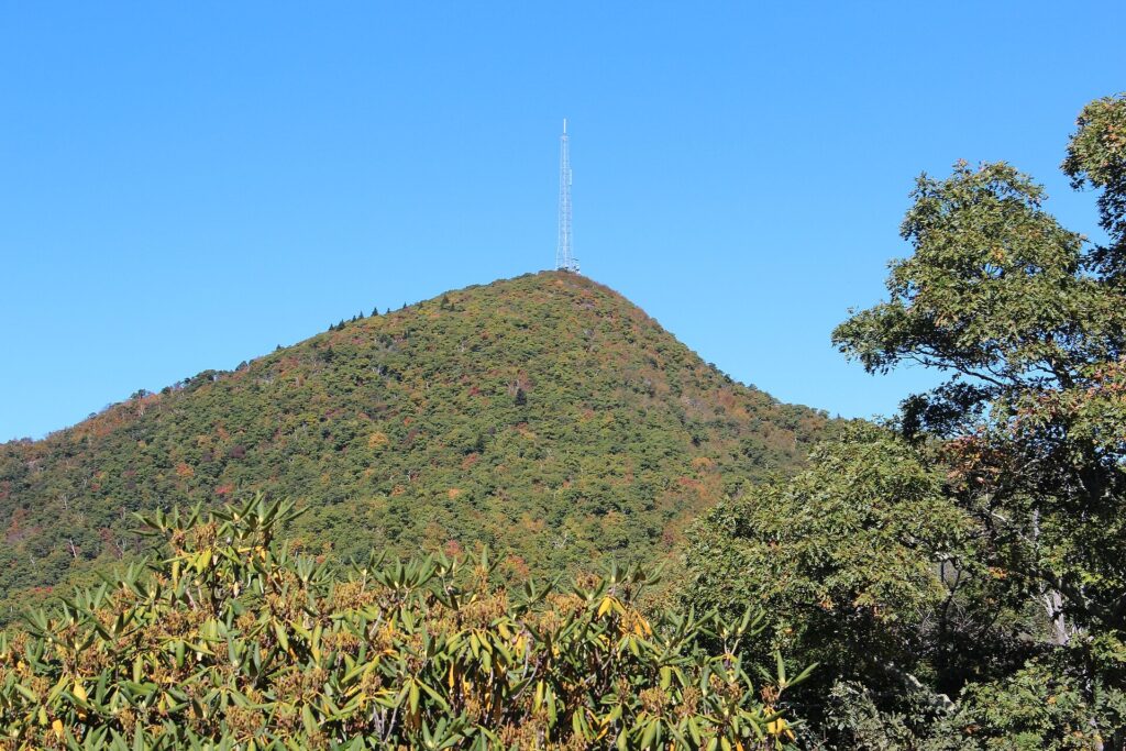
Mount Pisgah Blue Ridge Parkway
Mount Pisgah sits at milepost 408, the first stop south of Asheville worth more than a photo. The inn up here is the highest-elevation lodging on the whole parkway, the park’s own lodging page confirms. It’s open only from early spring through the end of fall color. Pack a jacket even in July. The elevation makes the air feel a season behind the valley.
There’s a short paved overlook right at the parking area. A steeper trail climbs to the summit fire tower if you want the workout. We usually stop for the overlook and keep moving. The summit hike adds close to two hours round trip. There’s a better hike a few miles south, at Graveyard Fields. The restaurant here is one of only a handful of sit-down options on the whole parkway. Book ahead if lunch timing lines up, rather than hope for a table.
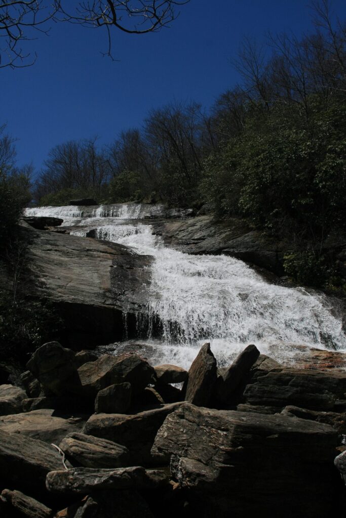
Graveyard Fields Blue Ridge Parkway
Graveyard Fields, milepost 418, is the one stop here that turns into an actual hike. A loop trail under two miles drops into a high valley and reaches two waterfalls. Second Falls is the one everyone photographs, from the rock ledge above the plunge pool.
The name comes from old tree stumps. Early visitors thought they looked like headstones, after a 1920s fire and logging left the valley bare. It’s grown back thick with blueberry bushes and rhododendron since. The color here in early October is some of the best on this whole drive. Give it 45 minutes for the overlook and lower falls, 90 for the full loop past both waterfalls.
Parking fills fast on fall weekends. Arrive before 9 a.m. or plan to circle back later in the day.
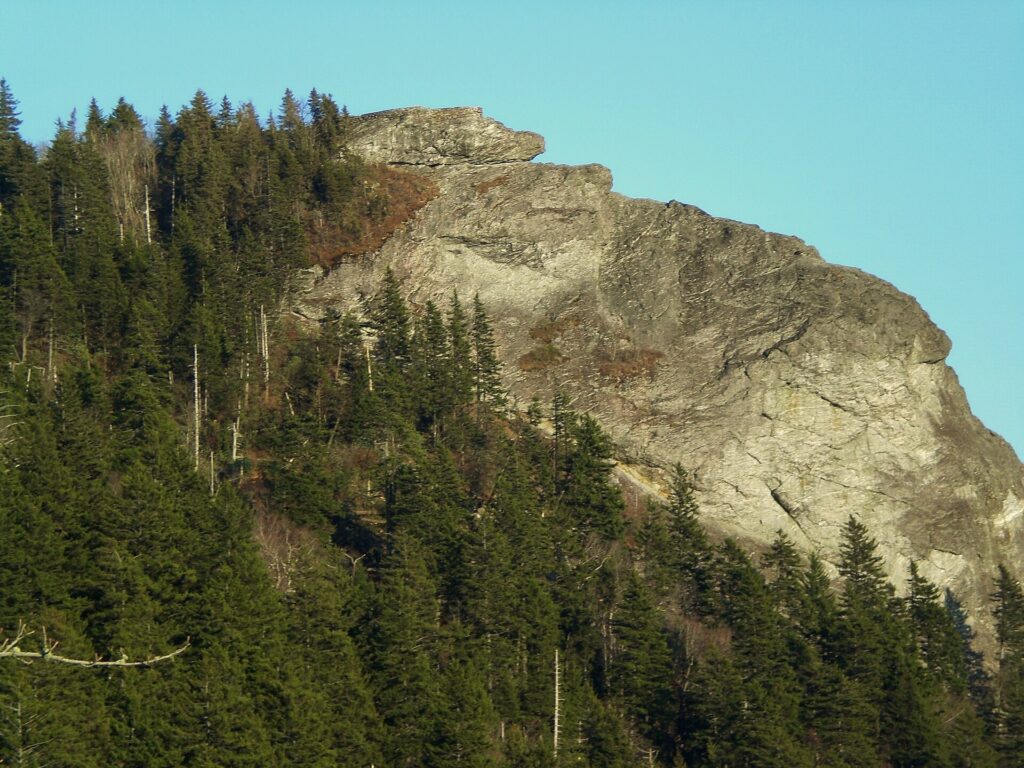
Devil’s Courthouse Blue Ridge Parkway
Devil’s Courthouse, milepost 422, is a half-mile paved trail straight up to a bare rock outcrop. The view is one of the widest on this stretch of the parkway, ridgeline after ridgeline running off toward South Carolina and Georgia. It’s steep for its length. The pavement turns slick when it’s wet or icy.
Cherokee tradition holds that a cave beneath the summit was the home of Judaculla, a giant said to rule the mountain. We mention that every time we bring someone up here for the first time; it adds something the view alone doesn’t.
Thirty minutes covers the round trip for most people. Skip it in fog. The drive up is scenic on its own. But the summit view is the whole point of stopping, and fog erases it completely.
Richland Balsam Blue Ridge Parkway
Richland Balsam, milepost 431, is the highest point on the entire Blue Ridge Parkway, at 6,053 feet. There’s no big overlook lot here, the way there is at Waterrock Knob. Just a pull-off, and a trailhead into spruce-fir forest that feels more like Canada than North Carolina.
A loop trail climbs through that high-elevation forest toward the summit. The top itself is wooded, and doesn’t open up the way Waterrock Knob’s does. Most people skip the hike, note the elevation marker at the pull-off, and keep driving.
The temperature swing here is real. It can run fifteen or twenty degrees colder than Asheville, even in summer.
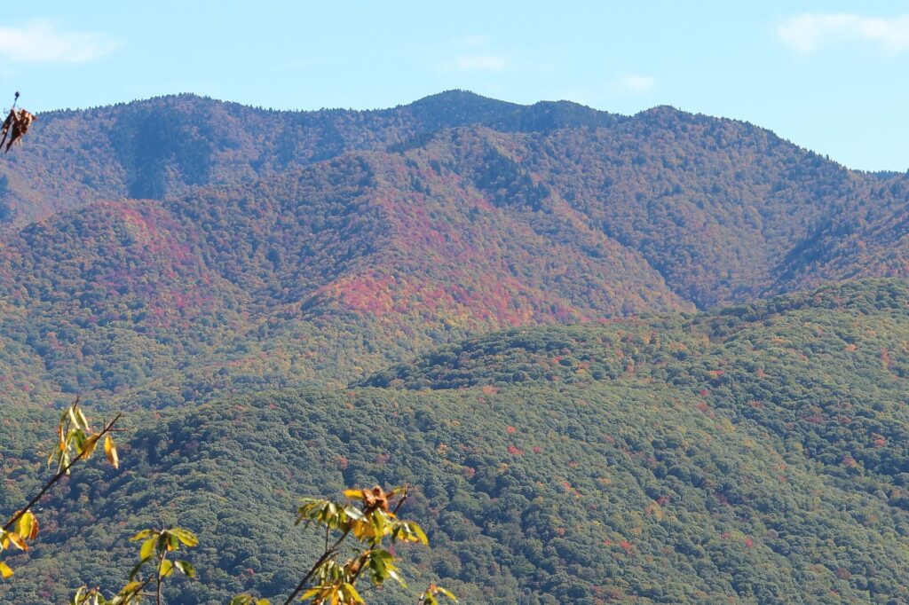
Waterrock Knob Blue Ridge Parkway
Waterrock Knob, milepost 451, is the last big stop before the parkway ends. The visitor center has restrooms, and it’s the last reliable bathroom break before Cherokee. A half-mile trail climbs from there to a summit with one of the best 360-degree views on the whole southern parkway.
That half mile is steeper than it sounds. Figure 30 to 45 minutes round trip, longer if you’re not used to the elevation. On a clear day you can see the high peaks of the Smokies to the west. A good preview of where the drive is headed.
We treat this as the last real stop before the terminus. After Waterrock Knob, the parkway drops fast toward Cherokee and there isn’t much reason to pull over again.

Blue Ridge Parkway Southern Terminus
Milepost 469 is where the Blue Ridge Parkway ends. It meets US 441 at a junction just outside Cherokee, near the Oconaluftee entrance to the Smokies. There’s a sign marking the spot, and a small pull-off, nothing more. It’s a milestone to note, not a destination to linger at.
From here, US 441 carries you into Cherokee in a few minutes. Or north into the park, toward Kuwohi and Newfound Gap. Either way, the parkway drive is done, and a different kind of mountain road takes over.
We don’t stop long at the terminus itself. The real payoff of this drive is everything between Asheville and here, not the sign at the end of it.
How Long Does It Take To Drive The Blue Ridge Parkway?
Eighty-five miles, and it never feels like eighty-five miles. Budget three to four hours for the overlooks that are actually worth it: Mount Pisgah, Graveyard Fields, Devil’s Courthouse, Richland Balsam and Waterrock Knob. That’s without doing any of the longer hikes.
Add real hiking time and the day stretches. The Graveyard Fields loop alone can eat 90 minutes. Do that plus the Waterrock Knob summit trail, and you’re closer to five or six hours end to end. Plus whatever time you spend in Cherokee once you arrive.
We treat this as a half-day drive, not a full one. We build the rest of the day around Asheville in the morning and Cherokee for the evening. Trying to pack a full day of Asheville sightseeing in ahead of it is the mistake we see people make most.
Blue Ridge Parkway Tunnels
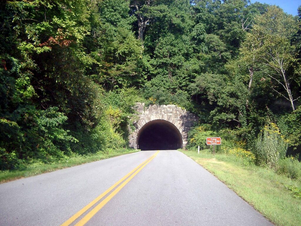
This stretch has more tunnels than any other section of the parkway. The road has 26 tunnels in all. The park’s own tunnel history page counts 25 of them in North Carolina, most within reach of this drive.
They’re narrow and unlit, cut through solid rock rather than lined with concrete. Headlights on is the rule, even at midday. Tall RVs and trailers should check clearances before committing. A couple of these tunnels run low enough to matter.
None of it is dramatic if you’re paying attention. Slow down, use headlights, and treat each tunnel mouth like a blind curve, because that’s effectively what it is.
Blue Ridge Parkway Road Conditions
The speed limit runs 45 mph for most of this drive. It drops to 25 or 35 mph on the tighter curves, according to the parkway’s own driving safety page. It’s enforced, and for good reason. Blind curves and low guardrails don’t forgive going faster.
Fog is the bigger everyday hazard, more than snow most of the year. Elevation swings from under 2,000 feet in Asheville to over 6,000 feet at Richland Balsam. Clouds sit on these ridges more mornings than not, and visibility can drop to almost nothing with no warning.
Winter brings the more serious closures. The park’s real-time road-status page is the only reliable way to check before you go. Not a review from last month. Not the weather in Asheville that morning. As of this writing, the Asheville-to-Cherokee stretch has stayed open through the parkway’s ongoing Hurricane Helene repair work. That work has closed other sections farther north, near Mount Mitchell.
Is the Blue Ridge Parkway worth driving?
Yes. It’s the drive I point people toward more than almost anything else in this corner of North Carolina. Five stops with real payoffs, in under 90 miles, is a good ratio for any road trip. The elevation change alone is worth it: from Asheville’s valley floor to spruce-fir forest above 6,000 feet.
Where it falls short: there’s no fuel, limited food, and cell service drops out for long stretches. This isn’t a spontaneous half-tank kind of trip. Fog can erase the views with zero notice. The tunnels slow down anyone not expecting them.
Do it on a clear day. Start with a full tank. Give it the better part of an afternoon, rather than squeezing it between two other stops. That’s the version of this drive that’s actually worth doing.
The northbound leg of this same corridor, from Asheville up to Mount Mitchell and Craggy Gardens, is its own drive with its own stops. Pair either leg with a day in Asheville, or start your whole trip from our Smoky Mountains trip-planning hub.
Blue Ridge Parkway Facts
Is there cell service on the Blue Ridge Parkway?
Cell service is spotty to nonexistent for long stretches, especially near Richland Balsam and Waterrock Knob. Download offline maps before you get on the parkway. Don’t count on a signal partway through.
Is the Blue Ridge Parkway free?
Yes. There’s no entrance fee or toll anywhere on the Blue Ridge Parkway, including this stretch between Asheville and Cherokee. The only costs are whatever you spend on food, lodging or activities at the stops themselves.
Where does the Blue Ridge Parkway end?
The Blue Ridge Parkway ends at milepost 469, just outside Cherokee. It meets US 441 there, at the edge of the Qualla Boundary and the Oconaluftee entrance to the Smokies.
How many tunnels are on the Blue Ridge Parkway?
The parkway has 26 tunnels in total. 25 of them are in North Carolina, most within this southern stretch between Asheville and Cherokee.
Can you drive the Blue Ridge Parkway in one day?
Yes, easily, for just this southern stretch. Budget three to four hours for the Asheville-to-Cherokee section alone. Build in a full day if you want to add the hikes at Graveyard Fields and Waterrock Knob.
Published September 26, 2026.
Photo credits: (1) A waterfall in the Graveyard Fields valley… — jay8085, CC BY 2.0, via Wikimedia Commons; (2) The rocky summit of Devil's Courthouse… — bradploeger, CC BY-SA 2.0, via Wikimedia Commons; (3) The view from the Waterrock Knob summit… — Brian Stansberry, CC BY 3.0, via Wikimedia Commons; (4) A stone tunnel portal on the Blue Ridge… — photographer: Barbara Bennett, CC BY-SA 2.0, via Wikimedia Commons.