

Some links on our site may earn us a commission at no extra cost to you. Learn more.
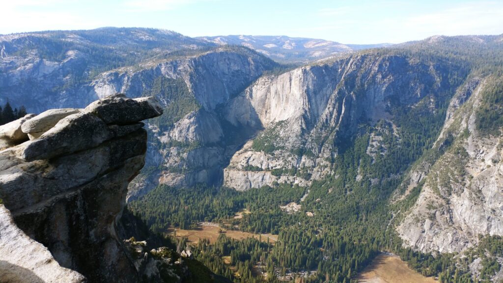
Glacier Point is the overlook 3,214 feet above Yosemite Valley, and you can drive to it from about late May to November. The road is 30 miles from the valley floor, about an hour each way, per the National Park Service. From the railing you look straight across at Half Dome, down on Vernal and Nevada Falls, and over to Yosemite Falls. Park entry is $35 per car for seven days, and for 2026 there is no timed reservation to get in.
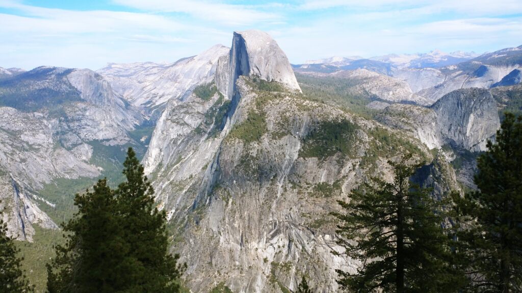
I have stood at that railing with Half Dome filling the view, and the photos on this page are mine. We went in fall. The Merced River in the valley was low enough to show its gravel bars, and the trees along it had turned gold.
Glacier Point Yosemite
| Quick facts | Glacier Point |
|---|---|
| Height above the valley | 3,214 ft above Curry Village |
| Road season | about late May to November; 2026 opened May 9 |
| Drive from the valley | 30 miles, about 1 hour |
| Park entry | $35 per car, 7 days; no reservation in 2026 |
| Walk to the overlook | 300 yards, paved, wheelchair-accessible |
| Bus option | Glacier Point Tour, $72.50 adult round trip, until Oct 12, 2026 |
| Nearby hikes | Sentinel Dome 2 mi, Taft Point 2.2 mi round trip |
| Vehicle limit | nothing over 30 ft or towing past the Sentinel Dome lot |
When is Glacier Point Road open?
From about late May or June until snow closes it, usually in November, per the park’s fall planning page. In 2026 the road opened to cars on May 9, per the park announcement carried by the Sierra Sun Times. The park’s conditions page listed it as open on September 18, 2026.
In winter the road is plowed only as far as Badger Pass, from mid-December to early April. After that, Glacier Point is a 10.5-mile ski or snowshoe trip each way. Short closures can also follow an early fall storm, so check conditions the morning you go.
How do you get to Glacier Point?
By car, the drive is 30 miles from Yosemite Valley or from Wawona, about an hour, per the Park Service. Take Wawona Road (Highway 41) toward Chinquapin, then turn onto Glacier Point Road. Vehicles longer than 30 feet, and anything towing a trailer, have to stop at the Sentinel Dome parking lot.
Without a car, the Glacier Point Tour leaves the Yosemite Valley Lodge lobby at 8:30 a.m. and 1:30 p.m., per the park concessioner. The four-hour round trip costs $72.50 for adults and $50.50 for children. The 2026 season runs to October 12. A one-way ticket, $28.50 for adults, lets hikers ride up and walk back down.
Yosemite Entrance Fee
The park entrance fee covers it. That is $35 per private vehicle for seven days, $30 per motorcycle, or $20 per person arriving on foot or by bike, per the Park Service fees page. Visitors who are not US residents and are 16 or older now pay an extra $100 each, unless they carry an annual or America the Beautiful pass. Nothing extra is charged for the road or the overlook. The bus tour is the only paid add-on, at $72.50 round trip or $28.50 one way for adults.
Glacier Point Parking Lot
Sometimes. The Park Service says parking there, as everywhere in the park, is limited, and advises arriving early. Yosemitehikes calls it a large lot that only occasionally fills. When it does, a free shuttle may run from Badger Pass, per Yosemite.com.
The busier lot is often the Sentinel Dome and Taft Point trailhead, partway along the road. It fills at midday and spills onto the road shoulder, per a 2026 visitor report. Do those two hikes first thing, then drive to the point.
What can you see from Glacier Point?
Most of the park’s headline views at once. The Park Service lists Yosemite Valley, Half Dome, Yosemite Falls, Tenaya Canyon, Vernal Fall, Nevada Fall, Illilouette Fall and the high country. Half Dome sits almost level with you across the canyon.
Two timing notes. Yosemite Falls runs roughly November through July and peaks in May, per the park, and it is often a trickle or dry by August. Vernal and Nevada Falls keep flowing at low levels into the fall. So a September visit trades the big waterfall for, by mid-October, fall color.
Sentinel Dome Taft Point Hike
Five, from a stroll to a full day. All figures here come from the Park Service’s Glacier Point hikes page, except the Panorama Trail, which comes from the park’s trailhead page.
| Hike | Distance | Elevation | Time | Start |
|---|---|---|---|---|
| Overlook walk | 300 yd one way | flat, paved | minutes | Glacier Point lot |
| Sentinel Dome | 2 mi round trip | 400 ft | 1 to 2 hr | Sentinel Dome/Taft Point trailhead |
| Taft Point | 2.2 mi round trip | 200 ft | 1 to 2 hr | Sentinel Dome/Taft Point trailhead |
| Four Mile Trail | 4.8 mi one way | 3,200 ft | 3 to 4 hr one way | Glacier Point or the valley |
| Panorama Trail | 8.2 mi one way | 3,200 ft down, 800 ft up | most of a day | Glacier Point |
The Panorama Trail passes Illilouette, Nevada and Vernal Falls on its way to Happy Isles, per the park. It finishes down the Mist Trail or the John Muir Trail. Through October the Mist Trail above the Vernal Fall footbridge is open only Friday to Sunday and on holidays, so plan the John Muir route on a weekday.
Four Mile Trail Yosemite
Hiking down from Glacier Point works well, and pairing it with a one-way bus ride up is the best way to do it. Ride the tour bus up one way for $28.50, then walk the Four Mile Trail or the Panorama Trail down to the valley. Four Mile drops 3,200 feet in 4.8 miles, which is hard on knees. Take the Panorama instead if you want waterfalls; it is longer but passes three.
The Four Mile Trail usually opens in May and closes below Union Point after heavy snow, by November or December. The conditions page listed no closure on it in mid-September 2026.
Glacier Point for Sunrise or Sunset
Glacier Point works well for both. Yosemitehikes says the sunsets there are the reason many people drive up. The Park Service names Glacier Point and nearby Washburn Point as its recommended stargazing spots, and summer ranger night-sky programs run there, some by reservation. Bring a warm layer. You are more than 3,000 feet above the valley floor, and the air cools fast after dark.
Glacier Point Snack Stand
The Park Service lists a snack bar, gift shop, restrooms, an amphitheater, bottle-filling stations, accessible parking and a tactile model of the valley. However, the May 2026 opening notice said there was no drinking water and vault toilets only. Carry your own water until you see the fill stations working.
Glacier Point Itinerary
Start early at Tunnel View on Wawona Road, which is open all year and frames El Capitan, Half Dome and Bridalveil Fall, per the park. Then drive the Glacier Point Road, walking Sentinel Dome or Taft Point before the trailhead lot fills. Spend the middle of the day at the point itself, and come back down to the valley for an afternoon along the Merced.
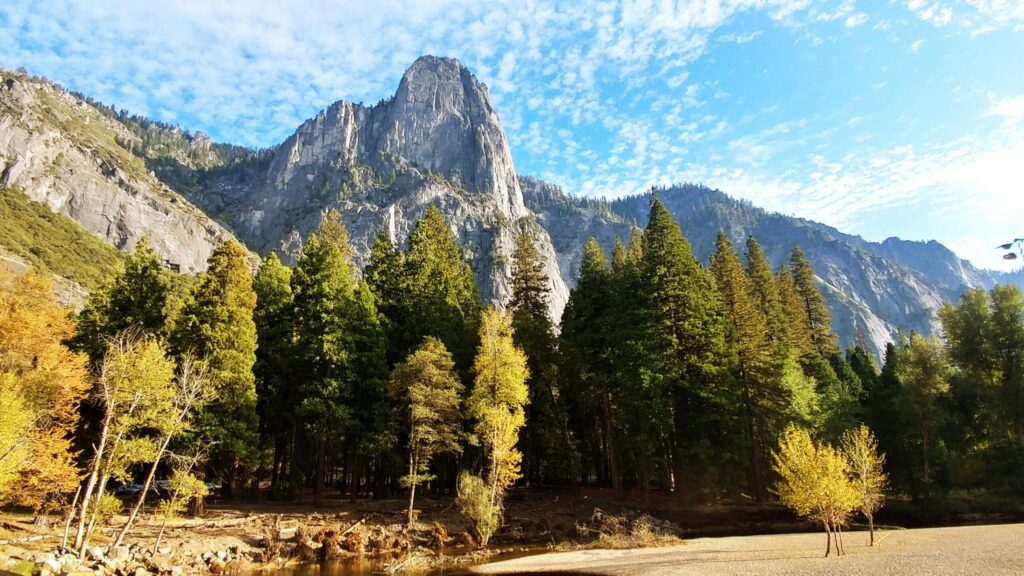
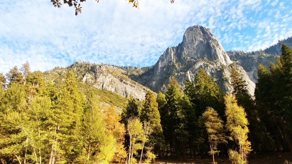
In fall, that river walk is the best part. Bigleaf maples, black oaks and Pacific dogwoods turn around mid-October, per the Park Service. When we went, the river was low and clear, and the gold trees lined the banks right under the granite walls.
Skip a midday arrival at the Sentinel Dome trailhead on a weekend. Also skip the RV past the Sentinel Dome lot, since anything over 30 feet cannot continue. Do not plan on Yosemite Falls in September; it is usually dry by then. And do not count on water at the point without checking first.
Frequently asked questions about Glacier Point
Is Glacier Point open now?
The road was open on September 18, 2026, per the park’s conditions page. It usually closes to cars with the first heavy snow, in November.
Do you need reservations for Yosemite?
No. The park dropped its timed-entry reservation system for 2026. You pay the $35 vehicle entry fee at the gate.
How long is the drive from Yosemite Valley to Glacier Point?
About an hour each way. It is 30 miles from Yosemite Valley or from Wawona, per the Park Service.
How high is Glacier Point above Yosemite Valley?
It sits 3,214 feet above Curry Village on the valley floor, per the Park Service.
Is Glacier Point open in winter?
Only on skis or snowshoes. The road is plowed to Badger Pass, and from there it is 10.5 miles each way.
Published September 21, 2026.
Prices are approximate, current as of publication, and change frequently — confirm the latest price with the retailer before buying.