

Some links on our site may earn us a commission at no extra cost to you. Learn more.
Bryce Canyon National Park works best as one full day or an easy two. One day covers the amphitheater viewpoints, the Rim Trail and the Queen’s Garden and Navajo loop. A second day adds the Southern Scenic Drive and Mossy Cave. Add the Fairyland Loop if your legs are up for it.
I would pack for Bryce Canyon like it is two seasons in one day, because on the rim it nearly is. A sunrise start wants a puffy jacket and gloves. By the time you climb out of the canyon, you are down to a T-shirt. We have done big national park mornings with nieces and nephews along. The cold start catches people out, not the hiking.
The park sits on a high plateau in southern Utah, a couple of hours from Zion. It pairs naturally with our Zion National Park itinerary. Dates and prices below come from the park pages as of early October 2026.
How many days do you need at Bryce Canyon?
One day is enough to see Bryce Canyon well. The famous part is the Bryce Amphitheater. It starts in the first three miles of the park road, so the main viewpoints sit close together. Two days lets you slow down and add the drive south.
Day one is sunrise at the rim and the Rim Trail. Then walk the Queen’s Garden and Navajo combination, and finish at Inspiration and Bryce Points. Day two is the Fairyland Loop for a hard hike, or the Southern Scenic Drive to Rainbow Point. Save Mossy Cave for the evening, then look at the stars.
| Stop | Time needed | Difficulty | Best light |
|---|---|---|---|
| Sunrise Point to Sunset Point (Rim Trail) | 20 to 60 minutes | Easy, flat, paved | Sunrise at Sunrise Point |
| Inspiration Point and Bryce Point | Short stops | Easy, viewpoints | Morning |
| Queen’s Garden and Navajo loop | 2 to 3 hours | Moderate, 2.9 miles | Morning |
| Fairyland Loop | 4 to 5 hours | Strenuous, 8 miles | Early start |
| Southern Scenic Drive to Rainbow Point | 40-minute drive each way, plus stops | Easy | Midday is fine |
| Bristlecone Loop | About 1 mile | Easy | Midday |
| Mossy Cave | 30 to 60 minutes | Easy, 0.8 miles | Early or late; busiest 10 a.m. to 6 p.m. |
| Stargazing | Evening | Easy | Week of the new moon |
Bryce Canyon entrance fee
In early October 2026, the park’s fee page listed $35 per private vehicle and $30 per motorcycle. Walking in or biking costs $20 per person, and youth 15 and under are free. Those passes are good for 7 days. An annual Bryce Canyon pass costs $70. The America the Beautiful annual pass costs $80 for U.S. residents and $250 for non-residents.
Mossy Cave sits outside the main entrance road but is still a fee area. Keep your receipt or pass in the vehicle. Day visitors do not need a reservation to enter.
Bryce Canyon shuttle
The shuttle is a seasonal service, free with park admission. In 2026 the park lists the season as April 3 through October 18, running 8 a.m. to 6 p.m. in spring and fall and until 8 p.m. from May 9 to September 20. Buses come about every 15 minutes at 15 stops, and the full loop takes about 50 minutes without getting off.
The shuttle is optional, but NPS calls it highly recommended because of traffic and tight viewpoint parking. Vehicles 23 feet or longer cannot park at the main viewpoints during shuttle hours. In shuttle season I would ride the bus to the amphitheater points and keep the car for the scenic drive. From late October to early April there is no bus, and the whole plan works by car.
Bryce Canyon sunrise
Sunrise Point earns its name, and it is the easiest place to catch the first light on the hoodoos. Hoodoos are the tall, thin rock spires that fill the amphitheater. I would be on the rim before the sun clears the horizon, jacket on. Then walk the Rim Trail while the colors warm up.
The Rim Trail from Sunrise Point to Sunset Point is a flat 1-mile round trip. It is one of the easiest walks in the park. Bryce Point is the other classic sunrise view. It is 1.5 miles from the visitor center to the turnoff, then a 2-mile road. Inspiration Point is worth a stop between them, with a steeper walk up to a higher overlook.
Bryce Canyon hikes
Pick one big hike per day. Every trail into the amphitheater goes down first. The climb back out comes at the end, when your legs are tired.
Navajo Loop and Queens Garden
The Queen’s Garden and Navajo combination is 2.9 miles and takes 2 to 3 hours. It is rated moderate, with 625 feet of elevation change, and starts at either Sunrise or Sunset Point. NPS recommends hiking it clockwise.
The steep Wall Street side of the Navajo Loop closes when precipitation meets freezing overnight temperatures, according to the park. The Two Bridges side stays open year-round. Check the park’s Conditions page the morning you go, since that is where closures post.

Fairyland Loop
The Fairyland Loop is the hard day: 8 miles, 4 to 5 hours and about 1,900 feet of elevation change. You can start at Fairyland Point or at the Tower Bridge trailhead on the rim north of Sunrise Point. NPS recommends hiking it counterclockwise.
There is no shuttle pickup at Fairyland Point. You have to hike back to your starting point to finish the loop. Pets are not allowed on this trail. In mid-winter it can be inaccessible under snow that NPS says runs 2 to 15 feet deep.
Mossy Cave
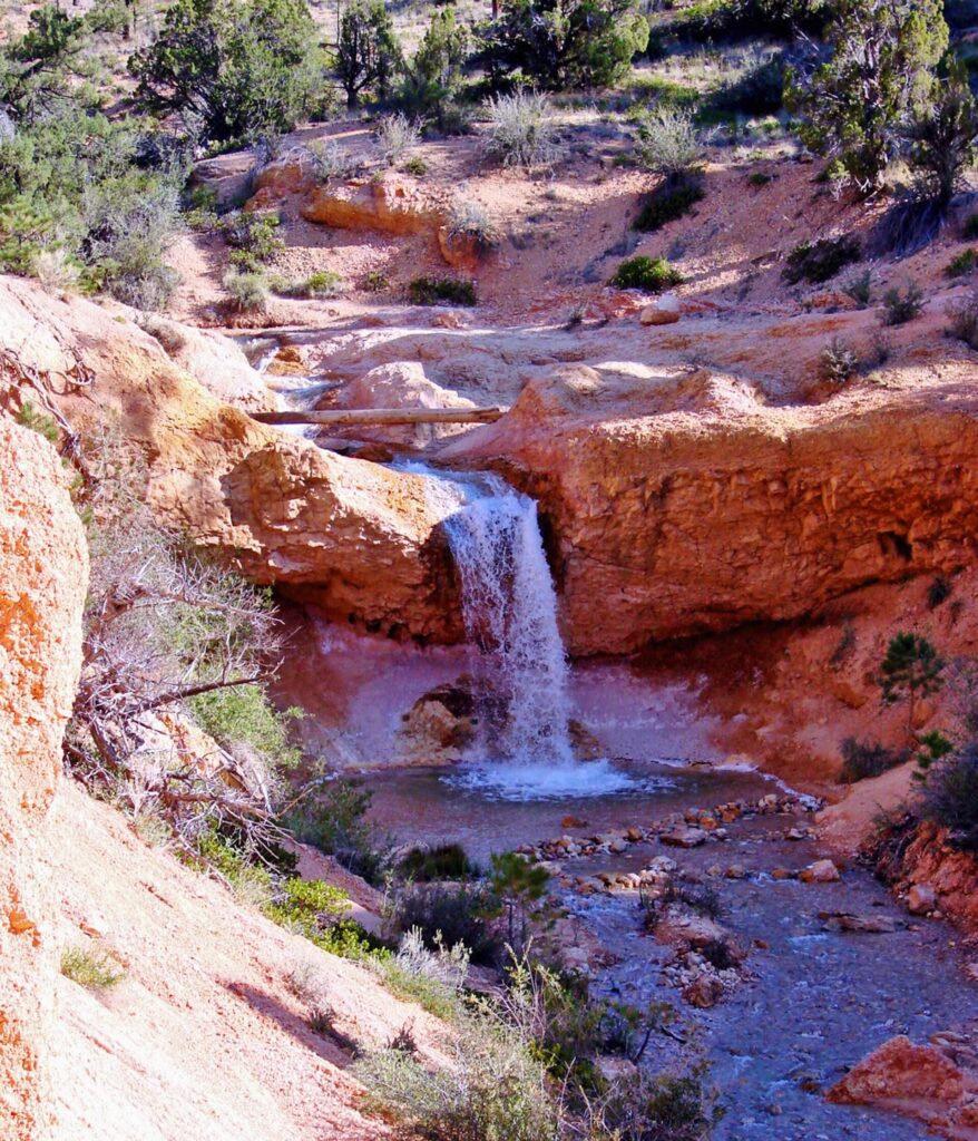
Mossy Cave is a short, easy walk of 0.8 miles that takes 30 to 60 minutes. The trailhead sits on Highway 12 at the northern end of the park. NPS lists it 4 miles east on that road. The trail has a waterfall in summer and icicles in winter.
It begins with a climb and ends with a descent. The park calls it extremely busy between 10 a.m. and 6 p.m., so go early or late. Pets are not allowed, and the delicate rock and plants are the reason to stay on the trail.
Rainbow Point
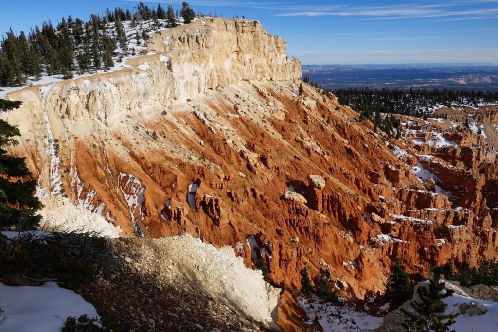
The Southern Scenic Drive carries on about 15 miles from the amphitheater. It ends at Rainbow and Yovimpa Points, the park’s highest at 9,115 feet. NPS puts the drive to Rainbow Point at about 40 minutes. Along the way you pass pullouts at Swamp Canyon, Natural Bridge, Agua Canyon, Ponderosa Canyon and Black Birch Canyon.
Stop at the end for the Bristlecone Loop, a quick mile of walking among old, twisted pines. I would drive straight to Rainbow Point. Stop at the pullouts on the way back, when you know how much time is left. The road can close temporarily after winter storms.
What to wear at Bryce Canyon
The southern end of the park tops 9,000 feet, and the weather turns fast up there. The park’s weather page says temperatures fall below freezing nearly every night from October through May. Summer days run in the 60s to 80s. My carry-on brain says one jacket, and Bryce says three.
- A base layer, a fleece and an insulated jacket that stuffs into a daypack.
- A hat and thin gloves for a sunrise start.
- Closed-toe shoes with real grip, since the trails are steep and the dirt is loose.
- Traction devices from fall through spring, which the park strongly recommends for winter hikes.
- A sun hat, sunscreen and more water than seems reasonable.
- A rain shell in July and August, when afternoon thunderstorms roll in.
Our national park road trip packing list covers the rest of the car. The national park camping checklist helps if you stay at a campground.
Bryce Canyon in winter
Winter changes the plan. The Wall Street side of the Navajo Loop closes every winter. The Bristlecone Loop is open only from spring through fall, and the scenic drive closes temporarily after storms. Queen’s Garden and Mossy Cave stay open year-round, but the shuttle only runs from April to mid-October. October itself can bring an early snowstorm.
Bryce Canyon stargazing
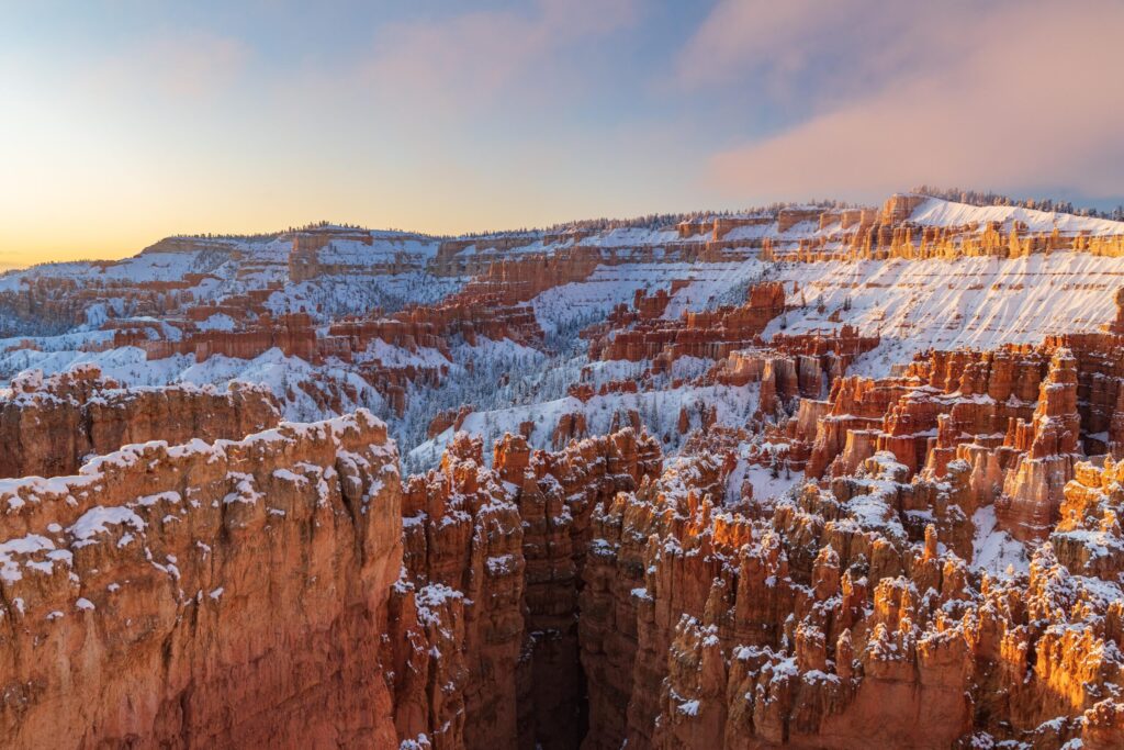
Bryce Canyon gained International Dark Sky status in 2019. On a moonless night the Milky Way runs from horizon to horizon. The park says the best time to come is the week of the new moon or the week before it.
Rangers run about 100 astronomy programs a year. Full moon hikes cover 1 to 2 miles and take 2 to 3 hours. Every summer the park also holds a 4-day Astronomy Festival. Bring the jacket for this too.
Red Canyon Utah
Red Canyon is the free warm-up on Highway 12 before you reach the park. It sits in Dixie National Forest, just off the byway near Panguitch. Its trails include Pink Ledges, Hoodoo, Birdseye and Golden Wall. The visitor center has restrooms, picnic tables and water, and it charges no fee.
Kodachrome Basin State Park lies farther along Highway 12 and is known for its stone spires. Escalante is beyond that. From Zion, Bryce Canyon is about a two-hour drive, so the trip fits easily. Our Utah Mighty 5 road trip strings the parks together.
Bryce Canyon facts
Is the Bryce Canyon shuttle free?
Yes. The shuttle is free with park admission and runs April 3 through October 18 in 2026. It is optional, but it saves you from circling full viewpoint lots. Outside that season, drive to the viewpoints.
Do you need reservations for Bryce Canyon?
No reservation is needed to enter as a day visitor. The campgrounds do require reservations through recreation.gov year-round, and Sunset campground sites open on a 6-month rolling basis.
Is Wall Street open on the Navajo Loop?
It depends on the weather. The park closes the Wall Street side when precipitation combines with freezing overnight temperatures, and keeps it closed through winter. The Two Bridges side is open year-round.
How far is Bryce Canyon from Zion?
Plan on about two hours by car. The drive is straightforward. It passes Red Canyon on Highway 12, so you can break it up with a short walk.
Is one day enough at Bryce Canyon?
Yes, for the main sights. One day covers sunrise, the Rim Trail and the Queen’s Garden and Navajo loop. Add a second day for the Fairyland Loop, Rainbow Point and Mossy Cave.
Prices are approximate, current as of publication, and change frequently — confirm the latest price with the retailer before buying.
Published October 17, 2026.
Photo credits: (1) featured, Hoodoos filling the Bryce Amphitheater seen… — NPS / Peter Densmore, U.S. Government work, public domain, via National Park Service; (2) Queen's Garden Trail winding among hoodoos… — NPS / Peter Densmore, U.S. Government work, public domain, via National Park Service; (3) Small waterfall on Mossy Cave Trail near… — inkknife_2000 (7.5 million views +), CC BY-SA 2.0, via Wikimedia Commons; (4) Bristlecone Loop trail near Yovimpa Point… — NPS / Peter Densmore, U.S. Government work, public domain, via National Park Service; (5) Winter sunrise light on snowy hoodoos below… — NPS / Keith Moore, U.S. Government work, public domain, via National Park Service.