

Some links on our site may earn us a commission at no extra cost to you. Learn more.
Mount Mitchell State Park, off the Blue Ridge Parkway near Asheville, tops out at 6,684 feet — the highest point east of the Mississippi River. Day use is free. The summit has an observation tower, and three trails leave from the parking area, from a short loop to a multi-day trek. The loop is the one to do if you’ve only got an hour.
I’ve been up here more times than I can count, usually as a stop between Asheville and Craggy Gardens rather than a destination on its own. The parking lot fills by mid-morning on a clear fall weekend. The wind at the summit runs ten or fifteen degrees colder than the valley floor. Bring a jacket, even in July.
Quick facts
| Detail | What to know |
|---|---|
| Elevation | 6,684 ft, highest point east of the Mississippi |
| Entrance fee | None for day use |
| Hours | 7 a.m.–6 p.m. (Nov–Feb) up to 7 a.m.–10 p.m. (May–Aug) |
| Restaurant | Closed for the season as of Aug. 4, 2026 |
| Concession stand | Open daily, 10 a.m.–5 p.m. |
| Camping | 9 walk-in tent sites, $30/night, May 1–Oct 31 |
| Parkway access | Blue Ridge Parkway near milepost 355, Asheville side only |
| Main trails | Balsam Nature Trail, Mount Mitchell Trail, Mountains-to-Sea Trail |
Mount Mitchell State Park Hours
Mount Mitchell State Park opens at 7 a.m. year-round, per the park’s own site, but closing time swings by season. From May through August it stays open until 10 p.m., giving you a shot at the summit near sunset. September closes at 9 p.m.; March, April and October at 8 p.m.; November through February the gate shuts at 6 p.m. The park closes only on Christmas Day.
Winter is the wild card. The Blue Ridge Parkway’s own status page notes frequent closures for ice, snow and ongoing repair work above 5,000 feet. Mount Mitchell sits well past that. Check current road status before a cold-weather trip, since the access road can close independent of the park’s posted hours.
Mount Mitchell State Park Entrance Fee
There’s no entrance fee for day use at Mount Mitchell State Park, the park’s own site confirms. That’s true of the whole Blue Ridge Parkway corridor it sits on. The only costs inside the gate are camping and whatever’s running at the concession stand.
Parking is free too, though the summit lot is small. It fills by mid-morning on clear weekends in October, the park’s busiest month for leaf color.
How Tall Is Mount Mitchell?
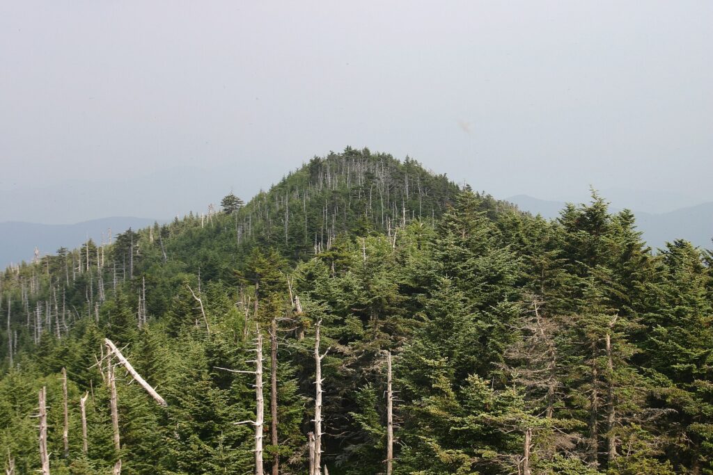
Mount Mitchell tops out at 6,684 feet, the highest point east of the Mississippi River. A short paved path from the parking area reaches the summit and its observation tower. On a clear day, the deck lifts you above the surrounding fir forest.
Fog rolls in fast up here, even on days that started clear in Asheville. Elevation alone drops the temperature. Plenty of visitors keep a jacket in the car in every season, not just winter.
Mount Mitchell State Park Hiking Trails
Three trails leave the summit parking area, and they point in very different directions. One is a short loop. Another drops more than 3,600 feet to a campground down in Pisgah National Forest. A third just keeps going, for miles, if you let it.
For most visitors, the loop is the only one that matters. It’s short, and it’s the most scenic of the three. That’s why people who’ve only got an hour at the summit still leave happy.
| Trail | Length | Difficulty | Leads to |
|---|---|---|---|
| Balsam Nature Trail | 0.7-mile loop | Moderate | Spruce-fir forest loop near the summit |
| Mount Mitchell Trail | 5.6 miles one way | Strenuous | Black Mountain Campground, Pisgah National Forest |
| Mountains-to-Sea Trail | 22.9 miles one way through the Black Mountains | Strenuous | Continues toward the Outer Banks; go as far as you want and turn back |
Balsam Nature Trail
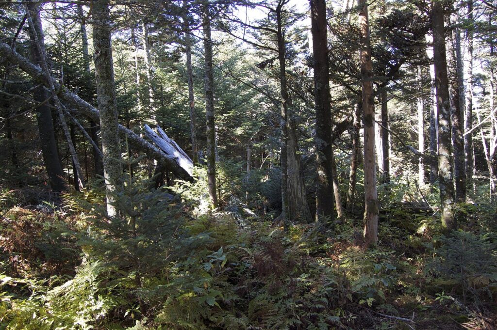
Balsam Nature Trail is the loop: 0.7 miles, rated moderate by the park’s own trail page. It circles through a red spruce and Fraser fir forest. That’s the kind of high-elevation, cold-climate woods you’d otherwise have to drive to Canada or northern New England to stand in. This pocket survives on a handful of Southern Appalachian summits because the elevation mimics a much colder latitude.
It’s the trail to do if you’re only doing one. The walk itself takes well under an hour. The forest is denser and darker than anything at the parking lot lets on, and roots cross the path constantly. Watch your footing, even on a trail this short.
Mount Mitchell Trail Black Mountain Campground
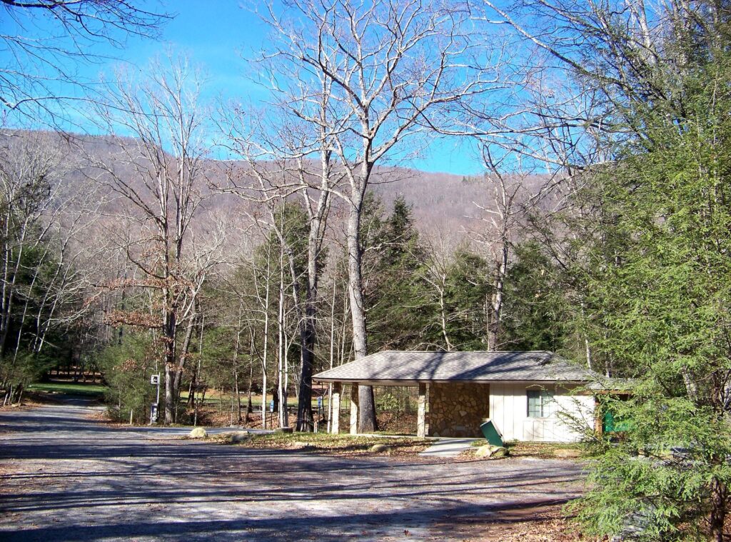
Mount Mitchell Trail runs 5.6 miles one way down to Black Mountain Campground, a U.S. Forest Service campground in Pisgah National Forest. It loses more than 3,600 feet of elevation along the way. Figure five to six hours for the descent, longer coming back up.
Most people don’t hike it end to end from the summit side. It works better as a one-way trip with a car shuttle, or as an out-and-back for as long as your legs want to go. Either way, it’s the trail to pick for real mileage. Spruce and fir give way to hardwood forest as the elevation drops.
Mountains-to-Sea Trail
The Mountains-to-Sea Trail also passes over Mount Mitchell, on its way toward the Outer Banks. It isn’t the Appalachian Trail — a mix-up we’ve made ourselves before. It’s North Carolina’s own long-distance trail, running 22.9 miles just within the Black Mountains section.
You don’t have to commit to the whole thing to enjoy a piece of it. We’ve walked out from the summit for about an hour and turned around. That’s plenty of time to leave the parking lot crowd behind without planning an overnight.

Mount Mitchell State Park Restaurant
As of this season, the restaurant at the Mount Mitchell summit is closed. The park’s own site lists it shut down for the year starting August 4, 2026. Its phone line is currently out of service too.
The concession stand has picked up the slack. It’s open daily, 10 a.m. to 5 p.m., with sandwiches, snacks and drinks. That’s longer hours than the restaurant ever kept, since that only ran Thursday through Sunday. The gift shop next door is open Thursday through Monday, 10 a.m. to 5 p.m., closed Tuesday and Wednesday.
None of this is guaranteed to hold past this season. Check the park’s current hours page before you plan a meal around it.
Mount Mitchell State Park Camping
Mount Mitchell’s own campground is walk-in only: nine sites, a short carry from the parking area, open May 1 through October 31, according to the park’s own camping page. Each site has a tent pad, grill, picnic table and a bear-proof storage box. Potable water and restrooms are nearby, but there are no showers. Fees run $30 a night, seniors and veterans get a small discount, and reservations are required through ReserveAmerica.
That’s a different setup from Black Mountain Campground, the Forest Service site at the bottom of the Mount Mitchell Trail. It’s drive-in and sits well below the summit’s cold and wind. It suits hikers coming down rather than campers staying up top. Either way, book ahead — nine sites disappear fast on a fall weekend.
Prices are approximate, current as of publication, and change frequently — confirm the latest price with the retailer before buying.
Craggy Gardens to Mount Mitchell
The way we do this stretch of the parkway: Balsam Nature Trail loop first, then back in the car for the short drive north to Craggy Gardens. It’s a natural pairing. Both sit within a few miles of each other on the parkway, and neither takes more than an hour or two.
Craggy Gardens brings a different kind of view — open, grassy summits instead of Mount Mitchell’s dense fir forest — plus a rhododendron bloom that draws crowds every June. Getting there means driving the parkway section between Asheville and Mount Mitchell. That stretch has stayed open through ongoing Hurricane Helene repair work. The section north of Mount Mitchell toward Little Switzerland has been under repair since the 2024 storm. It isn’t expected to fully reopen until late 2026, per the National Park Service. Check current road status before you go.
The same corridor connects to more of what makes this part of North Carolina worth a full day. Biltmore Estate is a straightforward drive back into Asheville. Waterfalls near Asheville cover the Pisgah side of the mountains if you want to add a hike-in fall to the day.
Is Mount Mitchell Worth Visiting?
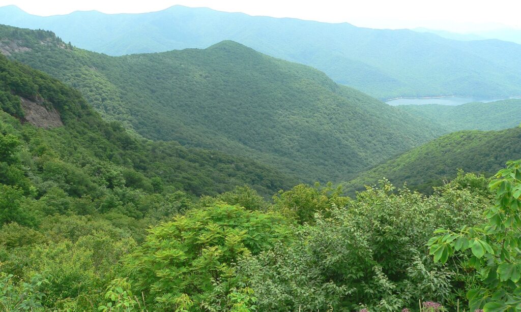
I think it’s worth the drive, even with the restaurant closed and part of the parkway still torn up. The summit tower view alone shows more of the Southern Appalachians at once than almost anywhere else in North Carolina, on a clear day.
Where it falls short: food options are thin right now, and the campground has just nine sites. Fog can wipe out the view with no warning, too. If your plan hinges on eating at the summit or guaranteed visibility, build in a backup.
Pair it with Craggy Gardens, or a day trip toward Chimney Rock. Do that, and it earns a full morning rather than a twenty-minute stop. Go early on weekends in October; the parking lot fills before most people have finished breakfast in Asheville.
Mount Mitchell Facts
Is Mount Mitchell State Park free?
Yes. There’s no entrance fee for day use. The only costs inside the park are camping and whatever’s running at the concession stand.
How tall is Mount Mitchell?
Mount Mitchell reaches 6,684 feet, the highest point east of the Mississippi River. An observation tower at the summit adds a public viewing deck. It sits above the surrounding fir forest.
What is the summit trail at Mount Mitchell State Park?
The summit loop is Balsam Nature Trail, a 0.7-mile moderate loop through red spruce and Fraser fir forest. It’s the shortest of the park’s three main trails, and the one most visitors do.
What is Black Mountain Campground?
Black Mountain Campground is a U.S. Forest Service campground in Pisgah National Forest. It’s reached by hiking 5.6 miles down the Mount Mitchell Trail from the summit. That’s a separate campground from the walk-in sites inside the state park.
How far is Craggy Gardens from Mount Mitchell?
Craggy Gardens sits a short drive north of Mount Mitchell on the Blue Ridge Parkway. That’s close enough to pair both stops in the same morning or afternoon. Check the parkway’s current road-status page before you go, since part of this stretch has been under repair since Hurricane Helene.
Published September 25, 2026.
Photo credits: (1) View from the Mount Mitchell observation… — SquareWave, CC BY-SA 3.0, via Wikimedia Commons; (2) Red spruce and Fraser fir forest on the… — Tsimmons, CC BY-SA 3.0, via Wikimedia Commons; (3) Black Mountain Campground in Pisgah… — Idawriter, CC BY-SA 3.0, via Wikimedia Commons; (4) A forest trail near the summit of Mount… — Idawriter, CC BY-SA 3.0, via Wikimedia Commons.