

Some links on our site may earn us a commission at no extra cost to you. Learn more.
Big Creek is the quiet North Carolina corner of Great Smoky Mountains National Park, reached from I-40 at Waterville Road. You get a gentle trail to a 41-foot waterfall, plus a creekside picnic area and a small tent campground in season. In early October 2026 the park listed Big Creek Trail as closed beyond Mouse Creek Falls, so check the closures page; the waterfall afternoon may be the whole trail.
The Smokies follow a pattern: the Tennessee side clogs by mid-morning and the back corners stay calm. Big Creek is a back corner. I would be at the trailhead early, walk the creek first and save any big climb for a separate day. We have done Smokies days with nieces and nephews along, and a short creek walk to a waterfall is how I would start them.
Big Creek Smoky Mountains
Big Creek sits on the northeast edge of the park, near the North Carolina-Tennessee line. The park describes a dense forest that has reclaimed the site of a former logging town, with a shady campground, a picnic area and several trails. There is no visitor center here. The nearest one is Sugarlands, so plan to be self-sufficient.
Take I-40 to the Waterville Road exit, Exit 451. Construction near that exit has used a temporary exit for Big Creek, about half a mile before the usual one when you are driving east toward Asheville. Watch for the signs and ignore an old map.
Services are thin. The park’s campground map puts Newport, Tennessee, 30 minutes away, so fill the tank and pack lunch before you head up the valley. If the Tennessee-side Cosby corner is on your list too, our Cosby guide covers its quiet-corner trails.
The parking tag applies here like everywhere else in the park. The park’s fee page lists $5 for a day, $15 for a week and $40 for a year, required for any vehicle parked longer than 15 minutes. Our parking tag guide covers how to buy one before you drive up.
Big Creek Trail
Big Creek Trail follows the creek upstream from the picnic area, and it is the reason most people come. The grade is gentle enough that a picnic lunch and small kids are realistic. The trail passes Midnight Hole and reaches Mouse Creek Falls at about the two-mile mark.
The park’s trail closures page in early October 2026 listed the trail as open only for the first two miles to hikers and equestrians. It listed the trail as closed beyond Mouse Creek Falls because of significant trail damage. That puts Walnut Bottom, farther up the same trail, out of reach until the park reopens it.
| Hike | How far | Effort | Best for |
|---|---|---|---|
| Midnight Hole | Half a mile before Mouse Creek Falls | Gentle grade | A short creek stop |
| Mouse Creek Falls | 4 miles round trip | Gentle grade, half day | The waterfall afternoon |
| Walnut Bottom | Beyond Mouse Creek Falls | Listed closed in early October 2026 | Check the closures page first |
| Mount Sterling | Long climb from the day-use area | Hard, full day | Fire tower and a big day |
The two easy rows are the whole plan for most visitors. Mount Sterling is a different trip and gets its own section below. For other hikes across the park, our best hiking trails guide ranks them by effort.
Midnight Hole
Midnight Hole is the first stop on the trail, a deep, dark pool where the creek slows under a rock ledge. It is also the landmark the park uses for the next stop, since Mouse Creek Falls sits half a mile farther up Big Creek Trail. Most people stop here, take photos and decide whether they have the legs for the rest.
The pool looks like a swimming hole, and that is the trap. Read the water rules further down before anyone gets in, because the park’s guidance is firmer than the creek’s reputation.
Mouse Creek Falls
Mouse Creek Falls drops 41 feet into Big Creek, and a log bench near the falls makes a natural lunch stop. The round trip from the picnic area is 4 miles on Big Creek Trail. It is a half-day walk, not a morning dash, so build in time at the water.
Stay off the rocks at the base. They are slick from mist and algae, and the park asks visitors not to climb them. The bench and the bank give you the whole view.

Mount Sterling
Mount Sterling is the hard day from this corner. The Baxter Creek Trail starts beside the Big Creek day-use area and climbs steadily to the ridge and the fire tower at the summit. It has nothing in common with the waterfall walk except the parking lot.
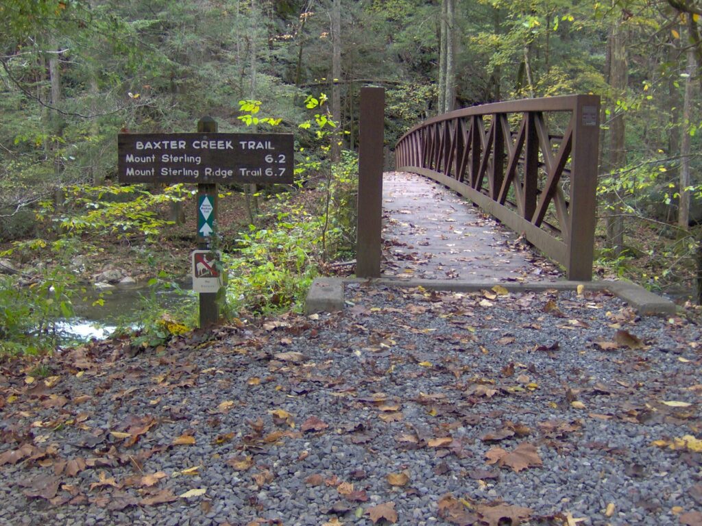
I would treat it as a full day. Start at first light, carry more water than you think you need and plan to be off the mountain well before dark. Do not pair it with the waterfall walk.
Camping on the mountain is a backcountry trip, and the rules are firm. The park’s backcountry page says a permit and advance reservations are required for all backcountry camping. It lists a $6 non-refundable permit fee plus $8 per person per night, booked through Recreation.gov, and a backcountry permit does not exempt you from the parking tag.
Check trail status the morning you go. The closures page lists trail-by-trail closures for the whole park. Storm damage changes that list quickly, so look again before you leave.

Big Creek camping
Big Creek Campground has 12 tent-only sites at about 1,700 feet, and you book them on recreation.gov. The listing says the campground is closed outside its peak season. Confirm the nightly fee and the season dates there before you build a weekend around it. From late October, assume it is closed or about to close for the winter until the listing says otherwise.
Tents only means no RVs, so this is a quieter campground than the big roadside ones. The creek runs beside it, and the trailheads start from the day-use area. That is the real appeal: you wake up, walk to the falls and are back for breakfast before the day-trippers arrive.
Bear rules apply at your site. Lock your vehicle with food inside it, because bears can open car doors, and put garbage in a bear-proof container or carry it out. Camp food sitting on a table is how a bear learns the campground is a buffet.
Big Creek Picnic Area
The picnic area has 10 sites, one of them ADA-accessible, and sits at 1,713 feet beside the creek. The 2026 picnic season runs May 15 through October 25, so the last day is October 25. Hours are sunrise to sunset, and the restroom is seasonal.
Grills are for charcoal only, and wood fires are not permitted. There is no pavilion, so have a plan for rain. The trailhead parking sits next to the picnic sites, which makes this the easiest lunch stop in the corner.
Big Creek swimming
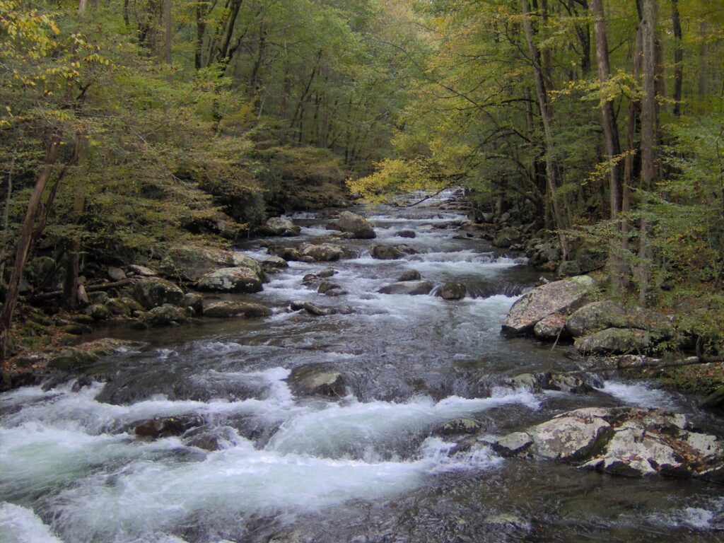
Big Creek looks like a swimming creek, and the park tells visitors otherwise. Its water safety page says water recreation is not recommended in the park, drowning is one of the leading causes of death, and there are no lifeguarded swimming areas.
River levels can rise rapidly after a storm far upstream, so skip the creek on rainy days and never cross a rain-swollen stream. Do not dive or jump, because submerged rocks and logs sit just under the surface. Cold water can bring on hypothermia in minutes.
The simplest rule is to treat the creek as scenery. Keep your boots on dry stone near the falls, and keep children within arm’s reach on any bank.
Smoky Mountains bear safety
The park’s bear page states that willfully approaching within 50 yards (150 feet), or any distance that disturbs or displaces a bear, is illegal. Food-storage and littering violations can bring fines up to $5,000 and up to six months in jail.
Carry food in a pack on the trail, never leave it on a picnic table and lock the car. Talk as you walk on a quiet trail like this one, because a surprised bear is the dangerous kind.
Cataloochee elk
Elk are the other reason to spend a day in this corner of the park. Cataloochee, Balsam Mountain and Oconaluftee are the elk-viewing areas on the North Carolina side, and early morning and late evening are the active hours. The legal minimum distance is 25 yards (75 feet), or farther if the animal reacts to you.
Our Cataloochee Valley guide has the full plan, so I will not repeat it here. Pair the two as separate days rather than rushing both into one.
Big Creek hike
The honest choice is between the waterfall afternoon and Mount Sterling, and the answer depends on your legs and your daylight. Big Creek Trail suits almost everyone and fits around a picnic. Mount Sterling is for people who already know they enjoy a long, steady climb.
Here is how I would plan the easy day. Arrive by 9 a.m., walk to Midnight Hole, continue to Mouse Creek Falls and eat lunch on the log bench. Be back at the picnic area by early afternoon and leave the creek before any storm builds. That keeps you out of the afternoon crowds and well inside daylight.
If you want the hard day, start at first light and give it the whole day. Swap the waterfall for a second visit. A tired group makes bad decisions at a stream crossing, and the Smokies punish those.
Big Creek FAQ
How far is Mouse Creek Falls from the Big Creek trailhead?
The park puts the round trip at 4 miles on Big Creek Trail, and the falls sit half a mile past Midnight Hole. In early October 2026 the park listed the trail as open for the first two miles, which is as far as the falls.
Do you need a parking tag at Big Creek?
Yes. The park requires a tag for any vehicle parked longer than 15 minutes, at $5 a day, $15 a week or $40 a year.
Can you swim at Big Creek?
The park does not recommend water recreation anywhere in the Smokies and has no lifeguarded swimming areas, so treat the creek as scenery. Do not dive or jump, and stay out of rain-swollen water.
Is Big Creek Trail open to Walnut Bottom?
Not in early October 2026, when the park’s closures page listed Big Creek Trail open only for the first two miles and closed beyond Mouse Creek Falls because of significant trail damage. Check that page again before you go.
When does the Big Creek picnic area close for the year?
The park lists the 2026 picnic season as May 15 through October 25. Hours are sunrise to sunset.
Prices are approximate, current as of publication, and change frequently — confirm the latest price with the retailer before buying.
Published October 21, 2026.
Photo credits: (1) featured, Big Creek flowing over boulders through… — Brian Stansberry, CC BY 3.0, via Wikimedia Commons; (2) Mouse Creek Falls cascading down a rock… — Frank Kovalchek from USA, CC BY 2.0, via Wikimedia Commons; (3) Baxter Creek Trailhead at the Big Creek day… — Brian Stansberry (photographer), CC BY 3.0, via Wikimedia Commons; (4) Fire tower at the summit of Mount Sterling… — Brian Stansberry, CC BY 3.0, via Wikimedia Commons; (5) Big Creek at the Baxter Creek Trail… — Brian Stansberry, CC BY 3.0, via Wikimedia Commons.